
Previsiones:

Pronóstico Corto PlazoAlgo de llovizna, más pesada durante la mañana de domingo. Warm (max 31°C el domingo por la mañana, min 28°C el domingo por la noche). Vientos crecientes (Vientos ligeros desde el S el domingo por la mañana, vientos frescos desde el S por la noche de lunes). | |||||||||||||||||||||||
domingo 2 | lunes 3 | martes 4 | |||||||||||||||||||||
4 AM | 7 AM | 10 AM | 1 PM | 4 PM | 7 PM | 10 PM | 1 AM | 4 AM | 7 AM | 10 AM | 1 PM | 4 PM | 7 PM | 10 PM | 1 AM | 4 AM | 7 AM | 10 AM | 1 PM | 4 PM | 7 PM | 10 PM | |
Mapa de Altura de Olas | 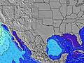 | 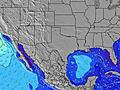 | 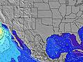 | 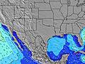 | 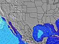 | 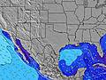 | 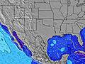 | 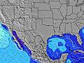 |  | ||||||||||||||
Oleaje Altura (m) Dirección Período (s) | S 5 | S 5 | SSW 5 | S 5 | S 5 | S 5 | S 5 | S 4 | SSW 4 | SSW 5 | SSW 5 | S 5 | SE 9 | S 5 | SSE 4 | S 4 | S 5 | S 5 | S 5 | S 5 | S 5 | SSE 5 | SSE 5 |
Gráfico Olas | |||||||||||||||||||||||
43 | 43 | 26 | 27 | 25 | 24 | 28 | 23 | 15 | 28 | 23 | 16 | 13 | 16 | 24 | 38 | 52 | 47 | 32 | 25 | 25 | 26 | 32 | |
Viento (km/h) | |||||||||||||||||||||||
Estado del Viento Viento de Mar Viento de Mar-Cruzado Cruzado Viento de Tierra-Cruzado Viento de Tierra Cristalino | cross-off | cross-off | cross-off | cross-on | cross-on | cross-on | cross-on | cross | cross | cross | cross | cross-on | cross-on | cross-on | cross-on | cross-on | cross-on | cross-on | cross-on | on | cross-on | on | on |
Marea alta | 7:52AM0.38m | 7:20PM0.32m | 7:57AM0.37m | 9:06PM0.31m | 7:50AM0.37m | ||||||||||||||||||
Marea baja | 12:15PM0.20m | 11:45PM0.15m | 12:58PM0.14m | 00:17AM0.23m | 1:47PM0.06m | ||||||||||||||||||
6:47 | — | — | — | — | — | — | — | 6:48 | — | — | — | — | — | — | — | 6:48 | — | — | — | — | — | — | |
— | — | — | — | — | 8:15 | — | — | — | — | — | — | — | 8:14 | — | — | — | — | — | — | — | 8:13 | — | |
mm | 5 | 2 | 1 | — | — | — | — | — | — | — | — | — | — | — | — | — | — | — | — | — | — | — | — |
Temp. °C | 29 | 29 | 30 | 31 | 31 | 30 | 29 | 29 | 29 | 28 | 29 | 29 | 30 | 29 | 29 | 29 | 29 | 28 | 29 | 29 | 29 | 29 | 29 |
Enfriamiento °C | 31 | 31 | 33 | 35 | 32 | 32 | 31 | 30 | 29 | 29 | 32 | 31 | 31 | 30 | 30 | 29 | 30 | 30 | 32 | 31 | 30 | 31 | 31 |
Oleaje 1 Altura (m) Dirección Período (s) | — | S 5 | SSW 5 | S 5 | SE 9 | ESE 8 | SE 7 | SE 8 | SSE 5 | SE 6 | SSW 5 | S 5 | S 5 | SE 9 | SE 9 | SE 9 | SE 9 | SE 9 | S 5 | S 5 | ESE 9 | ESE 8 | ESE 8 |
— | 43 | 26 | 27 | 3 | 7 | 7 | 11 | 9 | 5 | 23 | 16 | 11 | 13 | 12 | 12 | 12 | 12 | 32 | 25 | 7 | 7 | 7 | |
Oleaje 2 Altura (m) Dirección Período (s) | — | SE 9 | SE 6 | SE 9 | — | SE 5 | SE 5 | SE 6 | SE 6 | ESE 9 | SE 6 | SE 6 | SE 5 | — | — | — | — | — | SE 9 | ESE 9 | — | — | — |
— | 3 | 11 | 3 | — | 1 | 1 | 2 | 5 | 8 | 8 | 8 | 5 | — | — | — | — | — | 12 | 8 | — | — | — | |
Oleaje 3 Altura (m) Dirección Período (s) | — | — | SE 9 | SE 9 | — | — | — | — | ESE 10 | — | SE 9 | SE 9 | SE 9 | — | — | — | — | — | — | — | — | — | — |
— | — | 3 | 3 | — | — | — | — | 9 | — | 13 | 13 | 13 | — | — | — | — | — | — | — | — | — | — | |
Olas de Viento Altura (m) Dirección Período (s) | S 5 | SSW 5 | — | — | S 5 | S 5 | S 5 | S 4 | SSW 4 | SSW 5 | — | — | — | S 5 | SSE 4 | S 4 | S 5 | S 5 | — | — | S 5 | SSE 5 | SSE 5 |
43 | 36 | — | — | 25 | 24 | 28 | 23 | 15 | 28 | — | — | — | 16 | 24 | 38 | 52 | 47 | — | — | 25 | 26 | 32 | |
Viento del Tierra o Mar Limpio más proximo | |||||||||||||||||||||||
Distancia (km) | 120 | 112 | 82 | 1255 | 1483 | 1160 | 1147 | 860 | 945 | 945 | 1147 | 1147 | 1465 | 1317 | 1147 | 1147 | 1147 | 1147 | 1147 | 1162 | 1300 | 1268 | 1180 |
Mejores Olas Previstas en Texas | |||||||||||||||||||||||
Mejores Olas Previstas en United States | |||||||||||||||||||||||
Busca-Olas Global | |||||||||||||||||||||||
- Map Icons:
 Break
Break Live Wave Height (m)
 Live Wind Speed (km/h)
 Surf Rating (10 Max)
 Ocean Swells (m)
- Wind Speed (km/h)
GRÁTIS! Un widget de Surf-Forecast.com para tu sitio
Este widget grátis de previsiones de surf y tiempo puede ser añadido a cualquier otro sitio y da un resumen de previsiones de olas para Port O'Conner. Solo necesita cortar y pegar el código HTML de abajo en su web. Puede elegir preferencias de idioma y de unidades (métricas o imperiales) para convenir a los usuarios de su sitio. Clica aquí para obtener el código.
 Nearest