
Previsiones:

Pronóstico Corto PlazoAlgo de llovizna, más pesada durante la noche de sábado. Warm (max 28°C el martes por la tarde, min 16°C el domingo por la mañana). El viento será generalmente ligero. | |||||||||||||||||||
sáb 25 | domingo 26 | lunes 27 | |||||||||||||||||
5 PM | 8 PM | 11 PM | 2 AM | 5 AM | 8 AM | 11 AM | 2 PM | 5 PM | 8 PM | 11 PM | 2 AM | 5 AM | 8 AM | 11 AM | 2 PM | 5 PM | 8 PM | 11 PM | |
Mapa de Altura de Olas |  |  | 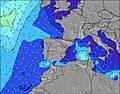 |  |  | 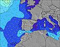 |  | ||||||||||||
Oleaje Altura (m) Dirección Período (s) | N 6 | N 7 | N 7 | N 6 | NNW 6 | NNW 6 | NNW 6 | NNW 6 | NNW 6 | NNW 12 | NNW 12 | NNW 11 | NNW 11 | NNW 10 | NNW 10 | NNW 10 | NNW 10 | NNW 10 | NNW 10 |
Gráfico Olas | |||||||||||||||||||
132 | 145 | 148 | 119 | 101 | 98 | 87 | 80 | 75 | 101 | 177 | 256 | 573 | 520 | 555 | 490 | 448 | 466 | 466 | |
Viento (km/h) | |||||||||||||||||||
Estado del Viento Viento de Mar Viento de Mar-Cruzado Cruzado Viento de Tierra-Cruzado Viento de Tierra Cristalino | on | on | cross-on | cross-on | cross-on | cross | cross-on | on | on | on | cross-on | cross | glassy | glassy | cross-off | cross-off | cross-off | cross-off | cross-off |
Marea alta | 2:44PM3.07m | 3:12AM2.98m | 3:34PM3.24m | 3:59AM3.11m | 4:16PM3.41m | ||||||||||||||
Marea baja | 9:04PM1.37m | 9:17AM1.34m | 9:53PM1.21m | 10:01AM1.20m | 10:34PM1.04m | ||||||||||||||
— | — | — | — | 7:05 | — | — | — | — | — | — | — | 7:07 | — | — | — | — | — | — | |
— | 9:53 | — | — | — | — | — | — | — | 9:52 | — | — | — | — | — | — | — | 9:52 | — | |
mm | 1 | 1 | — | — | — | — | — | — | — | — | — | — | — | — | — | — | — | — | — |
Temp. °C | 20 | 20 | 17 | 17 | 17 | 16 | 20 | 20 | 21 | 20 | 18 | 17 | 17 | 17 | 20 | 23 | 23 | 22 | 18 |
Enfriamiento °C | 19 | 19 | 16 | 17 | 17 | 15 | 19 | 19 | 20 | 20 | 19 | 18 | 19 | 18 | 21 | 22 | 22 | 22 | 18 |
Oleaje 1 Altura (m) Dirección Período (s) | W 8 | N 7 | N 7 | N 6 | NNW 6 | NNW 6 | NNW 6 | NNW 6 | NNW 6 | NNW 6 | NNW 7 | NW 7 | NNW 11 | NNW 10 | NNW 10 | NNW 10 | NNW 10 | NNW 10 | NNW 10 |
1 | 145 | 148 | 119 | 101 | 98 | 87 | 73 | 75 | 85 | 91 | 112 | 573 | 520 | 555 | 490 | 448 | 466 | 466 | |
Oleaje 2 Altura (m) Dirección Período (s) | W 10 | W 8 | NW 10 | NW 10 | NW 10 | WNW 9 | WNW 9 | WNW 9 | NNW 13 | NNW 12 | NNW 12 | NNW 11 | — | — | — | — | — | — | — |
2 | 1 | 4 | 4 | 4 | 9 | 8 | 8 | 66 | 101 | 177 | 256 | — | — | — | — | — | — | — | |
Oleaje 3 Altura (m) Dirección Período (s) | N 10 | W 10 | — | — | W 7 | N 13 | NNW 13 | NNW 12 | WNW 9 | WNW 9 | WNW 9 | — | — | — | — | — | — | — | — |
2 | 2 | — | — | 1 | 3 | 16 | 15 | 8 | 16 | 16 | — | — | — | — | — | — | — | — | |
Olas de Viento Altura (m) Dirección Período (s) | N 6 | — | — | W 8 | — | — | — | NW 6 | — | — | — | — | — | — | — | NE 4 | ENE 4 | ENE 4 | ENE 5 |
132 | — | — | 1 | — | — | — | 80 | — | — | — | — | — | — | — | 13 | 26 | 33 | 45 | |
Viento del Tierra o Mar Limpio más proximo | |||||||||||||||||||
Distancia (km) | 46 | 13 | 13 | 13 | 13 | 13 | 13 | 13 | 13 | 13 | 11 | 1 | 0 | 0 | 0 | 154 | 115 | 6 | 6 |
Mejores Olas Previstas en Asturias | |||||||||||||||||||
Mejores Olas Previstas en Spain (Europe) | |||||||||||||||||||
Busca-Olas Global | |||||||||||||||||||
- Map Icons:
 Break
Break Live Wave Height (m)
 Live Wind Speed (km/h)
 Surf Rating (10 Max)
 Ocean Swells (m)
- Wind Speed (km/h)
GRÁTIS! Un widget de Surf-Forecast.com para tu sitio
Este widget grátis de previsiones de surf y tiempo puede ser añadido a cualquier otro sitio y da un resumen de previsiones de olas para Playa de Salinas. Solo necesita cortar y pegar el código HTML de abajo en su web. Puede elegir preferencias de idioma y de unidades (métricas o imperiales) para convenir a los usuarios de su sitio. Clica aquí para obtener el código.
 Nearest