
Previsiones:

Pronóstico Corto PlazoMayormente seco. Warm (max 31°C el martes por la tarde, min 16°C el miércoles por la noche). El viento será generalmente ligero. | |||||||||||||||||||
lun 27 | martes 28 | miércoles 29 | |||||||||||||||||
5 PM | 8 PM | 11 PM | 2 AM | 5 AM | 8 AM | 11 AM | 2 PM | 5 PM | 8 PM | 11 PM | 2 AM | 5 AM | 8 AM | 11 AM | 2 PM | 5 PM | 8 PM | 11 PM | |
Mapa de Altura de Olas | 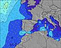 |  | 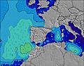 |  |  | 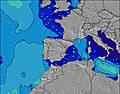 |  | ||||||||||||
Oleaje Altura (m) Dirección Período (s) | NNW 10 | NNW 10 | NW 10 | NW 10 | NNW 10 | NNW 10 | NW 10 | NW 10 | NW 10 | NW 9 | NW 9 | NW 9 | NW 9 | NW 9 | NW 9 | NW 9 | NW 8 | NW 8 | NW 8 |
Gráfico Olas | |||||||||||||||||||
457 | 466 | 416 | 416 | 340 | 333 | 286 | 220 | 211 | 170 | 162 | 138 | 135 | 95 | 74 | 73 | 69 | 69 | 97 | |
Viento (km/h) | |||||||||||||||||||
Estado del Viento Viento de Mar Viento de Mar-Cruzado Cruzado Viento de Tierra-Cruzado Viento de Tierra Cristalino | on | cross-on | cross-on | cross | cross | cross | cross-on | on | glassy | cross-off | off | glassy | glassy | cross-off | cross | cross | cross | cross | glassy |
Marea alta | 4:23PM3.06m | 4:45AM2.96m | 5:00PM3.24m | 5:20AM3.08m | 5:34PM3.38m | ||||||||||||||
Marea baja | 10:32PM0.73m | 10:41AM0.71m | 11:10PM0.57m | 11:17AM0.56m | |||||||||||||||
— | — | — | — | 7:09 | — | — | — | — | — | — | — | 7:09 | — | — | — | — | — | — | |
— | 9:52 | — | — | — | — | — | — | — | 9:52 | — | — | — | — | — | — | — | 9:51 | — | |
mm | — | — | — | — | — | — | — | — | — | — | — | — | — | — | — | — | — | — | — |
Temp. °C | 23 | 21 | 17 | 17 | 17 | 18 | 28 | 31 | 28 | 26 | 22 | 20 | 18 | 17 | 21 | 23 | 23 | 21 | 17 |
Enfriamiento °C | 22 | 20 | 17 | 17 | 17 | 18 | 28 | 31 | 29 | 26 | 22 | 20 | 18 | 18 | 22 | 23 | 24 | 22 | 19 |
Oleaje 1 Altura (m) Dirección Período (s) | NNW 10 | NNW 10 | NW 10 | NW 10 | NNW 10 | NNW 10 | NW 10 | NW 10 | NW 10 | NW 9 | NW 9 | NW 9 | NW 9 | NW 9 | NW 9 | NW 9 | NW 8 | NW 8 | NW 8 |
457 | 466 | 416 | 416 | 340 | 333 | 286 | 220 | 211 | 170 | 162 | 138 | 135 | 95 | 74 | 73 | 69 | 69 | 97 | |
Oleaje 2 Altura (m) Dirección Período (s) | — | — | — | — | — | — | — | — | ENE 5 | ENE 5 | ENE 5 | ENE 4 | ENE 4 | ENE 4 | ENE 4 | NNE 5 | ENE 4 | NW 4 | NE 4 |
— | — | — | — | — | — | — | — | 23 | 17 | 12 | 7 | 3 | 3 | 2 | 2 | 2 | 5 | 1 | |
Oleaje 3 Altura (m) Dirección Período (s) | — | — | — | — | — | — | — | — | — | — | — | — | — | NNE 5 | NNE 5 | E 4 | — | NE 4 | — |
— | — | — | — | — | — | — | — | — | — | — | — | — | 3 | 2 | 1 | — | 1 | — | |
Olas de Viento Altura (m) Dirección Período (s) | ENE 4 | ENE 4 | E 5 | E 5 | E 5 | ENE 5 | ENE 5 | ENE 5 | — | — | — | — | WNW 3 | NW 5 | NW 5 | WNW 5 | NW 4 | — | — |
24 | 33 | 52 | 56 | 47 | 38 | 31 | 32 | — | — | — | — | 1 | 19 | 28 | 16 | 7 | — | — | |
Viento del Tierra o Mar Limpio más proximo | |||||||||||||||||||
Distancia (km) | 96 | 13 | 10 | 3 | 3 | 3 | 3 | 13 | 0 | 0 | 0 | 0 | 0 | 0 | 33 | 359 | 174 | 33 | 0 |
Mejores Olas Previstas en Asturias | |||||||||||||||||||
Mejores Olas Previstas en Spain (Europe) | |||||||||||||||||||
Busca-Olas Global | |||||||||||||||||||
- Map Icons:
 Break
Break Live Wave Height (m)
 Live Wind Speed (km/h)
 Surf Rating (10 Max)
 Ocean Swells (m)
- Wind Speed (km/h)
GRÁTIS! Un widget de Surf-Forecast.com para tu sitio
Este widget grátis de previsiones de surf y tiempo puede ser añadido a cualquier otro sitio y da un resumen de previsiones de olas para Concha de Artedo. Solo necesita cortar y pegar el código HTML de abajo en su web. Puede elegir preferencias de idioma y de unidades (métricas o imperiales) para convenir a los usuarios de su sitio. Clica aquí para obtener el código.
 Nearest