
Previsiones:

Pronóstico Corto PlazoLluvia ligera (totál 4mm), cayendo mayormente el lunes por la mañana. Warm (max 27°C el martes por la mañana, min 22°C el domingo por la noche). El viento será generalmente ligero. | ||||||||||||||||||||||
domingo 2 | lunes 3 | martes 4 | ||||||||||||||||||||
6 AM | 9 AM | 12 PM | 3 PM | 6 PM | 9 PM | 12 AM | 3 AM | 6 AM | 9 AM | 12 PM | 3 PM | 6 PM | 9 PM | 12 AM | 3 AM | 6 AM | 9 AM | 12 PM | 3 PM | 6 PM | 9 PM | |
Mapa de Altura de Olas |  |  |  |  |  |  | 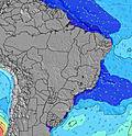 |  | ||||||||||||||
Oleaje Altura (m) Dirección Período (s) | ESE 7 | ESE 7 | ESE 7 | ESE 7 | ESE 7 | SE 7 | SE 7 | SE 7 | SE 7 | ESE 7 | ESE 7 | ESE 7 | ESE 7 | ESE 8 | ESE 8 | ESE 8 | ESE 8 | ESE 8 | ESE 8 | ESE 8 | ESE 8 | ESE 8 |
Gráfico Olas | ||||||||||||||||||||||
173 | 151 | 147 | 159 | 163 | 115 | 105 | 105 | 105 | 153 | 143 | 147 | 147 | 256 | 296 | 246 | 253 | 253 | 298 | 306 | 361 | 361 | |
Viento (km/h) | ||||||||||||||||||||||
Estado del Viento Viento de Mar Viento de Mar-Cruzado Cruzado Viento de Tierra-Cruzado Viento de Tierra Cristalino | cross | cross-on | cross-on | cross-on | cross-on | cross-on | cross | cross | cross | cross-on | cross-on | cross-on | cross-on | cross-on | cross-on | cross-on | cross-on | cross-on | cross-on | cross-on | cross-on | cross-on |
Marea alta | 6:08AM2.22m | 6:32PM2.06m | 6:46AM2.15m | 7:11PM2.01m | 7:29AM2.04m | 7:57PM1.93m | ||||||||||||||||
Marea baja | 12:23PM0.26m | 00:33AM0.37m | 1:00PM0.33m | 1:15AM0.43m | 1:43PM0.42m | |||||||||||||||||
5:31 | — | — | — | — | — | — | 5:30 | — | — | — | — | — | — | — | 5:30 | — | — | — | — | — | — | |
— | — | — | 5:22 | — | — | — | — | — | — | — | 5:22 | — | — | — | — | — | — | — | 5:22 | — | — | |
mm | — | — | — | — | — | — | — | — | — | 1 | 1 | — | — | — | — | — | — | 1 | 1 | — | — | — |
Temp. °C | 23 | 26 | 26 | 26 | 24 | 24 | 23 | 22 | 22 | 25 | 26 | 26 | 25 | 25 | 24 | 24 | 23 | 26 | 27 | 26 | 25 | 25 |
Enfriamiento °C | 23 | 24 | 25 | 25 | 23 | 25 | 24 | 23 | 23 | 26 | 26 | 26 | 26 | 27 | 25 | 25 | 24 | 26 | 27 | 25 | 25 | 26 |
Oleaje 1 Altura (m) Dirección Período (s) | NNE 8 | NNE 8 | NNE 8 | NNE 8 | ESE 9 | E 8 | E 8 | E 8 | E 7 | ESE 7 | ESE 7 | ESE 7 | NNE 10 | ESE 8 | ESE 8 | ESE 8 | ESE 8 | NE 9 | NNE 9 | NE 9 | NNE 9 | NNE 9 |
7 | 7 | 7 | 7 | 8 | 63 | 41 | 55 | 40 | 153 | 143 | 147 | 10 | 176 | 210 | 246 | 253 | 21 | 16 | 20 | 15 | 15 | |
Oleaje 2 Altura (m) Dirección Período (s) | S 12 | S 12 | S 15 | NNE 8 | NNE 8 | NNE 8 | NNE 8 | NNE 8 | NNE 8 | NNE 8 | NNE 11 | NNE 8 | N 7 | NNE 10 | NNE 10 | NE 10 | NE 9 | SE 14 | SE 14 | SE 13 | SSE 13 | SSE 13 |
3 | 3 | 4 | 7 | 6 | 6 | 6 | 6 | 6 | 6 | 12 | 6 | 4 | 10 | 10 | 15 | 14 | 8 | 8 | 7 | 18 | 17 | |
Oleaje 3 Altura (m) Dirección Período (s) | — | S 15 | S 11 | S 15 | S 14 | S 14 | — | N 13 | NE 10 | NE 11 | N 12 | NNE 11 | N 12 | N 8 | N 7 | N 7 | N 7 | N 11 | N 10 | N 10 | N 10 | N 10 |
— | 4 | 3 | 4 | 4 | 4 | — | 3 | 4 | 5 | 3 | 11 | 3 | 4 | 4 | 4 | 1 | 2 | 2 | 2 | 2 | 2 | |
Olas de Viento Altura (m) Dirección Período (s) | ESE 7 | ESE 7 | ESE 7 | ESE 7 | ESE 7 | SE 7 | SE 7 | SE 7 | SE 7 | — | — | — | ESE 7 | ESE 8 | ESE 8 | — | — | ESE 8 | ESE 8 | ESE 8 | ESE 8 | ESE 8 |
173 | 151 | 147 | 159 | 163 | 115 | 105 | 105 | 105 | — | — | — | 147 | 256 | 296 | — | — | 253 | 298 | 306 | 361 | 361 | |
Viento del Tierra o Mar Limpio más proximo | ||||||||||||||||||||||
Distancia (km) | 55 | 1514 | 1600 | 1035 | 1012 | 111 | 6 | 6 | 6 | 111 | 1600 | 2028 | 26 | 26 | 26 | 6 | 25 | 1514 | 1600 | 1600 | 1600 | 1035 |
Mejores Olas Previstas en Rio Grande Do Norte | ||||||||||||||||||||||
Mejores Olas Previstas en Brazil | ||||||||||||||||||||||
Busca-Olas Global | ||||||||||||||||||||||
- Map Icons:
 Break
Break Live Wave Height (m)
 Live Wind Speed (km/h)
 Surf Rating (10 Max)
 Ocean Swells (m)
- Wind Speed (km/h)
GRÁTIS! Un widget de Surf-Forecast.com para tu sitio
Este widget grátis de previsiones de surf y tiempo puede ser añadido a cualquier otro sitio y da un resumen de previsiones de olas para Pirangi Reef. Solo necesita cortar y pegar el código HTML de abajo en su web. Puede elegir preferencias de idioma y de unidades (métricas o imperiales) para convenir a los usuarios de su sitio. Clica aquí para obtener el código.
 Nearest