
Previsiones:

Pronóstico Corto PlazoAlgo de llovizna, más pesada durante la noche de sábado. Warm (max 23°C el jueves por la noche, min 19°C el viernes por la mañana). Vientos crecientes (calma el jueves por la noche, vientos fuertes desde el ONO por la tarde de sábado). | |||||||||||||||||||
jue 23 | viernes 24 | sábado 25 | |||||||||||||||||
5 PM | 8 PM | 11 PM | 2 AM | 5 AM | 8 AM | 11 AM | 2 PM | 5 PM | 8 PM | 11 PM | 2 AM | 5 AM | 8 AM | 11 AM | 2 PM | 5 PM | 8 PM | 11 PM | |
Mapa de Altura de Olas |  |  | 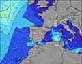 |  |  | 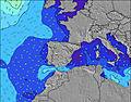 |  | ||||||||||||
Oleaje Altura (m) Dirección Período (s) | N 6 | NNE 6 | NNW 6 | NNW 6 | NNW 6 | NNW 6 | NNE 5 | NW 6 | WNW 5 | WNW 5 | WNW 6 | WNW 6 | WNW 6 | WNW 6 | WNW 6 | WNW 7 | WNW 7 | NW 7 | NW 7 |
Gráfico Olas | |||||||||||||||||||
39 | 17 | 28 | 33 | 26 | 18 | 15 | 35 | 59 | 117 | 148 | 145 | 150 | 175 | 280 | 529 | 553 | 720 | 658 | |
Viento (km/h) | |||||||||||||||||||
Estado del Viento Viento de Mar Viento de Mar-Cruzado Cruzado Viento de Tierra-Cruzado Viento de Tierra Cristalino | cross-on | glassy | cross-off | cross-off | cross-off | cross-off | cross-on | cross-on | cross-on | cross-on | cross-on | cross-on | cross-on | cross | cross-on | cross-on | cross-on | cross-on | cross-on |
Marea alta | 1:11AM2.63m | 1:47PM2.71m | 2:24AM2.66m | 2:51PM2.82m | |||||||||||||||
Marea baja | 6:44PM1.22m | 7:14AM1.25m | 7:55PM1.21m | 8:20AM1.21m | 8:57PM1.09m | ||||||||||||||
— | — | — | — | 6:52 | — | — | — | — | — | — | — | 6:52 | — | — | — | — | — | — | |
— | 9:43 | — | — | — | — | — | — | — | 9:42 | — | — | — | — | — | — | — | 9:40 | — | |
mm | — | — | — | — | — | — | — | — | — | — | — | — | — | — | — | — | — | 1 | — |
Temp. °C | 24 | 23 | 21 | 20 | 20 | 19 | 22 | 23 | 23 | 22 | 21 | 20 | 20 | 19 | 21 | 23 | 22 | 21 | 21 |
Enfriamiento °C | 22 | 23 | 21 | 19 | 19 | 18 | 21 | 21 | 20 | 18 | 17 | 16 | 16 | 15 | 15 | 18 | 16 | 16 | 17 |
Oleaje 1 Altura (m) Dirección Período (s) | N 6 | NNE 6 | NNW 6 | NNW 6 | NNW 6 | NNW 6 | NNE 5 | NNE 5 | NNE 5 | NNE 6 | NNE 6 | NNE 5 | — | — | N 12 | — | — | — | — |
39 | 17 | 28 | 33 | 26 | 18 | 15 | 16 | 6 | 6 | 3 | 3 | — | — | 3 | — | — | — | — | |
Oleaje 2 Altura (m) Dirección Período (s) | NW 9 | NNW 6 | NNE 6 | NNE 5 | NNE 5 | NNE 5 | NNW 6 | NNW 6 | — | — | — | — | — | — | — | — | — | — | — |
3 | 13 | 12 | 11 | 9 | 10 | 12 | 14 | — | — | — | — | — | — | — | — | — | — | — | |
Oleaje 3 Altura (m) Dirección Período (s) | — | NW 9 | NW 9 | NW 9 | NW 9 | NW 7 | NNW 7 | NW 9 | — | — | — | — | — | — | — | — | — | — | — |
— | 3 | 3 | 3 | 3 | 7 | 4 | 3 | — | — | — | — | — | — | — | — | — | — | — | |
Olas de Viento Altura (m) Dirección Período (s) | — | — | — | — | — | — | — | NW 6 | WNW 5 | WNW 5 | WNW 6 | WNW 6 | WNW 6 | WNW 6 | WNW 6 | WNW 7 | WNW 7 | NW 7 | NW 7 |
— | — | — | — | — | — | — | 35 | 59 | 117 | 148 | 145 | 150 | 175 | 280 | 529 | 553 | 720 | 658 | |
Viento del Tierra o Mar Limpio más proximo | |||||||||||||||||||
Distancia (km) | 101 | 101 | 12 | 12 | 53 | 183 | 441 | 208 | 208 | 218 | 37 | 37 | 37 | 444 | 208 | 198 | 208 | 52 | |
Mejores Olas Previstas en Pais Vasco | |||||||||||||||||||
Mejores Olas Previstas en Spain (Europe) | |||||||||||||||||||
Busca-Olas Global | |||||||||||||||||||
- Map Icons:
 Break
Break Live Wave Height (m)
 Live Wind Speed (km/h)
 Surf Rating (10 Max)
 Ocean Swells (m)
- Wind Speed (km/h)
GRÁTIS! Un widget de Surf-Forecast.com para tu sitio
Este widget grátis de previsiones de surf y tiempo puede ser añadido a cualquier otro sitio y da un resumen de previsiones de olas para Pena Roja. Solo necesita cortar y pegar el código HTML de abajo en su web. Puede elegir preferencias de idioma y de unidades (métricas o imperiales) para convenir a los usuarios de su sitio. Clica aquí para obtener el código.
 Nearest