

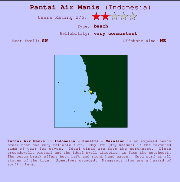
Pantai Air Manis Surf Guide
Pantai Air Manis in Indonesia - Sumatra - Mainland is an exposed beach break that is usually a safe bet. May-Oct (Dry Season) is the favoured time of year for waves. Works best in offshore winds from the northeast. Most of the surf here comes from groundswells and the optimum swell angle is from the southwest. The beach breaks offer lefts and rights. Good surf at all stages of the tide. When the surf is up, it can get quite busy in the water. Dangerous rips are a hazard of surfing here.
Pantai Air Manis Spot Info
| Type: | Rating: | Reliability: | Todays Sea Temp*: |
|---|---|---|---|
| very consistent | 29.5°C*ocean temperature recorded from satellite |
Surfing Pantai Air Manis:
The best conditions reported for surf at Pantai Air Manis occur when a Southwest swell combines with an offshore wind direction from the Northeast.

Energía de Olas (poder): 12 horas


Pantai Air Manis Surf:
Monday, 27 July 2026, 10:42 Local time| lunes 27 | ||||
| 10AM | 1PM | 4PM | 7PM | |
| Wave (m) | ||||
| Período (s) | 10 | 13 | 13 | 13 |
| Viento (km/h) | ||||
| Estado del Viento | glass | on | on | glass |
- /breaks/Pantai-Air-Manis/forecasts/latest
Pantai Air Manis Surf Guide
Pantai Air Manis in Indonesia - Sumatra - Mainland is an exposed beach break that is usually a safe bet. May-Oct (Dry Season) is the favoured time of year for waves. Works best in offshore winds from the northeast. Most of the surf here comes from groundswells and the optimum swell angle is from the southwest. The beach breaks offer lefts and rights. Good surf at all stages of the tide. When the surf is up, it can get quite busy in the water. Dangerous rips are a hazard of surfing here.
Pantai Air Manis Spot Info
Type: Rating: Reliability: Todays Sea Temp*:  Beach
Beach 2
2very consistent 29.5°C*ocean temperature recorded from satelliteSurfing Pantai Air Manis:
The best conditions reported for surf at Pantai Air Manis occur when a Southwest swell combines with an offshore wind direction from the Northeast.
Energía de Olas (poder): 12 horas
Usa la barra de navegación de arriba para ver la temperatura del mar en Pantai Air Manis, fotografías Pantai Air Manis, previsiones detalladas de olas para Pantai Air Manis, vientos y previsión del tiempo, webcams para Pantai Air Manis, viento actual desde estaciones meteorológicas en Sumatra - Mainland y predicciones de marea para Pantai Air Manis. Las mapas de olas para Indonesia enseñarán un mapa grande de Indonesia y los mares que rodean. Los mapas de olas pueden ser animadas para mostrar diferentes componentes de olas, la altura de ola, la energía de ola, el período, junto con previsiones de viento y del tiempo. Previsiones actuales del tiempo y del estado del mar provienen de boyas marinas de Indonesia, del barcos que transitan en la zona y de estaciones meteorológicas costeras. Cada página de previsiones tiene un Busca-Olas Regional y Global para localizar las mejores condiciones para surfear en el área de Pantai Air Manis.
Pantai Air Manis Surf:
Monday, 27 July 2026, 10:42 Local timelunes 27 10AM 1PM 4PM 7PM Wave (m) Período (s) 10 13 13 13 Viento (km/h) Estado del Viento glass on on glass - /breaks/Pantai-Air-Manis/forecasts/latest
- /breaks/Pantai-Air-Manis/forecasts/latest/six_day
Pantai Air Manis Surf Guide
Pantai Air Manis in Indonesia - Sumatra - Mainland is an exposed beach break that is usually a safe bet. May-Oct (Dry Season) is the favoured time of year for waves. Works best in offshore winds from the northeast. Most of the surf here comes from groundswells and the optimum swell angle is from the southwest. The beach breaks offer lefts and rights. Good surf at all stages of the tide. When the surf is up, it can get quite busy in the water. Dangerous rips are a hazard of surfing here.
Pantai Air Manis Spot Info
Type: Rating: Reliability: Todays Sea Temp*: Beach2very consistent 29.5°C*ocean temperature recorded from satelliteSurfing Pantai Air Manis:
The best conditions reported for surf at Pantai Air Manis occur when a Southwest swell combines with an offshore wind direction from the Northeast.
Energía de Olas (poder): 12 horas
Usa la barra de navegación de arriba para ver la temperatura del mar en Pantai Air Manis, fotografías Pantai Air Manis, previsiones detalladas de olas para Pantai Air Manis, vientos y previsión del tiempo, webcams para Pantai Air Manis, viento actual desde estaciones meteorológicas en Sumatra - Mainland y predicciones de marea para Pantai Air Manis. Las mapas de olas para Indonesia enseñarán un mapa grande de Indonesia y los mares que rodean. Los mapas de olas pueden ser animadas para mostrar diferentes componentes de olas, la altura de ola, la energía de ola, el período, junto con previsiones de viento y del tiempo. Previsiones actuales del tiempo y del estado del mar provienen de boyas marinas de Indonesia, del barcos que transitan en la zona y de estaciones meteorológicas costeras. Cada página de previsiones tiene un Busca-Olas Regional y Global para localizar las mejores condiciones para surfear en el área de Pantai Air Manis.
Pantai Air Manis Surf:
Monday, 27 July 2026, 10:42 Local timelunes 27 10AM 1PM 4PM 7PM Wave (m) Período (s) 10 13 13 13 Viento (km/h) Estado del Viento glass on on glass - /breaks/Pantai-Air-Manis/forecasts/latest
Pantai Air Manis Surf Guide
Pantai Air Manis in Indonesia - Sumatra - Mainland is an exposed beach break that is usually a safe bet. May-Oct (Dry Season) is the favoured time of year for waves. Works best in offshore winds from the northeast. Most of the surf here comes from groundswells and the optimum swell angle is from the southwest. The beach breaks offer lefts and rights. Good surf at all stages of the tide. When the surf is up, it can get quite busy in the water. Dangerous rips are a hazard of surfing here.
Pantai Air Manis Spot Info
Type: Rating: Reliability: Todays Sea Temp*: Beach2very consistent 29.5°C*ocean temperature recorded from satelliteSurfing Pantai Air Manis:
The best conditions reported for surf at Pantai Air Manis occur when a Southwest swell combines with an offshore wind direction from the Northeast.
Energía de Olas (poder): 12 horas
Usa la barra de navegación de arriba para ver la temperatura del mar en Pantai Air Manis, fotografías Pantai Air Manis, previsiones detalladas de olas para Pantai Air Manis, vientos y previsión del tiempo, webcams para Pantai Air Manis, viento actual desde estaciones meteorológicas en Sumatra - Mainland y predicciones de marea para Pantai Air Manis. Las mapas de olas para Indonesia enseñarán un mapa grande de Indonesia y los mares que rodean. Los mapas de olas pueden ser animadas para mostrar diferentes componentes de olas, la altura de ola, la energía de ola, el período, junto con previsiones de viento y del tiempo. Previsiones actuales del tiempo y del estado del mar provienen de boyas marinas de Indonesia, del barcos que transitan en la zona y de estaciones meteorológicas costeras. Cada página de previsiones tiene un Busca-Olas Regional y Global para localizar las mejores condiciones para surfear en el área de Pantai Air Manis.
Pantai Air Manis Surf:
Monday, 27 July 2026, 10:42 Local timelunes 27 10AM 1PM 4PM 7PM Wave (m) Período (s) 10 13 13 13 Viento (km/h) Estado del Viento glass on on glass Tide Times:
En Pantai Air Manis (0 km).
PROXIMA ES A LAS (hora local) quedan marea alta marea baja Pantai Air Manis Tide Times and Tide Chart
Live Weather:
At Minangkabau Airport, 25 km from Pantai Air Manis.
calm
(km/h)Air temperature
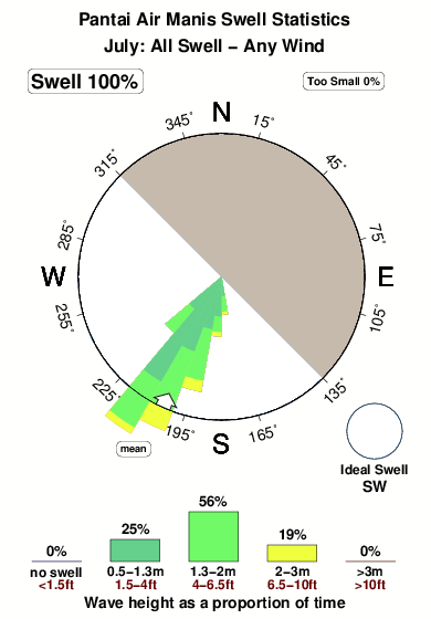
29°COverall Pantai Air Manis Surf Consistency and Wind Distribution in julio
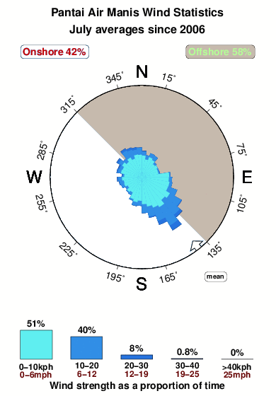


Wind stats for Pantai Air Manis: see the variation in direction and stength by month.
Fotos de Surf
de la galeríaContornos: Carreteras y Ríos: Selecciona un spot desde el menú 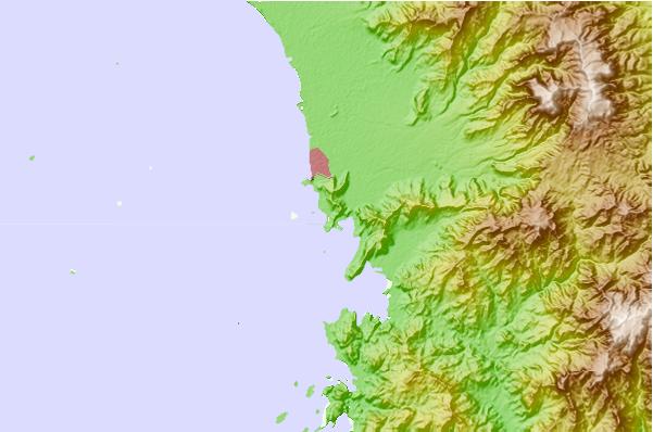
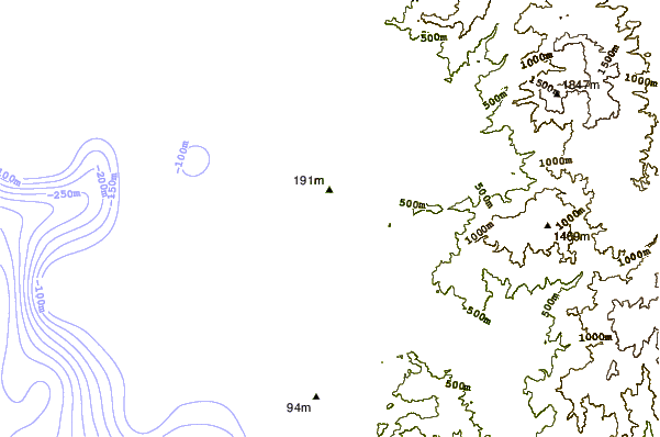
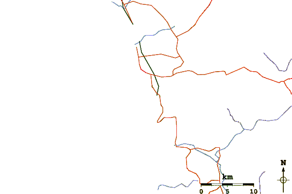
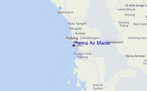
Usa este mapa para navegar hacia las playas de surf de Sumatra - Mainland y estaciones de marea cercanas de Pantai Air Manis
Spots de Surf más cercanos a Pantai Air Manis:
(Clica la ubicación para más detalles)- Closest spot90 mi
- Second closest spot92 mi
- Third closest spot94 mi
- Fourth closest spot94 mi
- Fifth closest spot96 mi
Boyas marinas más cercanas a Pantai Air Manis:
- Closest Boya Marinas2369 mi
- Second closest Boya Marinas2443 mi
- Third closest Boya Marinas2620 mi
- Fourth closest Boya Marinas2634 mi
- Fifth closest Boya Marinas2807 mi
Estaciones de marea más cercanas a Pantai Air Manis:
- Closest estación de mareaPariaman31 mi
- Second closest estación de mareaKualatungkal215 mi
- Third closest estación de mareaSibolga219 mi
- Fourth closest estación de mareaBengkulu234 mi
- Fifth closest estación de mareaMelaka255 mi
Airports
- The nearest passenger airport to Pantai Air Manis is Tabing (Padang) Airport (PDG) in Indonesia, which is 13 km (8 miles) away (directly).
- The second closest airport to Pantai Air Manis is Sultan Syarif Kasim Ii (Pekanbaru) Airport (PKU), also in Indonesia, 202 km (125 miles) away.
- /breaks/Pantai-Air-Manis/forecasts/latest
 Nearest