
Previsiones:

Pronóstico Corto PlazoMayormente seco. Warm (max 23°C el martes por la noche, min 22°C el martes por la noche). El viento será generalmente ligero. | ||||||||||||||||||||||||
mar 14 | miércoles 15 | jueves 16 | vie 17 | |||||||||||||||||||||
5 PM | 8 PM | 11 PM | 2 AM | 5 AM | 8 AM | 11 AM | 2 PM | 5 PM | 8 PM | 11 PM | 2 AM | 5 AM | 8 AM | 11 AM | 2 PM | 5 PM | 8 PM | 11 PM | 2 AM | 5 AM | 8 AM | 11 AM | 2 PM | |
Mapa de Altura de Olas | 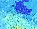 |  |  |  |  |  | 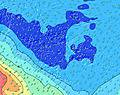 |  | 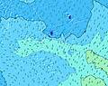 | |||||||||||||||
Oleaje Altura (m) Dirección Período (s) | SSW 12 | SSW 12 | SSW 12 | SSW 15 | SSW 15 | SSW 14 | SSW 14 | SSW 11 | SSW 14 | SSW 14 | SSW 14 | S 17 | S 16 | S 16 | S 16 | S 15 | S 15 | S 14 | S 14 | S 14 | S 14 | S 13 | S 13 | S 13 |
Gráfico Olas | ||||||||||||||||||||||||
1338 | 1316 | 1259 | 2529 | 2446 | 2200 | 1867 | 1049 | 1516 | 1538 | 1427 | 1722 | 2115 | 1988 | 2529 | 2507 | 2842 | 2151 | 1918 | 1979 | 1730 | 1866 | 1533 | 1708 | |
Viento (km/h) | ||||||||||||||||||||||||
Estado del Viento Viento de Mar Viento de Mar-Cruzado Cruzado Viento de Tierra-Cruzado Viento de Tierra Cristalino | cross-on | cross-on | cross-on | cross-on | cross-on | cross-on | cross-on | cross-on | cross-on | cross-on | cross-on | cross-on | cross-on | cross-on | cross-on | cross-on | cross-on | cross-on | cross-on | cross-on | cross-on | cross-on | cross-on | cross-on |
Marea alta | 1:13AM0.28m | 1:18PM0.32m | 1:41AM0.28m | 1:54PM0.32m | 2:08AM0.28m | |||||||||||||||||||
Marea baja | 7:10PM0.00m | 7:13AM0.03m | 7:44PM0.01m | 7:44AM0.03m | 8:16PM0.03m | 8:16AM0.03m | ||||||||||||||||||
— | — | — | — | 6:28 | — | — | — | — | — | — | — | 6:28 | — | — | — | — | — | — | — | 6:28 | — | — | — | |
5:37 | — | — | — | — | — | — | — | 5:38 | — | — | — | — | — | — | — | 5:38 | — | — | — | — | — | — | 5:38 | |
mm | — | — | — | — | — | — | — | — | — | — | — | — | — | — | — | — | — | — | — | — | — | — | — | — |
Temp. °C | 23 | 23 | 23 | 22 | 22 | 22 | 23 | 22 | 22 | 22 | 22 | 22 | 22 | 22 | 22 | 22 | 22 | 22 | 22 | 22 | 22 | 23 | 22 | 22 |
Enfriamiento °C | 20 | 20 | 20 | 19 | 19 | 19 | 20 | 19 | 18 | 18 | 19 | 19 | 19 | 18 | 18 | 18 | 18 | 18 | 18 | 18 | 18 | 20 | 19 | 19 |
Oleaje 1 Altura (m) Dirección Período (s) | SSW 12 | SSW 12 | SSW 12 | SSW 15 | SSW 15 | SSW 14 | SSW 14 | SSW 11 | SSW 14 | SSW 14 | SSW 14 | SSW 14 | S 16 | S 16 | S 16 | S 15 | S 15 | S 14 | S 14 | S 14 | S 14 | S 13 | S 13 | S 13 |
1338 | 1316 | 1259 | 2529 | 2446 | 2200 | 1867 | 1049 | 1516 | 1538 | 1427 | 1647 | 2115 | 1988 | 2529 | 2507 | 2842 | 2151 | 1918 | 1979 | 1730 | 1866 | 1533 | 1708 | |
Oleaje 2 Altura (m) Dirección Período (s) | SSW 16 | SSW 16 | SSW 15 | S 15 | S 14 | S 14 | S 13 | S 13 | S 13 | S 13 | S 13 | S 17 | SSW 14 | SSW 14 | SSW 14 | SSW 14 | SSW 14 | SSW 13 | SSW 13 | SSW 13 | SW 13 | SSW 13 | SW 13 | SSW 12 |
1169 | 1027 | 760 | 348 | 407 | 383 | 356 | 420 | 670 | 772 | 891 | 1722 | 1484 | 1587 | 1210 | 908 | 328 | 808 | 659 | 299 | 501 | 295 | 424 | 199 | |
Oleaje 3 Altura (m) Dirección Período (s) | NNW 12 | S 15 | S 14 | NNW 12 | NNW 12 | NNW 12 | WNW 12 | WNW 18 | S 19 | S 19 | S 18 | NW 16 | NW 16 | NW 16 | NW 16 | NW 16 | NW 16 | NW 16 | NW 16 | NW 16 | NW 15 | NW 15 | SW 18 | SW 19 |
15 | 159 | 264 | 14 | 14 | 14 | 14 | 30 | 65 | 254 | 420 | 41 | 41 | 41 | 65 | 65 | 40 | 38 | 61 | 61 | 58 | 57 | 81 | 125 | |
Olas de Viento Altura (m) Dirección Período (s) | — | — | — | — | — | — | — | — | — | — | — | — | — | — | — | — | — | — | — | — | — | — | — | — |
— | — | — | — | — | — | — | — | — | — | — | — | — | — | — | — | — | — | — | — | — | — | — | — | |
Viento del Tierra o Mar Limpio más proximo | ||||||||||||||||||||||||
Distancia (km) | 3825 | 3825 | 3505 | 3505 | 3505 | 3505 | 3505 | 3505 | 3515 | 3824 | 3515 | 3515 | 3505 | 3505 | 2628 | 39 | 2628 | 2628 | 2628 | 2628 | 2628 | 38 | 38 | 2628 |
Mejores Olas Previstas en Tahiti | ||||||||||||||||||||||||
Mejores Olas Previstas en French Polynesia | ||||||||||||||||||||||||
Busca-Olas Global | ||||||||||||||||||||||||
- Map Icons:
 Break
Break Live Wave Height (m)
 Live Wind Speed (km/h)
 Surf Rating (10 Max)
 Ocean Swells (m)
- Wind Speed (km/h)
GRÁTIS! Un widget de Surf-Forecast.com para tu sitio
Este widget grátis de previsiones de surf y tiempo puede ser añadido a cualquier otro sitio y da un resumen de previsiones de olas para Paea. Solo necesita cortar y pegar el código HTML de abajo en su web. Puede elegir preferencias de idioma y de unidades (métricas o imperiales) para convenir a los usuarios de su sitio. Clica aquí para obtener el código.
 Nearest