

Outer Banks Pier Surf Guide
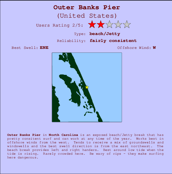
Outer Banks Pier in North Carolina is an exposed beach/Jetty break that has quite consistent surf and can work at any time of the year. The best wind direction is from the west. Most of the surf here comes from groundswells and the best swell direction is from the east northeast. Waves at the beach are both lefts and rights. Best around low tide when the tide is rising. Unlikely to be too crowded, even when the surf is up. Be wary of rips - they make surfing here dangerous.
Outer Banks Pier Spot Info
| Type: | Rating: | Reliability: | Todays Sea Temp*: |
|---|---|---|---|
 Beach/jetty Beach/jetty |  2 2 | fairly consistent | 18.2°C*ocean temperature recorded from satellite |
Surfing Outer Banks Pier:
The best conditions reported for surf at Outer Banks Pier occur when a East-northeast swell combines with an offshore wind direction from the West.
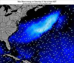
Energía de Olas (poder): 12 horas
Outer Banks Pier Surf:
Saturday, 24 October 2026, 19:58 Local time| sábado 24 | dom | |||
| 5PM | 8PM | 11PM | 2AM | |
| Wave (m) | ||||
| Período (s) | 10 | 6 | 7 | 7 |
| Viento (km/h) | ||||
| Estado del Viento | cross- on |
cross- on |
cross- on |
cross- on |
- /breaks/Outer-Banks-Pier/forecasts/latest

Outer Banks Pier Surf Guide
Outer Banks Pier in North Carolina is an exposed beach/Jetty break that has quite consistent surf and can work at any time of the year. The best wind direction is from the west. Most of the surf here comes from groundswells and the best swell direction is from the east northeast. Waves at the beach are both lefts and rights. Best around low tide when the tide is rising. Unlikely to be too crowded, even when the surf is up. Be wary of rips - they make surfing here dangerous.
Outer Banks Pier Spot Info
Type: Rating: Reliability: Todays Sea Temp*: Beach/jetty2fairly consistent 18.2°C*ocean temperature recorded from satelliteSurfing Outer Banks Pier:
The best conditions reported for surf at Outer Banks Pier occur when a East-northeast swell combines with an offshore wind direction from the West.
Energía de Olas (poder): 12 horas
Usa la barra de navegación de arriba para ver la temperatura del mar en Outer Banks Pier, fotografías Outer Banks Pier, previsiones detalladas de olas para Outer Banks Pier, vientos y previsión del tiempo, webcams para Outer Banks Pier, viento actual desde estaciones meteorológicas en Carolina North y predicciones de marea para Outer Banks Pier. Las mapas de olas para United States enseñarán un mapa grande de United States y los mares que rodean. Los mapas de olas pueden ser animadas para mostrar diferentes componentes de olas, la altura de ola, la energía de ola, el período, junto con previsiones de viento y del tiempo. Previsiones actuales del tiempo y del estado del mar provienen de boyas marinas de United States, del barcos que transitan en la zona y de estaciones meteorológicas costeras. Cada página de previsiones tiene un Busca-Olas Regional y Global para localizar las mejores condiciones para surfear en el área de Outer Banks Pier.
Outer Banks Pier Surf:
Saturday, 24 October 2026, 19:58 Local timesábado 24 dom 5PM 8PM 11PM 2AM Wave (m) Período (s) 10 6 7 7 Viento (km/h) Estado del Viento cross-
oncross-
oncross-
oncross-
on- /breaks/Outer-Banks-Pier/forecasts/latest
- /breaks/Outer-Banks-Pier/forecasts/latest/six_day
Outer Banks Pier Surf Guide
Outer Banks Pier in North Carolina is an exposed beach/Jetty break that has quite consistent surf and can work at any time of the year. The best wind direction is from the west. Most of the surf here comes from groundswells and the best swell direction is from the east northeast. Waves at the beach are both lefts and rights. Best around low tide when the tide is rising. Unlikely to be too crowded, even when the surf is up. Be wary of rips - they make surfing here dangerous.
Outer Banks Pier Spot Info
Type: Rating: Reliability: Todays Sea Temp*: Beach/jetty2fairly consistent 18.2°C*ocean temperature recorded from satelliteSurfing Outer Banks Pier:
The best conditions reported for surf at Outer Banks Pier occur when a East-northeast swell combines with an offshore wind direction from the West.
Energía de Olas (poder): 12 horas
Usa la barra de navegación de arriba para ver la temperatura del mar en Outer Banks Pier, fotografías Outer Banks Pier, previsiones detalladas de olas para Outer Banks Pier, vientos y previsión del tiempo, webcams para Outer Banks Pier, viento actual desde estaciones meteorológicas en Carolina North y predicciones de marea para Outer Banks Pier. Las mapas de olas para United States enseñarán un mapa grande de United States y los mares que rodean. Los mapas de olas pueden ser animadas para mostrar diferentes componentes de olas, la altura de ola, la energía de ola, el período, junto con previsiones de viento y del tiempo. Previsiones actuales del tiempo y del estado del mar provienen de boyas marinas de United States, del barcos que transitan en la zona y de estaciones meteorológicas costeras. Cada página de previsiones tiene un Busca-Olas Regional y Global para localizar las mejores condiciones para surfear en el área de Outer Banks Pier.
Outer Banks Pier Surf:
Saturday, 24 October 2026, 19:58 Local timesábado 24 dom 5PM 8PM 11PM 2AM Wave (m) Período (s) 10 6 7 7 Viento (km/h) Estado del Viento cross-
oncross-
oncross-
oncross-
on- /breaks/Outer-Banks-Pier/forecasts/latest
Outer Banks Pier Surf Guide
Outer Banks Pier in North Carolina is an exposed beach/Jetty break that has quite consistent surf and can work at any time of the year. The best wind direction is from the west. Most of the surf here comes from groundswells and the best swell direction is from the east northeast. Waves at the beach are both lefts and rights. Best around low tide when the tide is rising. Unlikely to be too crowded, even when the surf is up. Be wary of rips - they make surfing here dangerous.
Outer Banks Pier Spot Info
Type: Rating: Reliability: Todays Sea Temp*: Beach/jetty2fairly consistent 18.2°C*ocean temperature recorded from satelliteSurfing Outer Banks Pier:
The best conditions reported for surf at Outer Banks Pier occur when a East-northeast swell combines with an offshore wind direction from the West.
Energía de Olas (poder): 12 horas
Usa la barra de navegación de arriba para ver la temperatura del mar en Outer Banks Pier, fotografías Outer Banks Pier, previsiones detalladas de olas para Outer Banks Pier, vientos y previsión del tiempo, webcams para Outer Banks Pier, viento actual desde estaciones meteorológicas en Carolina North y predicciones de marea para Outer Banks Pier. Las mapas de olas para United States enseñarán un mapa grande de United States y los mares que rodean. Los mapas de olas pueden ser animadas para mostrar diferentes componentes de olas, la altura de ola, la energía de ola, el período, junto con previsiones de viento y del tiempo. Previsiones actuales del tiempo y del estado del mar provienen de boyas marinas de United States, del barcos que transitan en la zona y de estaciones meteorológicas costeras. Cada página de previsiones tiene un Busca-Olas Regional y Global para localizar las mejores condiciones para surfear en el área de Outer Banks Pier.
Outer Banks Pier Surf:
Saturday, 24 October 2026, 19:58 Local timesábado 24 dom 5PM 8PM 11PM 2AM Wave (m) Período (s) 10 6 7 7 Viento (km/h) Estado del Viento cross-
oncross-
oncross-
oncross-
onTide Times:
Para Jennette's Pier, North Carolina, a %{dist} %{km} de %{location}.
PROXIMA ES A LAS (hora local) quedan marea alta marea baja Outer Banks Pier Tide Times and Tide Chart
Live Weather:
At BUOY-ORIN7, 10 km from Outer Banks Pier.
fresh winds from the NE
(km/h)Air temperature
17.4°CCurrent weather near Outer Banks Pier
Buoy Data:
At Nags Head Buoy, NC, 12 miles from Outer Banks Pier.
3PM 4PM 5PM 6PM Antigüedad de datos 3 hr 2 hr 1 hr 0 hr Altura de Olas (m) 

Período Dominante (s) 13 11 7 11 Overall Outer Banks Pier Surf Consistency and Wind Distribution in octubre


Wind stats for Outer Banks Pier: see the variation in direction and stength by month.
Fotos de Surf
de la galeríaContornos: Carreteras y Ríos: Selecciona un spot desde el menú 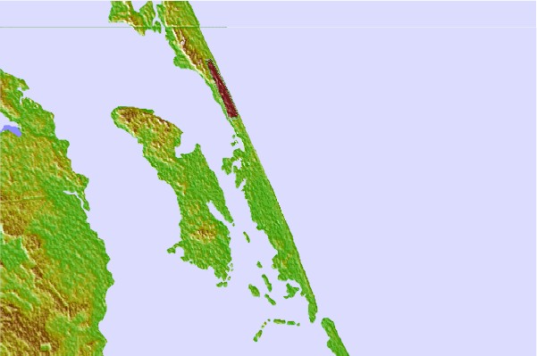
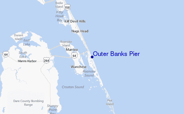
Usa este mapa para navegar hacia las playas de surf de Carolina North y estaciones de marea cercanas de Outer Banks Pier
Spots de Surf más cercanos a Outer Banks Pier:
(Clica la ubicación para más detalles)- Closest spot4 mi
- Second closest spot7 mi
- Third closest spot9 mi
- Fourth closest spot9 mi
- Fifth closest spot12 mi
Boyas marinas más cercanas a Outer Banks Pier:
- Closest Boya Marinas12 mi
- Second closest Boya Marinas17 mi
- Third closest Boya Marinas23 mi
- Fourth closest Boya Marinas23 mi
- Fifth closest Boya Marinas26 mi
Estaciones de marea más cercanas a Outer Banks Pier:
- Closest estación de mareaJennette's Pier2 mi
- Second closest estación de mareaRoanoke Sound Channel6 mi
- Third closest estación de mareaOregon Inlet Marina6 mi
- Fourth closest estación de mareaOld House Channel7 mi
- Fifth closest estación de mareaOregon Inlet Channel7 mi
Airports
- The closest passenger airport to Outer Banks Pier is Elizabeth City Cgas Rgnl Airport (ECG) in USA, 68 km (42 miles) away (directly).
- The second nearest airport to Outer Banks Pier is Oceana Nas Airport (NTU), also in USA, 112 km (70 miles) away.
- Third is Norfolk International Airport (ORF) in USA, 125 km (78 miles) away.
- Norfolk Ns Airport (NGU) in USA is 133 km (83 miles) away.
- Langley Afb (Hampton) Airport (LFI), also in USA is the fifth nearest airport to Outer Banks Pier and is 150 km (93 miles) away.
- /breaks/Outer-Banks-Pier/forecasts/latest

 Nearest