
Previsiones:

Pronóstico Corto PlazoMayormente seco. Warm (max 20°C el viernes por la mañana, min 18°C el jueves por la noche). Vientos decreciente (vientos fuertes desde el NNE el viernes por la noche, Vientos moderados desde el NNE por la mañana de domingo). | |||||||||||||||||||
jue 23 | viernes 24 | sábado 25 | |||||||||||||||||
4 PM | 7 PM | 10 PM | 1 AM | 4 AM | 7 AM | 10 AM | 1 PM | 4 PM | 7 PM | 10 PM | 1 AM | 4 AM | 7 AM | 10 AM | 1 PM | 4 PM | 7 PM | 10 PM | |
Mapa de Altura de Olas | 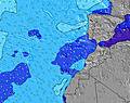 | 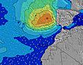 | 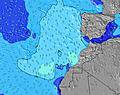 | 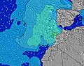 | 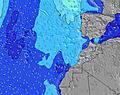 | 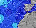 | 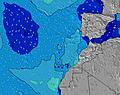 | ||||||||||||
Oleaje Altura (m) Dirección Período (s) | N 7 | N 7 | N 8 | N 8 | N 7 | N 8 | N 8 | N 8 | N 8 | N 8 | N 8 | N 8 | N 8 | N 8 | N 8 | N 8 | N 8 | N 8 | N 8 |
Gráfico Olas | |||||||||||||||||||
276 | 303 | 362 | 358 | 388 | 398 | 409 | 432 | 494 | 565 | 579 | 572 | 520 | 533 | 493 | 405 | 403 | 393 | 428 | |
Viento (km/h) | |||||||||||||||||||
Estado del Viento Viento de Mar Viento de Mar-Cruzado Cruzado Viento de Tierra-Cruzado Viento de Tierra Cristalino | cross-on | cross-on | cross-on | cross-on | cross | cross | cross | cross-on | cross-on | cross-on | cross-on | cross | cross | cross | cross | cross-on | cross-on | cross-on | cross-on |
Marea alta | 8:52PM1.36m | 9:33AM1.45m | 10:08PM1.38m | 10:38AM1.52m | |||||||||||||||
Marea baja | 2:33PM0.75m | 3:03AM0.73m | 4:04PM0.70m | 4:19AM0.68m | 5:07PM0.61m | ||||||||||||||
— | — | — | — | — | 7:28 | — | — | — | — | — | — | — | 7:28 | — | — | — | — | — | |
— | 8:51 | — | — | — | — | — | — | — | 8:50 | — | — | — | — | — | — | — | 8:50 | — | |
mm | — | — | — | — | — | — | — | — | — | — | — | — | — | — | — | — | — | — | — |
Temp. °C | 19 | 19 | 19 | 19 | 19 | 18 | 18 | 20 | 19 | 19 | 19 | 19 | 19 | 18 | 18 | 20 | 19 | 19 | 19 |
Enfriamiento °C | 15 | 15 | 15 | 13 | 13 | 13 | 13 | 16 | 14 | 14 | 12 | 12 | 13 | 12 | 13 | 16 | 16 | 15 | 15 |
Oleaje 1 Altura (m) Dirección Período (s) | WNW 9 | NW 9 | W 11 | W 11 | W 10 | W 10 | W 10 | W 14 | W 15 | W 15 | W 16 | W 16 | — | — | — | — | W 14 | W 14 | W 14 |
7 | 3 | 2 | 2 | 2 | 2 | 2 | 4 | 4 | 4 | 5 | 5 | — | — | — | — | 4 | 4 | 4 | |
Oleaje 2 Altura (m) Dirección Período (s) | W 11 | W 11 | W 16 | W 17 | — | — | — | — | — | — | — | — | — | — | — | — | — | — | — |
2 | 2 | 5 | 5 | — | — | — | — | — | — | — | — | — | — | — | — | — | — | — | |
Oleaje 3 Altura (m) Dirección Período (s) | — | W 16 | — | — | — | — | — | — | — | — | — | — | — | — | — | — | — | — | — |
— | 5 | — | — | — | — | — | — | — | — | — | — | — | — | — | — | — | — | — | |
Olas de Viento Altura (m) Dirección Período (s) | N 7 | N 7 | N 8 | N 8 | N 7 | N 8 | N 8 | N 8 | N 8 | N 8 | N 8 | N 8 | N 8 | N 8 | N 8 | N 8 | N 8 | N 8 | N 8 |
276 | 303 | 362 | 358 | 388 | 398 | 409 | 432 | 494 | 565 | 579 | 572 | 520 | 533 | 493 | 405 | 403 | 393 | 428 | |
Viento del Tierra o Mar Limpio más proximo | |||||||||||||||||||
Distancia (km) | 484 | 484 | 484 | 484 | 484 | 484 | 484 | 484 | 997 | 484 | 484 | 501 | 484 | 484 | 484 | 484 | 484 | 484 | 485 |
Mejores Olas Previstas en Western-Sahara - Coast | |||||||||||||||||||
Mejores Olas Previstas en Western Sahara | |||||||||||||||||||
Busca-Olas Global | |||||||||||||||||||
- Map Icons:
 Break
Break Live Wave Height (m)
 Live Wind Speed (km/h)
 Surf Rating (10 Max)
 Ocean Swells (m)
- Wind Speed (km/h)
GRÁTIS! Un widget de Surf-Forecast.com para tu sitio
Este widget grátis de previsiones de surf y tiempo puede ser añadido a cualquier otro sitio y da un resumen de previsiones de olas para Oumlabouir. Solo necesita cortar y pegar el código HTML de abajo en su web. Puede elegir preferencias de idioma y de unidades (métricas o imperiales) para convenir a los usuarios de su sitio. Clica aquí para obtener el código.
 Nearest