
Previsiones:

Pronóstico Corto PlazoLluvia moderada (totál 17mm), más pesada el lunes por la noche. Warm (max 28°C el domingo por la noche, min 19°C el sábado por la noche). Vientos crecientes (calma el sábado por la tarde, vientos frescos desde el NNO por la mañana de martes). | |||||||||||||||||||||
sáb 18 | domingo 19 | lunes 20 | |||||||||||||||||||
11 AM | 2 PM | 5 PM | 8 PM | 11 PM | 2 AM | 5 AM | 8 AM | 11 AM | 2 PM | 5 PM | 8 PM | 11 PM | 2 AM | 5 AM | 8 AM | 11 AM | 2 PM | 5 PM | 8 PM | 11 PM | |
Mapa de Altura de Olas | 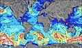 | 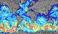 | 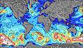 | 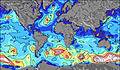 | 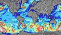 | 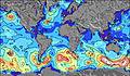 | 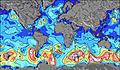 | 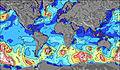 | |||||||||||||
Oleaje Altura (m) Dirección Período (s) | NNW 4 | NNW 3 | — | WSW 3 | WSW 3 | — | — | — | SSW 2 | SW 3 | SW 3 | SSW 3 | SSW 2 | SSW 3 | SW 4 | SW 5 | SW 6 | SW 6 | SW 6 | WSW 6 | WSW 6 |
Gráfico Olas | |||||||||||||||||||||
6 | 1 | 0 | 0 | 0 | 0 | 0 | 0 | 0 | 0 | 0 | 0 | 0 | 0 | 0 | 0 | 0 | 0 | 0 | 0 | 0 | |
Viento (km/h) | |||||||||||||||||||||
Estado del Viento Viento de Mar Viento de Mar-Cruzado Cruzado Viento de Tierra-Cruzado Viento de Tierra Cristalino | on | cross-on | glassy | cross-on | cross-off | off | off | off | cross-off | cross | cross | cross-off | cross-on | cross-off | cross-off | off | cross-off | cross | cross | off | off |
Marea alta | |||||||||||||||||||||
Marea baja | |||||||||||||||||||||
— | — | — | — | — | — | 6:20 | — | — | — | — | — | — | — | 6:22 | — | — | — | — | — | — | |
— | — | — | 9:45 | — | — | — | — | — | — | — | 9:44 | — | — | — | — | — | — | — | 9:44 | — | |
mm | — | — | — | — | — | — | — | — | — | — | — | — | — | 1 | 2 | 1 | — | 4 | 1 | 8 | — |
Temp. °C | 19 | 20 | 22 | 21 | 20 | 19 | 19 | 20 | 24 | 25 | 26 | 28 | 22 | 21 | 21 | 21 | 24 | 24 | 24 | 20 | 20 |
Enfriamiento °C | 18 | 20 | 23 | 21 | 19 | 18 | 17 | 19 | 23 | 25 | 26 | 29 | 22 | 22 | 22 | 23 | 24 | 26 | 26 | 20 | 20 |
Oleaje 1 Altura (m) Dirección Período (s) | W 4 | NNW 3 | — | — | WSW 3 | — | — | — | — | — | — | — | — | — | — | — | — | — | W 6 | — | — |
1 | 1 | — | — | 1 | — | — | — | — | — | — | — | — | — | — | — | — | — | 1 | — | — | |
Oleaje 2 Altura (m) Dirección Período (s) | — | — | — | — | — | — | — | — | — | — | — | — | — | — | — | — | — | — | — | — | — |
— | — | — | — | — | — | — | — | — | — | — | — | — | — | — | — | — | — | — | — | — | |
Oleaje 3 Altura (m) Dirección Período (s) | — | — | — | — | — | — | — | — | — | — | — | — | — | — | — | — | — | — | — | — | — |
— | — | — | — | — | — | — | — | — | — | — | — | — | — | — | — | — | — | — | — | — | |
Olas de Viento Altura (m) Dirección Período (s) | NNW 4 | — | — | WSW 3 | — | — | — | — | SSW 2 | SW 3 | SW 3 | SSW 3 | SSW 2 | SSW 3 | SW 4 | SW 5 | SW 6 | SW 6 | SW 6 | WSW 6 | WSW 6 |
6 | — | — | 1 | — | — | — | — | 1 | 2 | 2 | 1 | 1 | 4 | 21 | 65 | 141 | 217 | 219 | 164 | 84 | |
Viento del Tierra o Mar Limpio más proximo | |||||||||||||||||||||
Distancia (km) | 2190 | 2629 | 2813 | 1461 | 1461 | 510 | 1428 | 1451 | 1423 | 1423 | 1423 | 1425 | 1425 | 1425 | 1434 | 1438 | 350 | 350 | 1528 | 1528 | 1528 |
Mejores Olas Previstas en Lake Superior | |||||||||||||||||||||
Mejores Olas Previstas en United States | |||||||||||||||||||||
Busca-Olas Global | |||||||||||||||||||||
- Map Icons:
 Break
Break Live Wave Height (m)
 Live Wind Speed (km/h)
 Surf Rating (10 Max)
 Ocean Swells (m)
- Wind Speed (km/h)
GRÁTIS! Un widget de Surf-Forecast.com para tu sitio
Este widget grátis de previsiones de surf y tiempo puede ser añadido a cualquier otro sitio y da un resumen de previsiones de olas para Ontonagon. Solo necesita cortar y pegar el código HTML de abajo en su web. Puede elegir preferencias de idioma y de unidades (métricas o imperiales) para convenir a los usuarios de su sitio. Clica aquí para obtener el código.
 Nearest