
Previsiones:

Pronóstico Corto PlazoMayormente seco. Warm (max 26°C el martes por la tarde, min 13°C el domingo por la mañana). Vientos decreciente (vientos fuertes desde el N el domingo por la tarde, Vientos ligeros desde el NNE por la noche de martes). | ||||||||||||||||||||||||
domingo 2 | lunes 3 | martes 4 | ||||||||||||||||||||||
2 AM | 5 AM | 8 AM | 11 AM | 2 PM | 5 PM | 8 PM | 11 PM | 2 AM | 5 AM | 8 AM | 11 AM | 2 PM | 5 PM | 8 PM | 11 PM | 2 AM | 5 AM | 8 AM | 11 AM | 2 PM | 5 PM | 8 PM | 11 PM | |
Mapa de Altura de Olas |  |  |  |  | 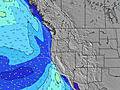 |  |  | 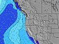 |  | |||||||||||||||
Oleaje Altura (m) Dirección Período (s) | NW 7 | WNW 7 | WNW 8 | NW 8 | NW 9 | NW 9 | NW 8 | NW 8 | NW 8 | NW 8 | NW 8 | NW 8 | NW 8 | NW 8 | NW 8 | NW 8 | NW 8 | NW 8 | NW 8 | NW 8 | NW 8 | NW 8 | NW 8 | NW 8 |
Gráfico Olas | ||||||||||||||||||||||||
269 | 142 | 183 | 414 | 399 | 505 | 459 | 401 | 330 | 273 | 239 | 260 | 362 | 434 | 381 | 602 | 260 | 233 | 239 | 239 | 284 | 311 | 507 | 306 | |
Viento (km/h) | ||||||||||||||||||||||||
Estado del Viento Viento de Mar Viento de Mar-Cruzado Cruzado Viento de Tierra-Cruzado Viento de Tierra Cristalino | cross-on | cross-on | cross-on | cross-on | cross-on | cross-on | cross-on | cross-on | cross-on | cross-on | cross-on | cross-on | cross-on | cross-on | cross-on | cross-on | cross-on | cross-on | cross-on | cross-on | on | on | cross-on | cross-on |
Marea alta | 2:16AM1.80m | 3:19PM1.85m | 3:04AM1.66m | 3:50PM1.92m | 4:01AM1.51m | 4:25PM1.97m | ||||||||||||||||||
Marea baja | 8:53AM0.05m | 9:26PM0.52m | 9:24AM0.23m | 10:19PM0.42m | 9:58AM0.42m | |||||||||||||||||||
— | 6:09 | — | — | — | — | — | — | — | 6:11 | — | — | — | — | — | — | — | 6:11 | — | — | — | — | — | — | |
— | — | — | — | — | — | 8:36 | — | — | — | — | — | — | — | 8:35 | — | — | — | — | — | — | — | 8:34 | — | |
mm | — | — | — | — | — | — | — | — | — | — | — | — | — | — | — | — | — | — | — | — | — | — | — | — |
Temp. °C | 12 | 12 | 13 | 20 | 21 | 20 | 17 | 14 | 13 | 13 | 15 | 23 | 25 | 24 | 20 | 16 | 16 | 16 | 18 | 24 | 26 | 25 | 22 | 18 |
Enfriamiento °C | 9 | 8 | 9 | 14 | 14 | 13 | 11 | 9 | 9 | 8 | 10 | 17 | 17 | 17 | 14 | 11 | 12 | 12 | 14 | 20 | 21 | 20 | 18 | 15 |
Oleaje 1 Altura (m) Dirección Período (s) | WNW 7 | WNW 7 | WNW 8 | NW 8 | SW 14 | SW 13 | SW 13 | NW 8 | NW 8 | NW 8 | NW 8 | SW 13 | SW 13 | SW 13 | SW 16 | NW 8 | NW 8 | NW 8 | NW 8 | NW 8 | SW 16 | SW 15 | NW 8 | NW 8 |
164 | 142 | 183 | 274 | 64 | 63 | 62 | 401 | 330 | 273 | 239 | 44 | 27 | 27 | 41 | 314 | 260 | 233 | 239 | 239 | 62 | 59 | 311 | 306 | |
Oleaje 2 Altura (m) Dirección Período (s) | SW 14 | SW 14 | SW 14 | SW 14 | SW 18 | WSW 18 | WSW 18 | SW 13 | SW 13 | SW 13 | SW 13 | WSW 17 | WSW 17 | SW 16 | SW 13 | SW 16 | SW 16 | SW 16 | SW 16 | SW 16 | SSW 12 | SSW 12 | SW 15 | SW 15 |
95 | 92 | 91 | 91 | 13 | 31 | 31 | 62 | 44 | 44 | 44 | 30 | 28 | 41 | 26 | 41 | 66 | 41 | 65 | 64 | 14 | 14 | 57 | 56 | |
Oleaje 3 Altura (m) Dirección Período (s) | WSW 19 | SW 19 | SW 19 | SW 19 | SW 18 | S 12 | S 12 | SW 18 | SW 18 | WSW 18 | WSW 18 | S 12 | S 12 | S 13 | S 16 | SW 13 | SW 12 | SW 12 | SSW 12 | SSW 12 | S 15 | S 15 | SSW 12 | SSW 12 |
37 | 15 | 15 | 14 | 13 | 12 | 11 | 80 | 49 | 30 | 30 | 3 | 3 | 3 | 5 | 25 | 24 | 24 | 15 | 14 | 17 | 4 | 14 | 14 | |
Olas de Viento Altura (m) Dirección Período (s) | NW 7 | NE 3 | NE 3 | NW 8 | NW 9 | NW 9 | NW 8 | NE 3 | NNE 3 | NNE 3 | NNE 3 | NW 8 | NW 8 | NW 8 | NW 8 | NW 8 | — | — | — | — | NW 8 | NW 8 | NW 8 | — |
269 | 1 | 2 | 414 | 399 | 505 | 459 | 2 | 4 | 6 | 6 | 260 | 362 | 434 | 381 | 602 | — | — | — | — | 284 | 311 | 507 | — | |
Viento del Tierra o Mar Limpio más proximo | ||||||||||||||||||||||||
Distancia (km) | 68 | 68 | 20 | 513 | 532 | 984 | 641 | 278 | 68 | 68 | 68 | 442 | 278 | 277 | 163 | 68 | 20 | 20 | 20 | 83 | 83 | 83 | 68 | 20 |
Mejores Olas Previstas en South Oregon | ||||||||||||||||||||||||
Mejores Olas Previstas en United States | ||||||||||||||||||||||||
Busca-Olas Global | ||||||||||||||||||||||||
- Map Icons:
 Break
Break Live Wave Height (m)
 Live Wind Speed (km/h)
 Surf Rating (10 Max)
 Ocean Swells (m)
- Wind Speed (km/h)
GRÁTIS! Un widget de Surf-Forecast.com para tu sitio
Este widget grátis de previsiones de surf y tiempo puede ser añadido a cualquier otro sitio y da un resumen de previsiones de olas para Nesika Beach. Solo necesita cortar y pegar el código HTML de abajo en su web. Puede elegir preferencias de idioma y de unidades (métricas o imperiales) para convenir a los usuarios de su sitio. Clica aquí para obtener el código.
 Nearest