
Previsiones:

Pronóstico Corto PlazoMayormente seco. Very mild (max 17°C el lunes por la tarde, min 14°C el domingo por la noche). El viento será generalmente ligero. | ||||||||||||||||||
sáb 25 | domingo 26 | lunes 27 | ||||||||||||||||
8 PM | 11 PM | 2 AM | 5 AM | 8 AM | 11 AM | 2 PM | 5 PM | 8 PM | 11 PM | 2 AM | 5 AM | 8 AM | 11 AM | 2 PM | 5 PM | 8 PM | 11 PM | |
Mapa de Altura de Olas |  |  | 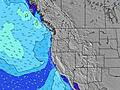 |  |  | 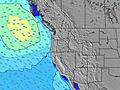 |  | |||||||||||
Oleaje Altura (m) Dirección Período (s) | SW 21 | SW 21 | SW 21 | SW 21 | SW 20 | SW 20 | SW 20 | SW 19 | SW 19 | SW 19 | SW 19 | SW 19 | SW 18 | SW 18 | SW 18 | SW 18 | SW 18 | SW 18 |
Gráfico Olas | ||||||||||||||||||
664 | 548 | 463 | 365 | 428 | 455 | 552 | 627 | 546 | 450 | 450 | 376 | 388 | 375 | 455 | 455 | 455 | 379 | |
Viento (km/h) | ||||||||||||||||||
Estado del Viento Viento de Mar Viento de Mar-Cruzado Cruzado Viento de Tierra-Cruzado Viento de Tierra Cristalino | cross | cross | cross | cross | cross | cross | cross-on | cross-on | cross-on | cross-off | cross-off | cross-off | cross-off | cross-on | cross-on | cross-on | cross | cross-off |
Marea alta | 10:09PM3.03m | 12:24PM2.50m | 10:57PM3.12m | 12:58PM2.60m | ||||||||||||||
Marea baja | 5:32AM0.60m | 5:04PM1.88m | 6:12AM0.48m | 5:49PM1.80m | ||||||||||||||
— | — | — | 5:50 | — | — | — | — | — | — | — | 5:52 | — | — | — | — | — | — | |
8:52 | — | — | — | — | — | — | — | 8:52 | — | — | — | — | — | — | — | 8:51 | — | |
mm | — | — | — | — | — | — | — | — | — | — | — | — | — | — | — | — | — | — |
Temp. °C | 15 | 15 | 16 | 15 | 15 | 16 | 16 | 16 | 16 | 15 | 15 | 14 | 15 | 16 | 17 | 16 | 16 | 15 |
Enfriamiento °C | 13 | 14 | 15 | 14 | 14 | 14 | 14 | 15 | 16 | 14 | 13 | 12 | 14 | 13 | 15 | 14 | 15 | 14 |
Oleaje 1 Altura (m) Dirección Período (s) | SW 6 | SW 6 | SW 21 | SW 21 | SW 20 | SW 20 | SW 20 | SW 19 | SW 19 | SW 19 | SW 19 | SW 19 | SW 18 | SW 18 | SW 18 | SW 18 | SW 18 | SW 18 |
73 | 52 | 463 | 365 | 428 | 455 | 552 | 627 | 546 | 450 | 450 | 376 | 388 | 375 | 455 | 455 | 455 | 379 | |
Oleaje 2 Altura (m) Dirección Período (s) | SW 21 | SW 21 | SW 6 | NW 10 | NW 10 | NW 10 | NW 10 | NW 9 | WNW 9 | NW 9 | NW 9 | NW 9 | NW 9 | WNW 9 | WNW 9 | WNW 9 | WNW 9 | WNW 9 |
664 | 548 | 35 | 82 | 98 | 94 | 92 | 86 | 119 | 67 | 65 | 65 | 65 | 54 | 53 | 53 | 50 | 49 | |
Oleaje 3 Altura (m) Dirección Período (s) | NW 9 | WNW 8 | WNW 11 | SW 6 | SSW 6 | SW 12 | SW 12 | SW 12 | SW 5 | WSW 5 | WSW 5 | WSW 5 | WSW 5 | SW 21 | SW 21 | SSW 11 | WSW 5 | WSW 5 |
36 | 47 | 76 | 27 | 21 | 23 | 23 | 22 | 4 | 15 | 17 | 19 | 18 | 72 | 72 | 13 | 17 | 18 | |
Olas de Viento Altura (m) Dirección Período (s) | — | — | — | — | — | SW 5 | SW 5 | SW 5 | — | — | — | — | — | SW 5 | SW 5 | SW 5 | — | — |
— | — | — | — | — | 14 | 16 | 12 | — | — | — | — | — | 28 | 28 | 27 | — | — | |
Viento del Tierra o Mar Limpio más proximo | ||||||||||||||||||
Distancia (km) | 115 | 104 | 115 | 115 | 104 | 115 | 115 | 115 | 76 | 76 | 9 | 9 | 9 | 115 | 115 | 115 | 76 | 9 |
Mejores Olas Previstas en North Oregon | ||||||||||||||||||
Mejores Olas Previstas en United States | ||||||||||||||||||
Busca-Olas Global | ||||||||||||||||||
- Map Icons:
 Break
Break Live Wave Height (m)
 Live Wind Speed (km/h)
 Surf Rating (10 Max)
 Ocean Swells (m)
- Wind Speed (km/h)
GRÁTIS! Un widget de Surf-Forecast.com para tu sitio
Este widget grátis de previsiones de surf y tiempo puede ser añadido a cualquier otro sitio y da un resumen de previsiones de olas para Needles. Solo necesita cortar y pegar el código HTML de abajo en su web. Puede elegir preferencias de idioma y de unidades (métricas o imperiales) para convenir a los usuarios de su sitio. Clica aquí para obtener el código.
 Nearest