
Previsiones:

Pronóstico Corto PlazoMayormente seco. Warm (max 25°C el martes por la mañana, min 12°C el domingo por la noche). Vientos decreciente (vientos frescos desde el N el lunes por la tarde, Vientos ligeros desde el NNE por la mañana de miércoles). | ||||||||||||||||||||
dom 2 | lunes 3 | martes 4 | ||||||||||||||||||
2 PM | 5 PM | 8 PM | 11 PM | 2 AM | 5 AM | 8 AM | 11 AM | 2 PM | 5 PM | 8 PM | 11 PM | 2 AM | 5 AM | 8 AM | 11 AM | 2 PM | 5 PM | 8 PM | 11 PM | |
Mapa de Altura de Olas |  | 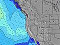 |  | 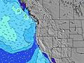 |  |  | 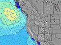 |  | ||||||||||||
Oleaje Altura (m) Dirección Período (s) | WNW 9 | WNW 9 | WNW 9 | WNW 9 | WNW 8 | WNW 8 | WNW 8 | WNW 8 | WNW 7 | NW 7 | NW 7 | NW 7 | NW 7 | NW 7 | NW 7 | WNW 7 | NW 7 | NW 7 | NW 7 | NW 7 |
Gráfico Olas | ||||||||||||||||||||
374 | 397 | 388 | 344 | 277 | 217 | 183 | 170 | 146 | 193 | 228 | 139 | 135 | 135 | 135 | 127 | 143 | 179 | 211 | 171 | |
Viento (km/h) | ||||||||||||||||||||
Estado del Viento Viento de Mar Viento de Mar-Cruzado Cruzado Viento de Tierra-Cruzado Viento de Tierra Cristalino | cross-on | cross | cross | cross-off | cross-off | cross-off | cross-off | cross | cross | cross | cross | cross-off | cross-off | cross-off | cross-off | cross | cross | cross | cross | cross-off |
Marea alta | 4:27PM2.01m | 4:12AM1.80m | 4:58PM2.08m | 5:09AM1.63m | 5:33PM2.14m | |||||||||||||||
Marea baja | 11:06PM0.42m | 11:04AM0.18m | 11:59PM0.34m | 11:38AM0.34m | ||||||||||||||||
— | — | — | — | — | 6:00 | — | — | — | — | — | — | — | 6:01 | — | — | — | — | — | — | |
— | — | 8:43 | — | — | — | — | — | — | — | 8:42 | — | — | — | — | — | — | — | 8:39 | — | |
mm | — | — | — | — | — | — | — | — | — | — | — | — | — | — | — | — | — | — | — | — |
Temp. °C | 17 | 17 | 15 | 13 | 12 | 12 | 13 | 20 | 21 | 21 | 18 | 16 | 16 | 17 | 18 | 25 | 25 | 23 | 19 | 18 |
Enfriamiento °C | 14 | 13 | 11 | 10 | 9 | 10 | 10 | 16 | 15 | 15 | 14 | 12 | 12 | 13 | 15 | 22 | 20 | 18 | 15 | 14 |
Oleaje 1 Altura (m) Dirección Período (s) | WNW 9 | WNW 9 | WNW 9 | WNW 9 | WNW 8 | WNW 8 | WNW 8 | WNW 8 | SW 13 | SW 13 | NW 7 | NW 7 | NW 7 | NW 7 | NW 7 | WNW 7 | NW 7 | WNW 10 | NW 7 | NW 7 |
374 | 397 | 388 | 344 | 277 | 217 | 183 | 170 | 27 | 27 | 178 | 139 | 135 | 135 | 135 | 127 | 143 | 31 | 211 | 171 | |
Oleaje 2 Altura (m) Dirección Período (s) | SW 14 | SW 13 | SW 13 | SW 13 | SW 13 | SW 13 | SW 13 | SW 13 | WSW 18 | WSW 17 | SW 13 | WSW 16 | WSW 16 | WSW 16 | WSW 16 | WSW 16 | WSW 16 | WSW 16 | WNW 9 | WNW 9 |
64 | 63 | 46 | 28 | 28 | 28 | 28 | 27 | 30 | 30 | 27 | 26 | 25 | 25 | 25 | 25 | 25 | 25 | 29 | 47 | |
Oleaje 3 Altura (m) Dirección Período (s) | SW 19 | SW 19 | SW 18 | WSW 18 | WSW 18 | WSW 18 | WSW 18 | WSW 18 | — | — | WSW 16 | SW 13 | SW 13 | SW 13 | SW 13 | SW 13 | WNW 10 | SW 12 | WSW 16 | SW 15 |
14 | 14 | 12 | 31 | 31 | 31 | 31 | 30 | — | — | 27 | 27 | 7 | 7 | 7 | 6 | 10 | 6 | 48 | 60 | |
Olas de Viento Altura (m) Dirección Período (s) | — | — | — | — | — | — | — | — | WNW 7 | NW 7 | NW 7 | — | — | — | — | — | — | NW 7 | — | — |
— | — | — | — | — | — | — | — | 146 | 193 | 228 | — | — | — | — | — | — | 179 | — | — | |
Viento del Tierra o Mar Limpio más proximo | ||||||||||||||||||||
Distancia (km) | 878 | 1308 | 878 | 270 | 3 | 3 | 3 | 126 | 182 | 296 | 523 | 292 | 27 | 25 | 3 | 126 | 182 | 296 | 290 | 290 |
Mejores Olas Previstas en North Oregon | ||||||||||||||||||||
Mejores Olas Previstas en United States | ||||||||||||||||||||
Busca-Olas Global | ||||||||||||||||||||
- Map Icons:
 Break
Break Live Wave Height (m)
 Live Wind Speed (km/h)
 Surf Rating (10 Max)
 Ocean Swells (m)
- Wind Speed (km/h)
GRÁTIS! Un widget de Surf-Forecast.com para tu sitio
Este widget grátis de previsiones de surf y tiempo puede ser añadido a cualquier otro sitio y da un resumen de previsiones de olas para Neakahine Point. Solo necesita cortar y pegar el código HTML de abajo en su web. Puede elegir preferencias de idioma y de unidades (métricas o imperiales) para convenir a los usuarios de su sitio. Clica aquí para obtener el código.
 Nearest