
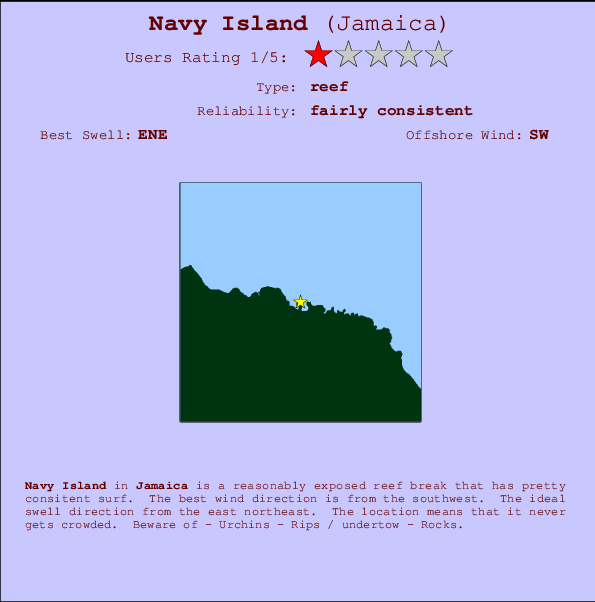
Navy Island Surf Guide
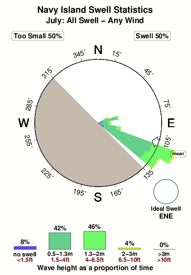
Navy Island in Jamaica is a fairly exposed reef break that has fairly consistent surf. Works best in offshore winds from the southwest. The ideal swell direction from the east northeast. Even when the surf is up, crowds are unknown. Hazards include - Urchins - Rips / undertow - Rocks.
Navy Island Spot Info
| Type: | Rating: | Reliability: | Todays Sea Temp*: |
|---|---|---|---|
| fairly consistent | 29.0°C*ocean temperature recorded from satellite |
Surfing Navy Island:
The best conditions reported for surf at Navy Island occur when a East-northeast swell combines with an offshore wind direction from the Southwest.
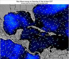
Energía de Olas (poder): 12 horas

Navy Island Surf:
Wednesday, 15 July 2026, 22:37 Local time| miércoles 15 | jue | |||
| 4PM | 7PM | 10PM | 1AM | |
| Wave (m) | ||||
| Período (s) | 8 | 8 | 9 | 9 |
| Viento (km/h) | ||||
| Estado del Viento | cross- on |
cross | cross | cross |
- /breaks/Navy-Island/forecasts/latest
Navy Island Surf Guide
Navy Island in Jamaica is a fairly exposed reef break that has fairly consistent surf. Works best in offshore winds from the southwest. The ideal swell direction from the east northeast. Even when the surf is up, crowds are unknown. Hazards include - Urchins - Rips / undertow - Rocks.
Navy Island Spot Info
Type: Rating: Reliability: Todays Sea Temp*:  Reef
Reef 1
1fairly consistent 29.0°C*ocean temperature recorded from satelliteSurfing Navy Island:
The best conditions reported for surf at Navy Island occur when a East-northeast swell combines with an offshore wind direction from the Southwest.
Energía de Olas (poder): 12 horas
Usa la barra de navegación de arriba para ver la temperatura del mar en Navy Island, fotografías Navy Island, previsiones detalladas de olas para Navy Island, vientos y previsión del tiempo, webcams para Navy Island, viento actual desde estaciones meteorológicas en Jamaica y predicciones de marea para Navy Island. Las mapas de olas para Jamaica enseñarán un mapa grande de Jamaica y los mares que rodean. Los mapas de olas pueden ser animadas para mostrar diferentes componentes de olas, la altura de ola, la energía de ola, el período, junto con previsiones de viento y del tiempo. Previsiones actuales del tiempo y del estado del mar provienen de boyas marinas de Jamaica, del barcos que transitan en la zona y de estaciones meteorológicas costeras. Cada página de previsiones tiene un Busca-Olas Regional y Global para localizar las mejores condiciones para surfear en el área de Navy Island.
Navy Island Surf:
Wednesday, 15 July 2026, 22:37 Local timemiércoles 15 jue 4PM 7PM 10PM 1AM Wave (m) Período (s) 8 8 9 9 Viento (km/h) Estado del Viento cross-
oncross cross cross - /breaks/Navy-Island/forecasts/latest
- /breaks/Navy-Island/forecasts/latest/six_day
Navy Island Surf Guide
Navy Island in Jamaica is a fairly exposed reef break that has fairly consistent surf. Works best in offshore winds from the southwest. The ideal swell direction from the east northeast. Even when the surf is up, crowds are unknown. Hazards include - Urchins - Rips / undertow - Rocks.
Navy Island Spot Info
Type: Rating: Reliability: Todays Sea Temp*: Reef1fairly consistent 29.0°C*ocean temperature recorded from satelliteSurfing Navy Island:
The best conditions reported for surf at Navy Island occur when a East-northeast swell combines with an offshore wind direction from the Southwest.
Energía de Olas (poder): 12 horas
Usa la barra de navegación de arriba para ver la temperatura del mar en Navy Island, fotografías Navy Island, previsiones detalladas de olas para Navy Island, vientos y previsión del tiempo, webcams para Navy Island, viento actual desde estaciones meteorológicas en Jamaica y predicciones de marea para Navy Island. Las mapas de olas para Jamaica enseñarán un mapa grande de Jamaica y los mares que rodean. Los mapas de olas pueden ser animadas para mostrar diferentes componentes de olas, la altura de ola, la energía de ola, el período, junto con previsiones de viento y del tiempo. Previsiones actuales del tiempo y del estado del mar provienen de boyas marinas de Jamaica, del barcos que transitan en la zona y de estaciones meteorológicas costeras. Cada página de previsiones tiene un Busca-Olas Regional y Global para localizar las mejores condiciones para surfear en el área de Navy Island.
Navy Island Surf:
Wednesday, 15 July 2026, 22:37 Local timemiércoles 15 jue 4PM 7PM 10PM 1AM Wave (m) Período (s) 8 8 9 9 Viento (km/h) Estado del Viento cross-
oncross cross cross - /breaks/Navy-Island/forecasts/latest
Navy Island Surf Guide
Navy Island in Jamaica is a fairly exposed reef break that has fairly consistent surf. Works best in offshore winds from the southwest. The ideal swell direction from the east northeast. Even when the surf is up, crowds are unknown. Hazards include - Urchins - Rips / undertow - Rocks.
Navy Island Spot Info
Type: Rating: Reliability: Todays Sea Temp*: Reef1fairly consistent 29.0°C*ocean temperature recorded from satelliteSurfing Navy Island:
The best conditions reported for surf at Navy Island occur when a East-northeast swell combines with an offshore wind direction from the Southwest.
Energía de Olas (poder): 12 horas
Usa la barra de navegación de arriba para ver la temperatura del mar en Navy Island, fotografías Navy Island, previsiones detalladas de olas para Navy Island, vientos y previsión del tiempo, webcams para Navy Island, viento actual desde estaciones meteorológicas en Jamaica y predicciones de marea para Navy Island. Las mapas de olas para Jamaica enseñarán un mapa grande de Jamaica y los mares que rodean. Los mapas de olas pueden ser animadas para mostrar diferentes componentes de olas, la altura de ola, la energía de ola, el período, junto con previsiones de viento y del tiempo. Previsiones actuales del tiempo y del estado del mar provienen de boyas marinas de Jamaica, del barcos que transitan en la zona y de estaciones meteorológicas costeras. Cada página de previsiones tiene un Busca-Olas Regional y Global para localizar las mejores condiciones para surfear en el área de Navy Island.
Navy Island Surf:
Wednesday, 15 July 2026, 22:37 Local timemiércoles 15 jue 4PM 7PM 10PM 1AM Wave (m) Período (s) 8 8 9 9 Viento (km/h) Estado del Viento cross-
oncross cross cross Tide Times:
Para Port Antonio, a %{dist} %{km} de %{location}.
PROXIMA ES A LAS (hora local) quedan marea alta marea baja Navy Island Tide Times and Tide Chart
Live Weather:
At SHIP5484, 41 km from Navy Island.
- Air temperature
-°COverall Navy Island Surf Consistency and Wind Distribution in julio
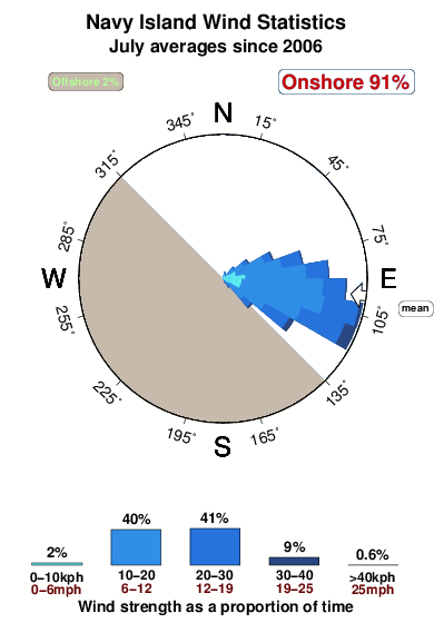


Wind stats for Navy Island: see the variation in direction and stength by month.
Fotos de Surf
de la galeríaContornos: Carreteras y Ríos: Selecciona un spot desde el menú 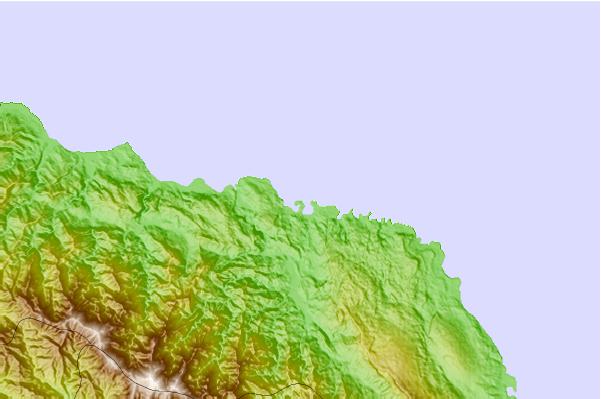
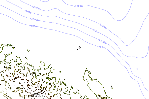
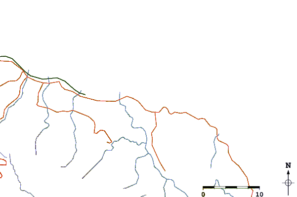
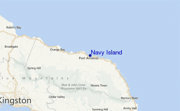
Usa este mapa para navegar hacia las playas de surf de Jamaica y estaciones de marea cercanas de Navy Island
Spots de Surf más cercanos a Navy Island:
(Clica la ubicación para más detalles)- Closest spot6 mi
- Second closest spot9 mi
- Third closest spot11 mi
- Fourth closest spot12 mi
- Fifth closest spot23 mi
Boyas marinas más cercanas a Navy Island:
- Closest Boya Marinas346 mi
- Second closest Boya Marinas533 mi
- Third closest Boya Marinas574 mi
- Fourth closest Boya Marinas602 mi
- Fifth closest Boya Marinas653 mi
Estaciones de marea más cercanas a Navy Island:
- Closest estación de mareaPort Antonio5 mi
- Second closest estación de mareaMorant Bay21 mi
- Third closest estación de mareaPort Morant22 mi
- Fourth closest estación de mareaYallahs24 mi
- Fifth closest estación de mareaNew Kingston25 mi
Airports
- The closest passenger airport to Navy Island is Ken Jones (Port Antonio) Airport (POT) in Jamaica, 9 km (6 miles) away (directly).
- The second nearest airport to Navy Island is Norman Manley International (Kingston) Airport (KIN), also in Jamaica, 45 km (28 miles) away.
- Third is Tinson Pen (Kingston) Airport (KTP) in Jamaica, 45 km (28 miles) away.
- Boscobel (Ocho Rios) Airport (OCJ) in Jamaica is 59 km (37 miles) away.
- Sangster International (Montego Bay) Airport (MBJ), also in Jamaica is the fifth nearest airport to Navy Island and is 158 km (98 miles) away.
- /breaks/Navy-Island/forecasts/latest

 Nearest