
Previsiones:

Pronóstico Corto PlazoLluvia moderada (totál 17mm), más pesada el domingo por la mañana. Warm (max 30°C el lunes por la tarde, min 25°C el domingo por la noche). El viento será generalmente ligero. | ||||||||||||||||||||||||
sábado 1 | domingo 2 | lunes 3 | ||||||||||||||||||||||
2 AM | 5 AM | 8 AM | 11 AM | 2 PM | 5 PM | 8 PM | 11 PM | 2 AM | 5 AM | 8 AM | 11 AM | 2 PM | 5 PM | 8 PM | 11 PM | 2 AM | 5 AM | 8 AM | 11 AM | 2 PM | 5 PM | 8 PM | 11 PM | |
Mapa de Altura de Olas |  | 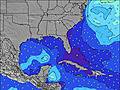 | 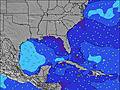 |  | 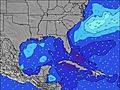 | 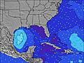 |  | 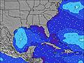 | 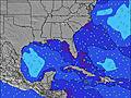 | |||||||||||||||
Oleaje Altura (m) Dirección Período (s) | W 4 | W 4 | W 4 | WNW 4 | — | WNW 4 | W 3 | W 3 | W 3 | W 4 | NW 4 | SSW 3 | SSW 3 | SSW 3 | SSW 3 | W 5 | W 6 | W 6 | W 6 | W 6 | W 6 | WNW 6 | W 6 | W 6 |
Gráfico Olas | ||||||||||||||||||||||||
1 | 1 | 1 | 2 | 0 | 2 | 1 | 1 | 1 | 2 | 0 | 1 | 2 | 2 | 1 | 2 | 2 | 2 | 3 | 3 | 4 | 4 | 3 | 3 | |
Viento (km/h) | ||||||||||||||||||||||||
Estado del Viento Viento de Mar Viento de Mar-Cruzado Cruzado Viento de Tierra-Cruzado Viento de Tierra Cristalino | cross-on | cross-on | on | on | on | on | cross-on | cross-on | cross-on | cross-on | cross | cross-on | cross-on | on | cross | off | cross-off | cross-off | cross-off | cross | on | cross-on | cross-off | off |
Marea alta | 3:08AM0.81m | 2:20PM0.94m | 3:36AM0.83m | 3:04PM0.88m | 4:02AM0.84m | 4:00PM0.82m | ||||||||||||||||||
Marea baja | 8:44AM0.35m | 9:14PM0.12m | 9:27AM0.31m | 9:46PM0.20m | 10:16AM0.27m | 10:18PM0.29m | ||||||||||||||||||
— | 6:52 | — | — | — | — | — | — | — | 6:52 | — | — | — | — | — | — | — | 6:52 | — | — | — | — | — | — | |
— | — | — | — | — | — | 8:13 | — | — | — | — | — | — | — | 8:13 | — | — | — | — | — | — | — | 8:12 | — | |
mm | — | — | — | — | — | — | — | — | — | 1 | 4 | — | 4 | 3 | 1 | 1 | — | — | — | 1 | 2 | — | — | — |
Temp. °C | 28 | 28 | 28 | 29 | 29 | 29 | 29 | 29 | 28 | 28 | 29 | 29 | 29 | 29 | 29 | 25 | 26 | 27 | 27 | 29 | 30 | 29 | 29 | 25 |
Enfriamiento °C | 32 | 32 | 31 | 31 | 30 | 30 | 31 | 32 | 31 | 31 | 31 | 31 | 30 | 31 | 32 | 25 | 27 | 27 | 30 | 32 | 33 | 30 | 30 | 26 |
Oleaje 1 Altura (m) Dirección Período (s) | — | W 4 | W 4 | WNW 4 | — | WNW 4 | — | — | W 3 | W 4 | NW 4 | NW 4 | NW 5 | SSW 3 | SSW 3 | SSW 3 | W 6 | W 6 | W 6 | W 6 | W 6 | S 3 | W 6 | W 6 |
— | 1 | 1 | 2 | — | 2 | — | — | 1 | 2 | 1 | 1 | 1 | 2 | 1 | 1 | 2 | 2 | 3 | 3 | 3 | 1 | 3 | 3 | |
Oleaje 2 Altura (m) Dirección Período (s) | — | — | — | — | — | — | — | — | — | — | — | — | — | — | W 5 | W 5 | — | — | — | — | WNW 6 | S 3 | — | — |
— | — | — | — | — | — | — | — | — | — | — | — | — | — | 1 | 2 | — | — | — | — | 4 | 1 | — | — | |
Oleaje 3 Altura (m) Dirección Período (s) | — | — | — | — | — | — | — | — | — | — | — | — | — | — | — | — | — | — | — | — | — | — | — | — |
— | — | — | — | — | — | — | — | — | — | — | — | — | — | — | — | — | — | — | — | — | — | — | — | |
Olas de Viento Altura (m) Dirección Período (s) | W 4 | — | — | — | — | W 2 | W 3 | W 3 | — | — | — | SSW 3 | SSW 3 | WNW 2 | NNW 3 | — | — | SE 3 | SSE 3 | SSE 3 | S 3 | WNW 6 | WNW 2 | — |
1 | — | — | — | — | 1 | 1 | 1 | — | — | — | 1 | 2 | 1 | 1 | — | — | 1 | 1 | 1 | 2 | 4 | 1 | — | |
Viento del Tierra o Mar Limpio más proximo | ||||||||||||||||||||||||
Distancia (km) | 959 | 959 | 757 | 1220 | 538 | 522 | 408 | 179 | 959 | 241 | 242 | 473 | 242 | 242 | 1326 | 242 | 408 | 348 | 408 | 408 | 150 | 187 | 209 | 408 |
Mejores Olas Previstas en Gulf Coast, Florida | ||||||||||||||||||||||||
Mejores Olas Previstas en United States | ||||||||||||||||||||||||
Busca-Olas Global | ||||||||||||||||||||||||
- Map Icons:
 Break
Break Live Wave Height (m)
 Live Wind Speed (km/h)
 Surf Rating (10 Max)
 Ocean Swells (m)
- Wind Speed (km/h)
GRÁTIS! Un widget de Surf-Forecast.com para tu sitio
Este widget grátis de previsiones de surf y tiempo puede ser añadido a cualquier otro sitio y da un resumen de previsiones de olas para Naples Pier. Solo necesita cortar y pegar el código HTML de abajo en su web. Puede elegir preferencias de idioma y de unidades (métricas o imperiales) para convenir a los usuarios de su sitio. Clica aquí para obtener el código.
 Nearest