
Previsiones:

Pronóstico Corto PlazoLluvia ligera (totál 5mm), cayendo mayormente el miércoles por la noche. Warm (max 28°C el lunes por la tarde, min 27°C el lunes por la noche). El viento será generalmente ligero. | |||||||||||||||||||
lun 3 | martes 4 | miércoles 5 | |||||||||||||||||
3 PM | 6 PM | 9 PM | 12 AM | 3 AM | 6 AM | 9 AM | 12 PM | 3 PM | 6 PM | 9 PM | 12 AM | 3 AM | 6 AM | 9 AM | 12 PM | 3 PM | 6 PM | 9 PM | |
Mapa de Altura de Olas | 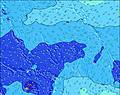 | 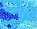 | 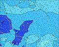 | 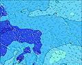 | 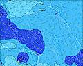 | 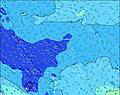 | 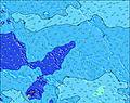 | ||||||||||||
Oleaje Altura (m) Dirección Período (s) | NE 11 | NE 11 | NE 11 | NE 10 | NE 10 | NE 10 | ENE 10 | ENE 10 | ENE 10 | ENE 10 | ENE 15 | SE 8 | NW 12 | NW 12 | NW 12 | NW 12 | ENE 15 | ENE 15 | ENE 15 |
Gráfico Olas | |||||||||||||||||||
119 | 117 | 115 | 82 | 79 | 77 | 63 | 61 | 61 | 37 | 77 | 33 | 69 | 73 | 73 | 69 | 126 | 128 | 123 | |
Viento (km/h) | |||||||||||||||||||
Estado del Viento Viento de Mar Viento de Mar-Cruzado Cruzado Viento de Tierra-Cruzado Viento de Tierra Cristalino | cross | cross | cross | cross-off | cross-off | cross-off | cross-off | cross-off | cross-off | cross-off | cross-off | cross-off | cross-off | off | cross-off | off | off | cross-off | cross-off |
Marea alta | 7:16PM1.66m | 7:25AM1.66m | 7:55PM1.60m | 8:06AM1.51m | 8:45PM1.52m | ||||||||||||||
Marea baja | 1:16AM0.32m | 1:38PM0.28m | 2:00AM0.43m | 2:18PM0.39m | |||||||||||||||
— | — | — | — | — | 6:28 | — | — | — | — | — | — | — | 6:28 | — | — | — | — | — | |
— | 6:39 | — | — | — | — | — | — | — | 6:38 | — | — | — | — | — | — | — | 6:38 | — | |
mm | — | — | — | — | — | 1 | — | — | — | — | — | — | 1 | — | — | — | — | — | — |
Temp. °C | 28 | 28 | 28 | 28 | 28 | 27 | 28 | 28 | 28 | 28 | 28 | 28 | 28 | 28 | 28 | 28 | 28 | 28 | 28 |
Enfriamiento °C | 30 | 30 | 30 | 31 | 32 | 30 | 31 | 31 | 30 | 30 | 31 | 31 | 32 | 32 | 31 | 30 | 30 | 30 | 31 |
Oleaje 1 Altura (m) Dirección Período (s) | WNW 10 | WNW 10 | WNW 10 | WNW 10 | WNW 10 | WNW 10 | WNW 10 | WNW 10 | WNW 10 | WNW 10 | WNW 10 | WNW 9 | WNW 9 | WNW 9 | WNW 9 | WNW 9 | WNW 9 | WNW 9 | WNW 9 |
120 | 120 | 120 | 117 | 120 | 109 | 109 | 105 | 125 | 125 | 125 | 78 | 75 | 73 | 73 | 71 | 73 | 73 | 75 | |
Oleaje 2 Altura (m) Dirección Período (s) | NE 11 | NE 11 | NE 11 | NE 10 | NE 10 | NE 10 | ENE 10 | ENE 10 | ENE 10 | SE 8 | SE 8 | SE 8 | SE 8 | SE 8 | NE 9 | NE 9 | ENE 15 | ENE 15 | ENE 15 |
119 | 117 | 115 | 82 | 79 | 77 | 63 | 61 | 61 | 32 | 32 | 33 | 33 | 33 | 38 | 38 | 126 | 128 | 123 | |
Oleaje 3 Altura (m) Dirección Período (s) | NNW 12 | NW 12 | SE 8 | SE 8 | SE 8 | NW 12 | SE 8 | SE 8 | SE 8 | ENE 10 | ENE 15 | ENE 9 | NW 12 | NW 12 | NW 12 | NW 12 | NE 9 | NE 9 | SE 8 |
94 | 68 | 33 | 33 | 32 | 68 | 31 | 32 | 32 | 37 | 77 | 33 | 69 | 73 | 73 | 69 | 38 | 38 | 31 | |
Olas de Viento Altura (m) Dirección Período (s) | — | — | — | — | — | — | — | — | SE 2 | SE 3 | SE 3 | SE 3 | — | — | — | — | — | SE 3 | — |
— | — | — | — | — | — | — | — | 1 | 1 | 2 | 2 | — | — | — | — | — | 2 | — | |
Viento del Tierra o Mar Limpio más proximo | |||||||||||||||||||
Distancia (km) | 2092 | 2320 | 2320 | 0 | 0 | 0 | 0 | 0 | 2409 | 2217 | 0 | 0 | 0 | 0 | 0 | 0 | 0 | 0 | 0 |
Mejores Olas Previstas en Gilbert Islands | |||||||||||||||||||
Mejores Olas Previstas en Kiribati | |||||||||||||||||||
Busca-Olas Global | |||||||||||||||||||
- Map Icons:
 Break
Break Live Wave Height (m)
 Live Wind Speed (km/h)
 Surf Rating (10 Max)
 Ocean Swells (m)
- Wind Speed (km/h)
GRÁTIS! Un widget de Surf-Forecast.com para tu sitio
Este widget grátis de previsiones de surf y tiempo puede ser añadido a cualquier otro sitio y da un resumen de previsiones de olas para Naa. Solo necesita cortar y pegar el código HTML de abajo en su web. Puede elegir preferencias de idioma y de unidades (métricas o imperiales) para convenir a los usuarios de su sitio. Clica aquí para obtener el código.
 Nearest