
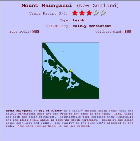
Mount Maunganui Surf Guide
Mount Maunguni in Bay of Plenty is a reasonably exposed beach break that has fairly consistent surf and can work at any time of the year. Offshore winds blow from the south southwest. Tends to receive distant groundswells and the best swell direction is from the north northeast. The beach break provides left and right handers. The quality of the surf isn't affected by the tide. When it's working here, it can get crowded. Take care of .
Mount Maunganui Spot Info
| Type: | Rating: | Reliability: | Todays Sea Temp*: |
|---|---|---|---|
| fairly consistent | 13.9°C*ocean temperature recorded from satellite |
Surfing Mount Maunganui:
The best conditions reported for surf at Mount Maunganui occur when a North-northeast swell combines with an offshore wind direction from the South-southwest.

Energía de Olas (poder): 12 horas


Mount Maunganui Surf:
Friday, 17 July 2026, 12:59 Local time| viernes 17 | ||||
| 9AM | 12PM | 3PM | 6PM | |
| Wave (m) | ||||
| Período (s) | 18 | 18 | 18 | 17 |
| Viento (km/h) | ||||
| Estado del Viento | cross- off |
cross- off |
cross- off |
cross- off |
- /breaks/Mount-Maunguni/forecasts/latest

Mount Maunganui Surf Guide
Mount Maunguni in Bay of Plenty is a reasonably exposed beach break that has fairly consistent surf and can work at any time of the year. Offshore winds blow from the south southwest. Tends to receive distant groundswells and the best swell direction is from the north northeast. The beach break provides left and right handers. The quality of the surf isn't affected by the tide. When it's working here, it can get crowded. Take care of .
Mount Maunganui Spot Info
Type: Rating: Reliability: Todays Sea Temp*:  Beach
Beach 3
3fairly consistent 13.9°C*ocean temperature recorded from satelliteSurfing Mount Maunganui:
The best conditions reported for surf at Mount Maunganui occur when a North-northeast swell combines with an offshore wind direction from the South-southwest.
Energía de Olas (poder): 12 horas
Usa la barra de navegación de arriba para ver la temperatura del mar en Mount Maunganui, fotografías Mount Maunganui, previsiones detalladas de olas para Mount Maunganui, vientos y previsión del tiempo, webcams para Mount Maunganui, viento actual desde estaciones meteorológicas en Bay of Plenty y predicciones de marea para Mount Maunganui. Las mapas de olas para New Zealand enseñarán un mapa grande de New Zealand y los mares que rodean. Los mapas de olas pueden ser animadas para mostrar diferentes componentes de olas, la altura de ola, la energía de ola, el período, junto con previsiones de viento y del tiempo. Previsiones actuales del tiempo y del estado del mar provienen de boyas marinas de New Zealand, del barcos que transitan en la zona y de estaciones meteorológicas costeras. Cada página de previsiones tiene un Busca-Olas Regional y Global para localizar las mejores condiciones para surfear en el área de Mount Maunganui.
Mount Maunganui Surf:
Friday, 17 July 2026, 12:59 Local timeviernes 17 9AM 12PM 3PM 6PM Wave (m) Período (s) 18 18 18 17 Viento (km/h) Estado del Viento cross-
offcross-
offcross-
offcross-
off- /breaks/Mount-Maunguni/forecasts/latest
- /breaks/Mount-Maunguni/forecasts/latest/six_day
Mount Maunganui Surf Guide
Mount Maunguni in Bay of Plenty is a reasonably exposed beach break that has fairly consistent surf and can work at any time of the year. Offshore winds blow from the south southwest. Tends to receive distant groundswells and the best swell direction is from the north northeast. The beach break provides left and right handers. The quality of the surf isn't affected by the tide. When it's working here, it can get crowded. Take care of .
Mount Maunganui Spot Info
Type: Rating: Reliability: Todays Sea Temp*: Beach3fairly consistent 13.9°C*ocean temperature recorded from satelliteSurfing Mount Maunganui:
The best conditions reported for surf at Mount Maunganui occur when a North-northeast swell combines with an offshore wind direction from the South-southwest.
Energía de Olas (poder): 12 horas
Usa la barra de navegación de arriba para ver la temperatura del mar en Mount Maunganui, fotografías Mount Maunganui, previsiones detalladas de olas para Mount Maunganui, vientos y previsión del tiempo, webcams para Mount Maunganui, viento actual desde estaciones meteorológicas en Bay of Plenty y predicciones de marea para Mount Maunganui. Las mapas de olas para New Zealand enseñarán un mapa grande de New Zealand y los mares que rodean. Los mapas de olas pueden ser animadas para mostrar diferentes componentes de olas, la altura de ola, la energía de ola, el período, junto con previsiones de viento y del tiempo. Previsiones actuales del tiempo y del estado del mar provienen de boyas marinas de New Zealand, del barcos que transitan en la zona y de estaciones meteorológicas costeras. Cada página de previsiones tiene un Busca-Olas Regional y Global para localizar las mejores condiciones para surfear en el área de Mount Maunganui.
Mount Maunganui Surf:
Friday, 17 July 2026, 12:59 Local timeviernes 17 9AM 12PM 3PM 6PM Wave (m) Período (s) 18 18 18 17 Viento (km/h) Estado del Viento cross-
offcross-
offcross-
offcross-
off- /breaks/Mount-Maunguni/forecasts/latest
Mount Maunganui Surf Guide
Mount Maunguni in Bay of Plenty is a reasonably exposed beach break that has fairly consistent surf and can work at any time of the year. Offshore winds blow from the south southwest. Tends to receive distant groundswells and the best swell direction is from the north northeast. The beach break provides left and right handers. The quality of the surf isn't affected by the tide. When it's working here, it can get crowded. Take care of .
Mount Maunganui Spot Info
Type: Rating: Reliability: Todays Sea Temp*: Beach3fairly consistent 13.9°C*ocean temperature recorded from satelliteSurfing Mount Maunganui:
The best conditions reported for surf at Mount Maunganui occur when a North-northeast swell combines with an offshore wind direction from the South-southwest.
Energía de Olas (poder): 12 horas
Usa la barra de navegación de arriba para ver la temperatura del mar en Mount Maunganui, fotografías Mount Maunganui, previsiones detalladas de olas para Mount Maunganui, vientos y previsión del tiempo, webcams para Mount Maunganui, viento actual desde estaciones meteorológicas en Bay of Plenty y predicciones de marea para Mount Maunganui. Las mapas de olas para New Zealand enseñarán un mapa grande de New Zealand y los mares que rodean. Los mapas de olas pueden ser animadas para mostrar diferentes componentes de olas, la altura de ola, la energía de ola, el período, junto con previsiones de viento y del tiempo. Previsiones actuales del tiempo y del estado del mar provienen de boyas marinas de New Zealand, del barcos que transitan en la zona y de estaciones meteorológicas costeras. Cada página de previsiones tiene un Busca-Olas Regional y Global para localizar las mejores condiciones para surfear en el área de Mount Maunganui.
Mount Maunganui Surf:
Friday, 17 July 2026, 12:59 Local timeviernes 17 9AM 12PM 3PM 6PM Wave (m) Período (s) 18 18 18 17 Viento (km/h) Estado del Viento cross-
offcross-
offcross-
offcross-
offTide Times:
Para Tauranga, New Zealand, a %{dist} %{km} de %{location}.
PROXIMA ES A LAS (hora local) quedan marea alta marea baja Mount Maunganui Tide Times and Tide Chart
Live Weather:
At Pilot Bay, 1 km from Mount Maunganui.
light winds from the SW
(km/h)
DryAir temperature
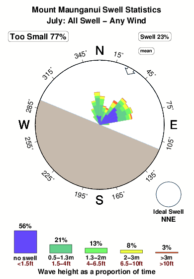
14.8°COverall Mount Maunganui Surf Consistency and Wind Distribution in julio
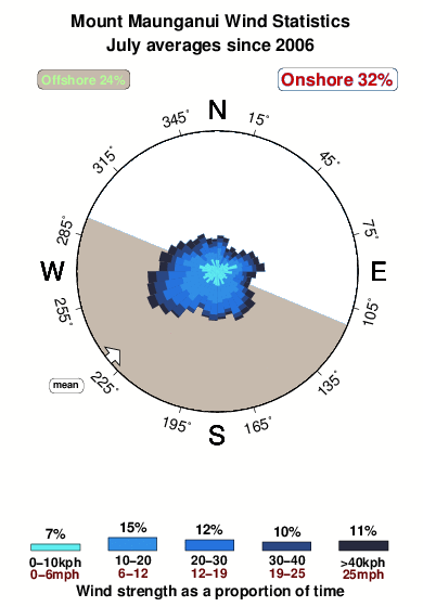


Wind stats for Mount Maunganui: see the variation in direction and stength by month.
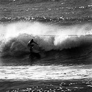
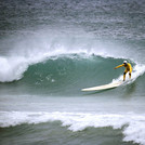
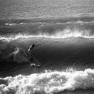
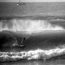
Fotos de Surf
de la galeríaContornos: Carreteras y Ríos: Selecciona un spot desde el menú 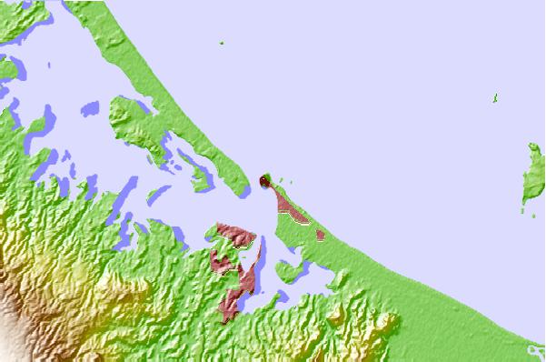
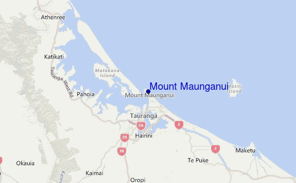
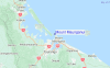
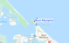
Usa este mapa para navegar hacia las playas de surf de Bay of Plenty y estaciones de marea cercanas de Mount Maunganui
Spots de Surf más cercanos a Mount Maunganui:
(Clica la ubicación para más detalles)- Closest spot0 mi
- Second closest spot2 mi
- Third closest spot2 mi
- Fourth closest spot7 mi
- Fifth closest spot7 mi
Boyas marinas más cercanas a Mount Maunganui:
- Closest Boya Marinas24 mi
- Second closest Boya Marinas151 mi
- Third closest Boya Marinas267 mi
- Fourth closest Boya Marinas274 mi
- Fifth closest Boya Marinas295 mi
Estaciones de marea más cercanas a Mount Maunganui:
- Closest estación de mareaTauranga1 mi
- Second closest estación de mareaSlipper Island42 mi
- Third closest estación de mareaMoutohora (Whale) Island47 mi
- Fourth closest estación de mareaTairua47 mi
- Fifth closest estación de mareaWhakatane50 mi
Airports
- The closest passenger airport to Mount Maunganui is Tauranga Airport (TRG) in New Zealand, 5 km (3 miles) away (directly).
- The second nearest airport to Mount Maunganui is Rotorua Airport (ROT), also in New Zealand, 55 km (34 miles) away.
- Third is Whakatane Airport (WHK) in New Zealand, 72 km (45 miles) away.
- Hamilton Airport (HLZ) in New Zealand is 79 km (49 miles) away.
- Taupo Airport (TUO), also in New Zealand is the fifth nearest airport to Mount Maunganui and is 124 km (77 miles) away.
- /breaks/Mount-Maunguni/forecasts/latest
 Nearest