
Previsiones:

Pronóstico Corto PlazoAlgo de llovizna, más pesada durante la mañana de sábado. Warm (max 32°C el miércoles por la tarde, min 21°C el viernes por la mañana). Vientos decreciente (vientos frescos desde el SO el jueves por la tarde, calma por la mañana de viernes). | ||||||||||||||||||||||||
mié 15 | jueves 16 | viernes 17 | sáb 18 | |||||||||||||||||||||
11 AM | 2 PM | 5 PM | 8 PM | 11 PM | 2 AM | 5 AM | 8 AM | 11 AM | 2 PM | 5 PM | 8 PM | 11 PM | 2 AM | 5 AM | 8 AM | 11 AM | 2 PM | 5 PM | 8 PM | 11 PM | 2 AM | 5 AM | 8 AM | |
Mapa de Altura de Olas |  | 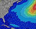 | 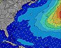 | 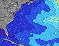 | 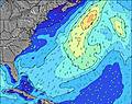 | 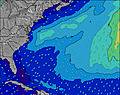 | 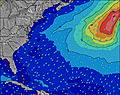 | 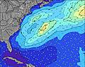 | 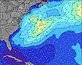 | |||||||||||||||
Oleaje Altura (m) Dirección Período (s) | SW 6 | SW 6 | SW 6 | SSW 6 | SSW 6 | SSW 6 | SSW 6 | SSW 6 | SSW 6 | SSW 6 | SW 5 | SW 6 | SSW 6 | SSW 6 | SSW 6 | SSW 6 | SSW 6 | SSW 6 | SSW 6 | SSW 6 | SSW 6 | SSW 6 | SSW 6 | S 5 |
Gráfico Olas | ||||||||||||||||||||||||
122 | 126 | 156 | 65 | 46 | 40 | 40 | 27 | 27 | 43 | 53 | 88 | 55 | 34 | 28 | 25 | 25 | 26 | 26 | 35 | 35 | 34 | 31 | 27 | |
Viento (km/h) | ||||||||||||||||||||||||
Estado del Viento Viento de Mar Viento de Mar-Cruzado Cruzado Viento de Tierra-Cruzado Viento de Tierra Cristalino | cross-off | cross-off | off | off | cross-off | cross-off | cross | cross | cross-off | cross-off | cross | cross-off | cross-off | off | cross-off | cross-off | glassy | cross | cross | cross | cross | cross | cross | cross-on |
Marea alta | 9:16AM0.91m | 9:35PM1.07m | 10:07AM0.94m | 10:23PM1.02m | 10:56AM0.95m | 11:08PM0.94m | ||||||||||||||||||
Marea baja | 2:46PM-0.09m | 3:40AM-0.12m | 3:39PM-0.06m | 4:23AM-0.09m | 4:31PM-0.02m | 5:04AM-0.05m | ||||||||||||||||||
— | — | — | — | — | — | 5:28 | — | — | — | — | — | — | — | 5:28 | — | — | — | — | — | — | — | 5:30 | — | |
— | — | — | 8:17 | — | — | — | — | — | — | — | 8:17 | — | — | — | — | — | — | — | 8:16 | — | — | — | 8:15 | |
mm | — | — | — | — | — | — | — | — | — | — | — | — | — | — | — | — | — | — | — | — | — | — | — | — |
Temp. °C | 27 | 31 | 32 | 31 | 28 | 26 | 26 | 26 | 26 | 28 | 27 | 27 | 28 | 25 | 24 | 21 | 23 | 25 | 26 | 25 | 23 | 23 | 23 | 23 |
Enfriamiento °C | 26 | 29 | 29 | 27 | 25 | 25 | 24 | 24 | 23 | 23 | 22 | 25 | 26 | 23 | 22 | 18 | 22 | 21 | 21 | 20 | 19 | 22 | 23 | 22 |
Oleaje 1 Altura (m) Dirección Período (s) | SE 9 | SE 9 | SW 6 | SSW 6 | SSW 6 | SSW 6 | SSW 6 | SSW 6 | SSW 6 | SE 9 | SE 9 | SE 9 | SSW 6 | SSW 6 | SSW 6 | SSW 6 | SSW 6 | SSW 6 | SE 8 | SE 8 | SE 8 | SE 8 | SE 8 | SE 8 |
12 | 12 | 109 | 65 | 46 | 40 | 40 | 27 | 27 | 3 | 3 | 3 | 55 | 34 | 28 | 25 | 25 | 26 | 3 | 3 | 3 | 3 | 3 | 3 | |
Oleaje 2 Altura (m) Dirección Período (s) | — | S 17 | SE 9 | ESE 9 | ESE 9 | ESE 9 | NNW 3 | SE 9 | SE 9 | S 15 | SE 15 | SE 15 | SE 9 | SE 9 | N 3 | SE 9 | SE 8 | SE 8 | SE 14 | SE 14 | SE 14 | SE 14 | SE 14 | SE 14 |
— | 5 | 12 | 8 | 8 | 8 | 1 | 3 | 3 | 4 | 9 | 9 | 3 | 3 | 1 | 3 | 3 | 3 | 8 | 8 | 8 | 8 | 8 | 7 | |
Oleaje 3 Altura (m) Dirección Período (s) | — | — | S 17 | S 17 | S 17 | S 17 | SE 9 | — | SE 15 | — | — | — | SE 15 | SE 15 | SE 9 | — | SE 14 | SE 14 | — | E 9 | — | — | E 9 | E 8 |
— | — | 5 | 5 | 6 | 5 | 3 | — | 9 | — | — | — | 9 | 9 | 3 | — | 8 | 8 | — | 2 | — | — | 2 | 1 | |
Olas de Viento Altura (m) Dirección Período (s) | SW 6 | SW 6 | SW 6 | NW 3 | NNW 4 | NNW 3 | — | — | SW 2 | SSW 6 | SW 5 | SW 6 | NW 3 | NNW 3 | — | — | — | — | SSW 6 | SSW 6 | SSW 6 | SSW 6 | SSW 6 | S 5 |
122 | 126 | 156 | 9 | 9 | 4 | — | — | 1 | 43 | 53 | 88 | 3 | 4 | — | — | — | — | 26 | 35 | 35 | 34 | 31 | 27 | |
Viento del Tierra o Mar Limpio más proximo | ||||||||||||||||||||||||
Distancia (km) | 0 | 45 | 0 | 0 | 25 | 25 | 658 | 1798 | 1107 | 1686 | 1686 | 45 | 0 | 25 | 25 | 666 | 658 | 658 | 669 | 2516 | 1107 | 658 | 658 | 658 |
Mejores Olas Previstas en Long Island New York | ||||||||||||||||||||||||
Mejores Olas Previstas en United States | ||||||||||||||||||||||||
Busca-Olas Global | ||||||||||||||||||||||||
- Map Icons:
 Break
Break Live Wave Height (m)
 Live Wind Speed (km/h)
 Surf Rating (10 Max)
 Ocean Swells (m)
- Wind Speed (km/h)
GRÁTIS! Un widget de Surf-Forecast.com para tu sitio
Este widget grátis de previsiones de surf y tiempo puede ser añadido a cualquier otro sitio y da un resumen de previsiones de olas para Montauk Point - Turtles. Solo necesita cortar y pegar el código HTML de abajo en su web. Puede elegir preferencias de idioma y de unidades (métricas o imperiales) para convenir a los usuarios de su sitio. Clica aquí para obtener el código.
 Nearest