
Previsiones:

Pronóstico Corto PlazoLluvia moderada (totál 14mm), más pesada el martes por la tarde. Very mild (max 12°C el lunes por la noche, min 7°C el martes por la tarde). Vientos decreciente (vientos fuertes desde el NNO el martes por la mañana, Vientos ligeros desde el OSO por la tarde de jueves). | ||||||||||||||||||
lun 27 | martes 28 | miércoles 29 | ||||||||||||||||
7 PM | 10 PM | 1 AM | 4 AM | 7 AM | 10 AM | 1 PM | 4 PM | 7 PM | 10 PM | 1 AM | 4 AM | 7 AM | 10 AM | 1 PM | 4 PM | 7 PM | 10 PM | |
Mapa de Altura de Olas |  |  |  |  |  | 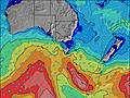 |  | |||||||||||
Oleaje Altura (m) Dirección Período (s) | NNW 5 | NNW 5 | NNW 6 | NNW 7 | N 7 | NNW 8 | NNW 8 | NNW 8 | N 8 | NW 7 | NW 6 | NNW 7 | NNW 12 | NNW 15 | NW 14 | NW 14 | NW 14 | NW 14 |
Gráfico Olas | ||||||||||||||||||
27 | 45 | 201 | 410 | 679 | 881 | 1186 | 829 | 157 | 346 | 245 | 234 | 93 | 298 | 167 | 92 | 66 | 29 | |
Viento (km/h) | ||||||||||||||||||
Estado del Viento Viento de Mar Viento de Mar-Cruzado Cruzado Viento de Tierra-Cruzado Viento de Tierra Cristalino | cross-on | cross-on | cross-on | cross-on | cross-on | cross-on | cross-on | cross-off | cross-off | cross | cross | cross-off | cross-off | cross-off | cross-off | cross-off | cross-off | cross-off |
Marea alta | 9:38PM2.53m | 10:45AM2.47m | 10:30PM2.52m | 11:38AM2.50m | ||||||||||||||
Marea baja | 4:13AM0.63m | 4:36PM1.17m | 5:05AM0.62m | 5:30PM1.15m | ||||||||||||||
— | — | — | — | 7:28 | — | — | — | — | — | — | — | 7:28 | — | — | — | — | — | |
— | — | — | — | — | — | — | 5:20 | — | — | — | — | — | — | — | 5:20 | — | — | |
mm | — | — | 1 | 1 | — | — | 3 | 4 | 1 | 1 | 2 | 1 | — | — | — | — | — | — |
Temp. °C | 12 | 12 | 12 | 12 | 12 | 12 | 11 | 10 | 7 | 8 | 8 | 7 | 8 | 8 | 9 | 9 | 8 | 8 |
Enfriamiento °C | 9 | 7 | 6 | 5 | 5 | 4 | 3 | 4 | 1 | 1 | 2 | 2 | 2 | 1 | 1 | 2 | 2 | 2 |
Oleaje 1 Altura (m) Dirección Período (s) | NW 12 | NW 12 | — | — | — | — | — | — | N 8 | NW 16 | NW 15 | NNW 7 | NNW 7 | NNW 15 | NW 14 | NW 14 | NW 14 | NW 14 |
6 | 6 | — | — | — | — | — | — | 157 | 10 | 36 | 234 | 91 | 298 | 167 | 92 | 66 | 29 | |
Oleaje 2 Altura (m) Dirección Período (s) | — | — | — | — | — | — | — | — | NW 17 | — | — | NW 19 | NNW 12 | NW 7 | N 6 | — | — | — |
— | — | — | — | — | — | — | — | 11 | — | — | 15 | 93 | 7 | 3 | — | — | — | |
Oleaje 3 Altura (m) Dirección Período (s) | — | — | — | — | — | — | — | — | — | — | — | — | NW 17 | NE 7 | E 6 | — | — | — |
— | — | — | — | — | — | — | — | — | — | — | — | 76 | 2 | 1 | — | — | — | |
Olas de Viento Altura (m) Dirección Período (s) | NNW 5 | NNW 5 | NNW 6 | NNW 7 | N 7 | NNW 8 | NNW 8 | NNW 8 | NW 8 | NW 7 | NW 6 | WSW 3 | W 4 | WSW 5 | SW 5 | SW 4 | WSW 4 | SW 4 |
27 | 45 | 201 | 410 | 679 | 881 | 1186 | 829 | 407 | 346 | 245 | 7 | 33 | 80 | 67 | 45 | 29 | 24 | |
Viento del Tierra o Mar Limpio más proximo | ||||||||||||||||||
Distancia (km) | 266 | 277 | 288 | 288 | 288 | 288 | 637 | 288 | 283 | 266 | 121 | 86 | 86 | 266 | 1530 | 926 | 290 | 262 |
Mejores Olas Previstas en North Coast of Tasmania | ||||||||||||||||||
Mejores Olas Previstas en Australia | ||||||||||||||||||
Busca-Olas Global | ||||||||||||||||||
- Map Icons:
 Break
Break Live Wave Height (m)
 Live Wind Speed (km/h)
 Surf Rating (10 Max)
 Ocean Swells (m)
- Wind Speed (km/h)
GRÁTIS! Un widget de Surf-Forecast.com para tu sitio
Este widget grátis de previsiones de surf y tiempo puede ser añadido a cualquier otro sitio y da un resumen de previsiones de olas para Mini Bluff. Solo necesita cortar y pegar el código HTML de abajo en su web. Puede elegir preferencias de idioma y de unidades (métricas o imperiales) para convenir a los usuarios de su sitio. Clica aquí para obtener el código.
 Nearest