
Previsiones:

Pronóstico Corto PlazoLluvia moderada (totál 17mm), más pesada el martes por la noche. Very mild (max 14°C el lunes por la tarde, min 11°C el martes por la tarde). Vientos crecientes (calma el domingo por la noche, vientos fuertes desde el E por la tarde de martes). | ||||||||||||||||||||||||
lunes 3 | martes 4 | miércoles 5 | ||||||||||||||||||||||
1 AM | 4 AM | 7 AM | 10 AM | 1 PM | 4 PM | 7 PM | 10 PM | 1 AM | 4 AM | 7 AM | 10 AM | 1 PM | 4 PM | 7 PM | 10 PM | 1 AM | 4 AM | 7 AM | 10 AM | 1 PM | 4 PM | 7 PM | 10 PM | |
Mapa de Altura de Olas |  | 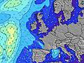 |  |  |  |  |  |  |  | |||||||||||||||
Oleaje Altura (m) Dirección Período (s) | N 9 | N 9 | N 9 | N 9 | N 9 | N 8 | N 8 | N 8 | N 8 | N 8 | N 8 | N 8 | ESE 5 | ESE 5 | ESE 6 | ESE 7 | ESE 7 | E 7 | E 7 | ENE 6 | NE 6 | NE 6 | NNE 6 | NNE 6 |
Gráfico Olas | ||||||||||||||||||||||||
165 | 165 | 162 | 153 | 119 | 113 | 88 | 86 | 86 | 65 | 63 | 46 | 44 | 103 | 225 | 325 | 355 | 357 | 293 | 216 | 182 | 151 | 100 | 143 | |
Viento (km/h) | ||||||||||||||||||||||||
Estado del Viento Viento de Mar Viento de Mar-Cruzado Cruzado Viento de Tierra-Cruzado Viento de Tierra Cristalino | off | glassy | on | cross-on | cross-on | cross-on | cross | cross | cross-on | cross | cross-on | cross-on | cross-on | cross-on | cross-on | cross-on | cross-on | cross-on | on | on | on | on | on | cross-on |
Marea alta | 1:48AM2.54m | 2:24PM2.20m | 2:23AM2.45m | 3:02PM2.15m | 3:04AM2.34m | 3:47PM2.08m | ||||||||||||||||||
Marea baja | 7:56AM0.23m | 7:58PM0.53m | 8:33AM0.32m | 8:39PM0.61m | 9:16AM0.45m | 9:27PM0.72m | ||||||||||||||||||
— | 4:58 | — | — | — | — | — | — | — | 5:01 | — | — | — | — | — | — | — | 5:03 | — | — | — | — | — | — | |
— | — | — | — | — | — | 9:30 | — | — | — | — | — | — | — | 9:29 | — | — | — | — | — | — | — | 9:25 | — | |
mm | — | — | — | — | — | — | — | — | — | — | — | 1 | 1 | 2 | 1 | 1 | 2 | 3 | 2 | 1 | 1 | 1 | 1 | 1 |
Temp. °C | 13 | 13 | 12 | 13 | 13 | 14 | 14 | 13 | 13 | 13 | 13 | 13 | 12 | 11 | 12 | 12 | 12 | 12 | 12 | 12 | 13 | 12 | 12 | 12 |
Enfriamiento °C | 11 | 12 | 9 | 10 | 10 | 11 | 11 | 9 | 9 | 8 | 8 | 7 | 4 | 2 | 3 | 4 | 5 | 5 | 5 | 5 | 7 | 5 | 5 | 6 |
Oleaje 1 Altura (m) Dirección Período (s) | N 9 | N 9 | N 9 | N 9 | N 9 | N 8 | N 8 | N 8 | N 8 | N 8 | N 8 | N 8 | N 8 | N 8 | N 8 | N 8 | N 8 | N 7 | N 7 | N 7 | — | — | ESE 6 | ESE 6 |
165 | 165 | 162 | 153 | 119 | 113 | 88 | 86 | 86 | 65 | 63 | 46 | 44 | 29 | 28 | 28 | 18 | 27 | 17 | 16 | — | — | 36 | 19 | |
Oleaje 2 Altura (m) Dirección Período (s) | — | WNW 7 | — | W 7 | — | — | — | — | — | — | — | — | — | — | W 7 | — | — | — | — | — | — | — | — | — |
— | 5 | — | 1 | — | — | — | — | — | — | — | — | — | — | 1 | — | — | — | — | — | — | — | — | — | |
Oleaje 3 Altura (m) Dirección Período (s) | — | — | — | — | — | — | — | — | — | — | — | — | — | — | — | — | — | — | — | — | — | — | — | — |
— | — | — | — | — | — | — | — | — | — | — | — | — | — | — | — | — | — | — | — | — | — | — | — | |
Olas de Viento Altura (m) Dirección Período (s) | — | — | — | SSE 3 | — | SE 2 | SE 3 | SSE 4 | SSE 5 | SE 4 | SE 4 | SE 4 | ESE 5 | ESE 5 | ESE 6 | ESE 7 | ESE 7 | E 7 | E 7 | ENE 6 | NE 6 | NE 6 | NNE 6 | NNE 6 |
— | — | — | 1 | — | 1 | 3 | 7 | 12 | 16 | 14 | 20 | 44 | 103 | 225 | 325 | 355 | 357 | 293 | 216 | 182 | 151 | 100 | 143 | |
Viento del Tierra o Mar Limpio más proximo | ||||||||||||||||||||||||
Distancia (km) | 0 | 0 | 53 | 71 | 73 | 73 | 41 | 41 | 114 | 114 | 78 | 457 | 457 | 242 | 242 | 220 | 160 | 160 | 160 | 161 | 168 | 220 | 220 | 1207 |
Mejores Olas Previstas en Orkney Islands | ||||||||||||||||||||||||
Mejores Olas Previstas en United Kingdom | ||||||||||||||||||||||||
Busca-Olas Global | ||||||||||||||||||||||||
- Map Icons:
 Break
Break Live Wave Height (m)
 Live Wind Speed (km/h)
 Surf Rating (10 Max)
 Ocean Swells (m)
- Wind Speed (km/h)
GRÁTIS! Un widget de Surf-Forecast.com para tu sitio
Este widget grátis de previsiones de surf y tiempo puede ser añadido a cualquier otro sitio y da un resumen de previsiones de olas para Mill Bay. Solo necesita cortar y pegar el código HTML de abajo en su web. Puede elegir preferencias de idioma y de unidades (métricas o imperiales) para convenir a los usuarios de su sitio. Clica aquí para obtener el código.
 Nearest