
Previsiones:

Pronóstico Corto PlazoMayormente seco. Warm (max 22°C el sábado por la mañana, min 19°C el lunes por la mañana). Mayormente vientos frescos. | ||||||||||||||||||||||||
sábado 11 | domingo 12 | lunes 13 | ||||||||||||||||||||||
2 AM | 5 AM | 8 AM | 11 AM | 2 PM | 5 PM | 8 PM | 11 PM | 2 AM | 5 AM | 8 AM | 11 AM | 2 PM | 5 PM | 8 PM | 11 PM | 2 AM | 5 AM | 8 AM | 11 AM | 2 PM | 5 PM | 8 PM | 11 PM | |
Mapa de Altura de Olas |  |  |  |  |  | 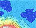 | 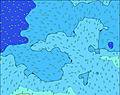 | 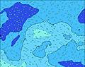 | 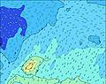 | |||||||||||||||
Oleaje Altura (m) Dirección Período (s) | WSW 11 | WSW 10 | WSW 10 | SW 11 | SW 10 | SW 10 | SW 10 | SW 10 | SW 10 | SSW 17 | SSW 16 | SSW 16 | SSW 16 | SSW 16 | SSW 14 | SSW 13 | SSW 13 | SSW 13 | SSW 12 | WNW 13 | SSW 12 | SSW 12 | WNW 12 | WNW 12 |
Gráfico Olas | ||||||||||||||||||||||||
0 | 0 | 0 | 0 | 0 | 0 | 0 | 0 | 0 | 0 | 0 | 0 | 0 | 0 | 0 | 0 | 0 | 0 | 0 | 16 | 0 | 0 | 15 | 15 | |
Viento (km/h) | ||||||||||||||||||||||||
Estado del Viento Viento de Mar Viento de Mar-Cruzado Cruzado Viento de Tierra-Cruzado Viento de Tierra Cristalino | cross-off | cross-off | cross-off | cross-off | cross-off | cross-off | cross-off | cross-off | cross-off | cross-off | cross-off | off | off | off | off | off | off | off | off | off | off | off | off | off |
Marea alta | 6:09AM0.68m | 6:43PM0.51m | 7:04AM0.73m | 7:38PM0.55m | 7:57AM0.76m | 8:30PM0.57m | ||||||||||||||||||
Marea baja | 11:31PM-0.06m | 12:23PM-0.14m | 00:26AM-0.10m | 1:16PM-0.19m | 1:19AM-0.13m | 2:06PM-0.22m | ||||||||||||||||||
— | 7:16 | — | — | — | — | — | — | — | 7:16 | — | — | — | — | — | — | — | 7:16 | — | — | — | — | — | — | |
— | — | — | — | — | 6:12 | — | — | — | — | — | — | — | 6:12 | — | — | — | — | — | — | — | 6:13 | — | — | |
mm | — | — | — | — | — | — | — | — | — | — | — | — | — | — | — | — | — | — | — | — | — | — | — | — |
Temp. °C | 22 | 22 | 22 | 22 | 22 | 22 | 22 | 22 | 22 | 21 | 21 | 21 | 21 | 21 | 21 | 20 | 20 | 20 | 19 | 20 | 20 | 19 | 19 | 19 |
Enfriamiento °C | 18 | 18 | 19 | 19 | 18 | 18 | 18 | 18 | 18 | 18 | 19 | 18 | 16 | 17 | 16 | 16 | 16 | 14 | 14 | 16 | 16 | 15 | 15 | 15 |
Oleaje 1 Altura (m) Dirección Período (s) | WSW 11 | WSW 10 | WSW 10 | SW 11 | WSW 11 | WSW 10 | SW 10 | SW 10 | SW 10 | SW 10 | SW 10 | SW 9 | SSW 16 | SSW 16 | SSW 14 | SSW 13 | SSW 13 | SSW 13 | SSW 12 | SSW 16 | SSW 12 | SSW 12 | SSW 16 | SSW 16 |
1148 | 1110 | 1071 | 584 | 308 | 358 | 800 | 665 | 665 | 546 | 486 | 396 | 1324 | 1663 | 1541 | 1561 | 1901 | 1935 | 1759 | 838 | 1622 | 1493 | 768 | 740 | |
Oleaje 2 Altura (m) Dirección Período (s) | SSW 16 | SW 13 | SSW 12 | WSW 11 | SW 12 | SW 12 | SSW 15 | SSW 17 | SSW 17 | SSW 17 | SSW 16 | SSW 16 | WSW 10 | WSW 9 | WSW 9 | WSW 10 | SSW 18 | SSW 18 | SSW 18 | WSW 10 | SSW 16 | SSW 16 | NNE 9 | WNW 12 |
179 | 162 | 193 | 469 | 202 | 137 | 279 | 475 | 475 | 911 | 683 | 612 | 223 | 153 | 146 | 135 | 408 | 644 | 644 | 19 | 798 | 788 | 7 | 15 | |
Oleaje 3 Altura (m) Dirección Período (s) | SSW 13 | SSW 16 | SSW 16 | SSW 12 | SSW 16 | SSW 15 | SSW 18 | SSW 14 | SSW 13 | ESE 10 | ESE 9 | SSW 10 | SSW 20 | SSW 20 | SSW 20 | SSW 19 | WSW 10 | WSW 10 | WSW 10 | WNW 13 | WSW 10 | WSW 9 | WNW 12 | NNE 9 |
113 | 234 | 232 | 193 | 322 | 204 | 276 | 236 | 229 | 18 | 29 | 73 | 158 | 336 | 336 | 243 | 74 | 77 | 34 | 16 | 30 | 17 | 15 | 8 | |
Olas de Viento Altura (m) Dirección Período (s) | — | — | — | — | SW 10 | SW 10 | — | — | — | — | — | — | — | — | — | — | — | — | SSW 12 | SSW 12 | — | — | SSW 12 | S 11 |
— | — | — | — | 602 | 437 | — | — | — | — | — | — | — | — | — | — | — | — | 2094 | 1794 | — | — | 1390 | 1252 | |
Viento del Tierra o Mar Limpio más proximo | ||||||||||||||||||||||||
Distancia (km) | 1510 | 1166 | 5 | 5 | 1166 | 1131 | 5 | 5 | 5 | 5 | 5 | 1008 | 1131 | 1131 | 1120 | 1008 | 1131 | 1118 | 1008 | 1008 | 1008 | 2440 | 2440 | 2440 |
Mejores Olas Previstas en Cook-Islands - Rarotonga | ||||||||||||||||||||||||
Mejores Olas Previstas en Cook Islands | ||||||||||||||||||||||||
Busca-Olas Global | ||||||||||||||||||||||||
- Map Icons:
 Break
Break Live Wave Height (m)
 Live Wind Speed (km/h)
 Surf Rating (10 Max)
 Ocean Swells (m)
- Wind Speed (km/h)
GRÁTIS! Un widget de Surf-Forecast.com para tu sitio
Este widget grátis de previsiones de surf y tiempo puede ser añadido a cualquier otro sitio y da un resumen de previsiones de olas para Matai Wreck. Solo necesita cortar y pegar el código HTML de abajo en su web. Puede elegir preferencias de idioma y de unidades (métricas o imperiales) para convenir a los usuarios de su sitio. Clica aquí para obtener el código.
 Nearest