
Previsiones:

Pronóstico Corto PlazoLluvia ligera (totál 8mm), cayendo mayormente el jueves por la tarde. Warm (max 29°C el jueves por la mañana, min 26°C el miércoles por la noche). El viento será generalmente ligero. | |||||||||||||||||
jueves 16 | viernes 17 | ||||||||||||||||
9 PM | 12 AM | 3 AM | 6 AM | 9 AM | 12 PM | 3 PM | 6 PM | 9 PM | 12 AM | 3 AM | 6 AM | 9 AM | 12 PM | 3 PM | 6 PM | 9 PM | |
Mapa de Altura de Olas |  |  | 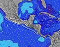 |  |  | 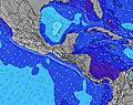 |  | ||||||||||
Oleaje Altura (m) Dirección Período (s) | SW 16 | SW 16 | SSW 12 | SSW 13 | SSW 13 | SSW 13 | SSW 13 | SSW 14 | SSW 14 | SSW 12 | SSW 12 | SSW 12 | SSW 12 | SSW 13 | SSW 13 | SSW 13 | SSW 13 |
Gráfico Olas | |||||||||||||||||
163 | 163 | 220 | 116 | 261 | 298 | 396 | 421 | 465 | 163 | 163 | 210 | 271 | 303 | 372 | 331 | 307 | |
Viento (km/h) | |||||||||||||||||
Estado del Viento Viento de Mar Viento de Mar-Cruzado Cruzado Viento de Tierra-Cruzado Viento de Tierra Cristalino | on | cross | cross | cross-off | cross-off | cross-off | cross-on | on | glassy | cross | cross-off | cross-off | cross-off | glassy | cross-on | cross-on | cross-on |
Marea alta | 3:55AM2.67m | 4:09PM2.74m | 4:44AM2.73m | 4:59PM2.68m | |||||||||||||
Marea baja | 9:38PM-0.04m | 10:00AM0.17m | 10:27PM-0.04m | 10:52AM0.18m | |||||||||||||
— | — | 5:26 | — | — | — | — | — | — | — | 5:26 | — | — | — | — | — | — | |
— | — | — | — | — | — | — | 6:05 | — | — | — | — | — | — | — | 6:05 | — | |
mm | — | — | — | — | — | — | — | 2 | — | — | — | — | — | — | — | 2 | 1 |
Temp. °C | 28 | 27 | 27 | 26 | 28 | 29 | 29 | 28 | 28 | 27 | 27 | 26 | 28 | 29 | 29 | 28 | 28 |
Enfriamiento °C | 32 | 31 | 31 | 29 | 31 | 32 | 32 | 32 | 32 | 31 | 30 | 30 | 32 | 34 | 32 | 31 | 32 |
Oleaje 1 Altura (m) Dirección Período (s) | SSW 12 | SSW 12 | SSW 12 | S 12 | SSW 13 | SSW 13 | SSW 13 | SSW 14 | SSW 14 | SSW 12 | SSW 12 | SSW 12 | SSW 12 | SSW 13 | SSW 13 | SSW 13 | SSW 13 |
111 | 113 | 220 | 106 | 261 | 298 | 396 | 421 | 465 | 161 | 153 | 210 | 271 | 303 | 372 | 331 | 307 | |
Oleaje 2 Altura (m) Dirección Período (s) | SW 13 | S 15 | SW 16 | SSW 13 | SW 16 | SW 16 | SW 16 | SW 20 | SSW 19 | SSW 14 | SSW 14 | SW 15 | SW 15 | SW 15 | SW 15 | S 16 | S 7 |
84 | 159 | 163 | 116 | 91 | 91 | 41 | 16 | 37 | 163 | 163 | 76 | 75 | 75 | 54 | 80 | 14 | |
Oleaje 3 Altura (m) Dirección Período (s) | SW 16 | SW 16 | SSW 16 | SW 16 | S 8 | SSW 16 | SW 21 | SW 9 | W 17 | SW 15 | SW 15 | SSW 15 | SW 19 | SW 19 | SW 20 | S 7 | S 16 |
163 | 163 | 51 | 91 | 11 | 25 | 17 | 3 | 6 | 75 | 75 | 72 | 57 | 58 | 62 | 14 | 81 | |
Olas de Viento Altura (m) Dirección Período (s) | — | — | — | — | — | — | — | — | — | — | — | — | — | — | — | — | — |
— | — | — | — | — | — | — | — | — | — | — | — | — | — | — | — | — | |
Viento del Tierra o Mar Limpio más proximo | |||||||||||||||||
Distancia (km) | 39 | 1 | 1 | 0 | 0 | 0 | 39 | 14 | 0 | 1 | 0 | 0 | 0 | 0 | 81 | 39 | 4 |
Mejores Olas Previstas en Golfo de Nicoya | |||||||||||||||||
Mejores Olas Previstas en Costa Rica | |||||||||||||||||
Busca-Olas Global | |||||||||||||||||
- Map Icons:
 Break
Break Live Wave Height (m)
 Live Wind Speed (km/h)
 Surf Rating (10 Max)
 Ocean Swells (m)
- Wind Speed (km/h)
GRÁTIS! Un widget de Surf-Forecast.com para tu sitio
Este widget grátis de previsiones de surf y tiempo puede ser añadido a cualquier otro sitio y da un resumen de previsiones de olas para Mar Azul. Solo necesita cortar y pegar el código HTML de abajo en su web. Puede elegir preferencias de idioma y de unidades (métricas o imperiales) para convenir a los usuarios de su sitio. Clica aquí para obtener el código.
 Nearest