
Previsiones:

Pronóstico Corto PlazoMayormente seco. Very mild (max 18°C el domingo por la tarde, min 12°C el sábado por la noche). El viento será generalmente ligero. | ||||||||||||||||||||||
viernes 17 | sábado 18 | domingo 19 | ||||||||||||||||||||
8 AM | 11 AM | 2 PM | 5 PM | 8 PM | 11 PM | 2 AM | 5 AM | 8 AM | 11 AM | 2 PM | 5 PM | 8 PM | 11 PM | 2 AM | 5 AM | 8 AM | 11 AM | 2 PM | 5 PM | 8 PM | 11 PM | |
Mapa de Altura de Olas |  | 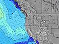 | 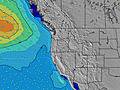 | 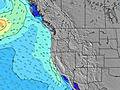 |  |  | 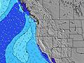 | 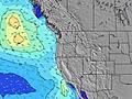 | ||||||||||||||
Oleaje Altura (m) Dirección Período (s) | WNW 17 | WNW 17 | WNW 16 | WNW 16 | WNW 16 | WNW 16 | WNW 11 | WNW 16 | WNW 16 | WNW 16 | WNW 16 | WNW 10 | WNW 16 | WSW 18 | WSW 18 | WNW 15 | WNW 8 | WNW 8 | WNW 8 | WNW 8 | NW 8 | WNW 8 |
Gráfico Olas | ||||||||||||||||||||||
390 | 367 | 273 | 346 | 266 | 266 | 281 | 263 | 333 | 256 | 253 | 250 | 250 | 246 | 240 | 231 | 187 | 178 | 178 | 224 | 248 | 278 | |
Viento (km/h) | ||||||||||||||||||||||
Estado del Viento Viento de Mar Viento de Mar-Cruzado Cruzado Viento de Tierra-Cruzado Viento de Tierra Cristalino | cross-off | cross-on | cross-on | on | glassy | cross-off | cross-off | cross-off | cross | cross-on | cross-on | cross | cross | cross | cross-off | cross-off | cross | cross | cross-on | cross | cross | cross |
Marea alta | 4:04PM2.24m | 3:32AM2.29m | 4:45PM2.28m | 4:28AM2.01m | 5:25PM2.30m | |||||||||||||||||
Marea baja | 9:30AM-0.37m | 9:47PM0.57m | 10:11AM-0.15m | 10:47PM0.52m | 10:50AM0.12m | |||||||||||||||||
5:41 | — | — | — | — | — | — | 5:43 | — | — | — | — | — | — | — | 5:43 | — | — | — | — | — | — | |
— | — | — | — | 9:00 | — | — | — | — | — | — | — | 8:59 | — | — | — | — | — | — | — | 8:59 | — | |
mm | — | — | — | — | — | — | — | — | — | — | — | — | — | — | — | — | — | — | — | — | — | — |
Temp. °C | 15 | 15 | 16 | 15 | 15 | 14 | 14 | 13 | 14 | 17 | 17 | 17 | 15 | 13 | 12 | 12 | 13 | 17 | 17 | 18 | 16 | 14 |
Enfriamiento °C | 14 | 13 | 14 | 14 | 15 | 14 | 14 | 12 | 13 | 14 | 13 | 13 | 12 | 10 | 9 | 10 | 10 | 13 | 13 | 14 | 13 | 11 |
Oleaje 1 Altura (m) Dirección Período (s) | WNW 8 | WNW 17 | WNW 8 | WNW 7 | WNW 7 | WNW 11 | WNW 11 | WNW 10 | WNW 10 | WNW 10 | WNW 10 | WNW 10 | WNW 9 | WNW 9 | NW 9 | WNW 8 | WNW 8 | WNW 8 | WNW 8 | WNW 8 | NW 8 | WNW 8 |
88 | 367 | 72 | 70 | 66 | 170 | 281 | 260 | 245 | 240 | 231 | 241 | 130 | 124 | 174 | 179 | 187 | 178 | 178 | 224 | 248 | 278 | |
Oleaje 2 Altura (m) Dirección Período (s) | WNW 17 | NW 7 | WNW 16 | WNW 16 | WNW 16 | WNW 16 | WNW 16 | WNW 16 | WNW 16 | WNW 16 | WNW 16 | WNW 16 | WNW 16 | WNW 15 | WNW 15 | WNW 15 | W 15 | W 14 | W 14 | W 14 | W 14 | W 14 |
390 | 54 | 273 | 346 | 266 | 266 | 263 | 263 | 333 | 256 | 253 | 250 | 250 | 246 | 240 | 231 | 155 | 150 | 150 | 148 | 104 | 104 | |
Oleaje 3 Altura (m) Dirección Período (s) | SW 16 | WSW 16 | WNW 12 | WNW 12 | WNW 11 | WNW 7 | SW 14 | SW 14 | SW 14 | SW 14 | SW 14 | SW 18 | WSW 17 | WSW 18 | WSW 18 | SW 18 | SW 19 | SW 13 | SW 16 | SW 16 | SW 16 | SW 16 |
63 | 94 | 81 | 119 | 140 | 42 | 54 | 54 | 53 | 54 | 53 | 79 | 202 | 204 | 211 | 161 | 123 | 45 | 41 | 64 | 89 | 127 | |
Olas de Viento Altura (m) Dirección Período (s) | — | — | — | — | — | — | — | — | — | — | — | NW 5 | NW 5 | NW 5 | — | — | — | — | — | — | — | — |
— | — | — | — | — | — | — | — | — | — | — | 29 | 29 | 24 | — | — | — | — | — | — | — | — | |
Viento del Tierra o Mar Limpio más proximo | ||||||||||||||||||||||
Distancia (km) | 84 | 96 | 135 | 135 | 7 | 7 | 7 | 7 | 7 | 64 | 438 | 438 | 422 | 64 | 29 | 29 | 29 | 273 | 274 | 300 | 273 | 129 |
Mejores Olas Previstas en North Oregon | ||||||||||||||||||||||
Mejores Olas Previstas en United States | ||||||||||||||||||||||
Busca-Olas Global | ||||||||||||||||||||||
- Map Icons:
 Break
Break Live Wave Height (m)
 Live Wind Speed (km/h)
 Surf Rating (10 Max)
 Ocean Swells (m)
- Wind Speed (km/h)
GRÁTIS! Un widget de Surf-Forecast.com para tu sitio
Este widget grátis de previsiones de surf y tiempo puede ser añadido a cualquier otro sitio y da un resumen de previsiones de olas para Manzanita. Solo necesita cortar y pegar el código HTML de abajo en su web. Puede elegir preferencias de idioma y de unidades (métricas o imperiales) para convenir a los usuarios de su sitio. Clica aquí para obtener el código.
 Nearest