
Previsiones:

Pronóstico Corto PlazoMayormente seco. Warm (max 29°C el jueves por la mañana, min 25°C el jueves por la noche). Mayormente vientos frescos. | ||||||||||||||||||||||||
jueves 16 | viernes 17 | sábado 18 | ||||||||||||||||||||||
2 AM | 5 AM | 8 AM | 11 AM | 2 PM | 5 PM | 8 PM | 11 PM | 2 AM | 5 AM | 8 AM | 11 AM | 2 PM | 5 PM | 8 PM | 11 PM | 2 AM | 5 AM | 8 AM | 11 AM | 2 PM | 5 PM | 8 PM | 11 PM | |
Mapa de Altura de Olas |  | 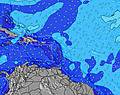 |  |  |  |  |  |  |  | |||||||||||||||
Oleaje Altura (m) Dirección Período (s) | E 7 | E 8 | E 7 | E 7 | E 7 | E 4 | E 5 | E 5 | E 5 | E 6 | E 6 | E 7 | E 7 | E 6 | E 6 | E 6 | E 6 | E 7 | E 7 | E 7 | E 7 | E 7 | E 7 | E 7 |
Gráfico Olas | ||||||||||||||||||||||||
70 | 72 | 54 | 70 | 88 | 37 | 34 | 37 | 45 | 50 | 98 | 104 | 124 | 128 | 128 | 132 | 116 | 124 | 128 | 154 | 154 | 150 | 124 | 104 | |
Viento (km/h) | ||||||||||||||||||||||||
Estado del Viento Viento de Mar Viento de Mar-Cruzado Cruzado Viento de Tierra-Cruzado Viento de Tierra Cristalino | cross | cross | cross | cross-on | cross-on | cross-on | cross-on | cross | cross | cross | cross | cross-on | cross-on | cross-on | cross-on | cross-on | cross | cross | cross | cross-on | cross-on | cross-on | cross-on | cross |
Marea alta | 10:03AM0.55m | 10:44PM0.77m | 11:01AM0.58m | 11:31PM0.71m | 11:59AM0.60m | |||||||||||||||||||
Marea baja | 4:26AM0.12m | 4:01PM0.03m | 5:12AM0.11m | 5:01PM0.08m | 5:56AM0.11m | 6:01PM0.13m | ||||||||||||||||||
— | 6:11 | — | — | — | — | — | — | — | 6:11 | — | — | — | — | — | — | — | 6:11 | — | — | — | — | — | — | |
— | — | — | — | — | 7:22 | — | — | — | — | — | — | — | 7:22 | — | — | — | — | — | — | — | 7:22 | — | — | |
mm | — | — | — | — | — | — | — | — | — | — | — | — | — | — | — | — | — | — | — | — | — | — | — | — |
Temp. °C | 25 | 24 | 26 | 29 | 29 | 29 | 27 | 26 | 25 | 25 | 26 | 28 | 28 | 28 | 27 | 26 | 25 | 25 | 26 | 28 | 28 | 28 | 26 | 26 |
Enfriamiento °C | 27 | 26 | 27 | 28 | 27 | 29 | 27 | 27 | 27 | 27 | 28 | 28 | 26 | 28 | 27 | 26 | 26 | 27 | 28 | 27 | 27 | 27 | 26 | 27 |
Oleaje 1 Altura (m) Dirección Período (s) | E 7 | E 8 | E 7 | N 7 | N 7 | N 7 | NNE 7 | E 7 | E 7 | E 7 | NNE 7 | NNE 7 | NNE 7 | NNE 6 | NNE 7 | NNE 7 | NNE 7 | NNE 7 | NE 8 | NE 9 | NE 9 | NE 9 | NE 9 | NE 9 |
70 | 72 | 54 | 10 | 9 | 9 | 9 | 17 | 17 | 25 | 5 | 5 | 5 | 4 | 4 | 5 | 4 | 5 | 15 | 12 | 3 | 3 | 12 | 12 | |
Oleaje 2 Altura (m) Dirección Período (s) | N 8 | N 8 | N 8 | — | — | — | — | NNE 7 | NNE 7 | N 6 | N 6 | N 6 | N 6 | NE 9 | NE 9 | NE 9 | NE 9 | NE 9 | NE 10 | — | NNE 7 | NE 7 | — | — |
5 | 10 | 10 | — | — | — | — | 9 | 9 | 3 | 3 | 1 | 1 | 3 | 3 | 3 | 3 | 3 | 4 | — | 4 | 2 | — | — | |
Oleaje 3 Altura (m) Dirección Período (s) | — | — | — | — | — | — | — | — | NNE 7 | NE 7 | — | NE 10 | — | — | — | — | — | — | — | — | — | — | — | — |
— | — | — | — | — | — | — | — | 5 | 2 | — | 4 | — | — | — | — | — | — | — | — | — | — | — | — | |
Olas de Viento Altura (m) Dirección Período (s) | — | — | — | E 7 | E 7 | E 4 | E 5 | E 5 | E 5 | E 6 | E 6 | E 7 | E 7 | E 6 | E 6 | E 6 | E 6 | E 7 | E 7 | E 7 | E 7 | E 7 | E 7 | E 7 |
— | — | — | 70 | 88 | 37 | 34 | 37 | 45 | 50 | 98 | 104 | 124 | 128 | 128 | 132 | 116 | 124 | 128 | 154 | 154 | 150 | 124 | 104 | |
Viento del Tierra o Mar Limpio más proximo | ||||||||||||||||||||||||
Distancia (km) | 6 | 6 | 6 | 885 | 885 | 1010 | 1078 | 151 | 33 | 14 | 33 | 505 | 505 | 1078 | 367 | 14 | 14 | 14 | 14 | 1064 | 823 | 1004 | 1004 | 14 |
Mejores Olas Previstas en Amber Coast | ||||||||||||||||||||||||
Mejores Olas Previstas en Dominican Republic | ||||||||||||||||||||||||
Busca-Olas Global | ||||||||||||||||||||||||
- Map Icons:
 Break
Break Live Wave Height (m)
 Live Wind Speed (km/h)
 Surf Rating (10 Max)
 Ocean Swells (m)
- Wind Speed (km/h)
GRÁTIS! Un widget de Surf-Forecast.com para tu sitio
Este widget grátis de previsiones de surf y tiempo puede ser añadido a cualquier otro sitio y da un resumen de previsiones de olas para Mañanero. Solo necesita cortar y pegar el código HTML de abajo en su web. Puede elegir preferencias de idioma y de unidades (métricas o imperiales) para convenir a los usuarios de su sitio. Clica aquí para obtener el código.
 Nearest