
Previsiones:

Pronóstico Corto PlazoMayormente seco. Warm (max 28°C el jueves por la mañana, min 27°C el miércoles por la mañana). El viento será generalmente ligero. | ||||||||||||||||||||||||
miércoles 15 | jueves 16 | viernes 17 | sáb 18 | |||||||||||||||||||||
6 AM | 9 AM | 12 PM | 3 PM | 6 PM | 9 PM | 12 AM | 3 AM | 6 AM | 9 AM | 12 PM | 3 PM | 6 PM | 9 PM | 12 AM | 3 AM | 6 AM | 9 AM | 12 PM | 3 PM | 6 PM | 9 PM | 12 AM | 3 AM | |
Mapa de Altura de Olas |  |  |  | 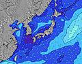 |  |  | 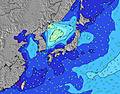 |  |  | |||||||||||||||
Oleaje Altura (m) Dirección Período (s) | SW 4 | SW 5 | E 9 | WSW 5 | E 9 | WSW 5 | WSW 5 | E 9 | WSW 5 | WSW 5 | WSW 5 | WSW 5 | WSW 5 | WSW 5 | WSW 9 | E 10 | WSW 5 | WSW 5 | E 10 | E 10 | E 10 | W 6 | E 10 | W 8 |
Gráfico Olas | ||||||||||||||||||||||||
14 | 19 | 6 | 19 | 7 | 21 | 17 | 6 | 24 | 27 | 28 | 26 | 20 | 20 | 0 | 7 | 44 | 39 | 8 | 8 | 8 | 27 | 8 | 22 | |
Viento (km/h) | ||||||||||||||||||||||||
Estado del Viento Viento de Mar Viento de Mar-Cruzado Cruzado Viento de Tierra-Cruzado Viento de Tierra Cristalino | cross | cross | cross-on | cross-on | cross | cross | cross | cross-on | cross-on | cross-on | cross-on | cross-on | cross-on | cross | cross | cross | cross-on | cross | cross-on | cross-on | cross | cross | cross-on | cross-on |
Marea alta | 7:16AM2.21m | 8:39PM2.07m | 8:02AM2.23m | 9:14PM2.08m | 8:47AM2.19m | 9:49PM2.07m | ||||||||||||||||||
Marea baja | 2:05PM0.03m | 2:17AM0.87m | 2:46PM0.08m | 2:59AM0.79m | 3:25PM0.18m | |||||||||||||||||||
5:45 | — | — | — | — | — | — | 5:45 | — | — | — | — | — | — | — | 5:46 | — | — | — | — | — | — | — | 5:46 | |
— | — | — | — | 7:23 | — | — | — | — | — | — | — | 7:23 | — | — | — | — | — | — | — | 7:22 | — | — | 7:22 | |
mm | — | — | — | — | — | — | — | — | — | — | — | — | — | — | — | — | — | — | — | — | — | — | — | — |
Temp. °C | 26 | 27 | 27 | 27 | 27 | 27 | 27 | 27 | 27 | 27 | 28 | 28 | 28 | 27 | 27 | 27 | 27 | 27 | 28 | 28 | 28 | 27 | 27 | 28 |
Enfriamiento °C | 28 | 29 | 29 | 29 | 30 | 30 | 30 | 30 | 30 | 30 | 32 | 32 | 31 | 30 | 29 | 29 | 29 | 29 | 30 | 31 | 31 | 29 | 29 | 30 |
Oleaje 1 Altura (m) Dirección Período (s) | SW 10 | SW 10 | S 7 | SW 10 | S 7 | SW 10 | SW 10 | S 7 | SW 10 | SW 10 | SW 10 | SW 9 | SW 9 | SW 9 | ESE 10 | E 10 | E 10 | SW 9 | E 10 | E 10 | E 10 | W 6 | W 6 | W 8 |
80 | 79 | 9 | 77 | 10 | 59 | 60 | 4 | 58 | 58 | 44 | 42 | 29 | 29 | 19 | 7 | 7 | 38 | 8 | 8 | 8 | 27 | 7 | 22 | |
Oleaje 2 Altura (m) Dirección Período (s) | S 8 | S 7 | E 9 | ESE 11 | E 9 | S 7 | E 9 | E 9 | E 10 | E 9 | E 10 | E 10 | E 10 | E 10 | S 9 | SE 10 | W 8 | W 8 | SE 9 | SE 9 | SE 9 | SE 9 | SE 9 | ESE 9 |
10 | 4 | 6 | 22 | 7 | 4 | 7 | 6 | 7 | 7 | 8 | 7 | 7 | 7 | 2 | 4 | 5 | 10 | 3 | 3 | 3 | 3 | 3 | 8 | |
Oleaje 3 Altura (m) Dirección Período (s) | E 9 | E 9 | SE 11 | S 7 | SE 11 | E 10 | S 8 | SSW 10 | S 7 | S 7 | S 7 | S 7 | S 7 | SE 10 | S 7 | SW 9 | SE 10 | E 10 | S 7 | S 7 | S 7 | E 10 | E 10 | E 10 |
6 | 7 | 4 | 10 | 5 | 7 | 4 | 10 | 4 | 4 | 4 | 4 | 1 | 4 | 1 | 3 | 4 | 8 | 1 | 1 | 1 | 8 | 8 | 8 | |
Olas de Viento Altura (m) Dirección Período (s) | SW 4 | SW 5 | SW 10 | WSW 5 | SW 10 | WSW 5 | WSW 5 | WSW 10 | WSW 5 | WSW 5 | WSW 5 | WSW 5 | WSW 5 | WSW 5 | WSW 9 | WSW 9 | WSW 5 | WSW 5 | WSW 7 | WSW 6 | WSW 6 | SW 8 | WSW 8 | SW 8 |
14 | 19 | 160 | 19 | 137 | 21 | 17 | 164 | 24 | 27 | 28 | 26 | 20 | 20 | 124 | 135 | 44 | 39 | 91 | 75 | 73 | 82 | 133 | 143 | |
Viento del Tierra o Mar Limpio más proximo | ||||||||||||||||||||||||
Distancia (km) | 600 | 600 | 608 | 608 | 683 | 73 | 600 | 600 | 73 | 73 | 683 | 694 | 760 | 73 | 608 | 608 | 608 | 600 | 608 | 660 | 652 | 652 | 600 | 600 |
Mejores Olas Previstas en Okinawa | ||||||||||||||||||||||||
Mejores Olas Previstas en Japan | ||||||||||||||||||||||||
Busca-Olas Global | ||||||||||||||||||||||||
- Map Icons:
 Break
Break Live Wave Height (m)
 Live Wind Speed (km/h)
 Surf Rating (10 Max)
 Ocean Swells (m)
- Wind Speed (km/h)
GRÁTIS! Un widget de Surf-Forecast.com para tu sitio
Este widget grátis de previsiones de surf y tiempo puede ser añadido a cualquier otro sitio y da un resumen de previsiones de olas para Mainside. Solo necesita cortar y pegar el código HTML de abajo en su web. Puede elegir preferencias de idioma y de unidades (métricas o imperiales) para convenir a los usuarios de su sitio. Clica aquí para obtener el código.
 Nearest