
Previsiones:

Pronóstico Corto PlazoMayormente seco. Warm (max 22°C el martes por la tarde, min 15°C el lunes por la noche). El viento será generalmente ligero. | ||||||||||||||||||||||||
lun 13 | martes 14 | miércoles 15 | jue 16 | |||||||||||||||||||||
5 PM | 8 PM | 11 PM | 2 AM | 5 AM | 8 AM | 11 AM | 2 PM | 5 PM | 8 PM | 11 PM | 2 AM | 5 AM | 8 AM | 11 AM | 2 PM | 5 PM | 8 PM | 11 PM | 2 AM | 5 AM | 8 AM | 11 AM | 2 PM | |
Mapa de Altura de Olas |  |  |  |  |  |  |  |  | 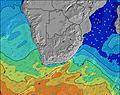 | |||||||||||||||
Oleaje Altura (m) Dirección Período (s) | E 8 | E 8 | ENE 8 | ENE 8 | ESE 8 | ESE 9 | E 9 | E 9 | E 9 | ENE 10 | E 10 | E 10 | E 10 | E 10 | E 10 | E 10 | E 10 | E 10 | E 10 | E 11 | E 11 | E 11 | E 11 | E 11 |
Gráfico Olas | ||||||||||||||||||||||||
362 | 337 | 345 | 271 | 290 | 516 | 664 | 685 | 693 | 1022 | 755 | 802 | 724 | 738 | 696 | 621 | 524 | 524 | 545 | 588 | 599 | 588 | 517 | 442 | |
Viento (km/h) | ||||||||||||||||||||||||
Estado del Viento Viento de Mar Viento de Mar-Cruzado Cruzado Viento de Tierra-Cruzado Viento de Tierra Cristalino | on | cross-on | cross-on | cross | cross | cross | on | on | on | cross-on | cross-off | off | off | off | cross-off | cross-off | cross-off | off | cross-off | cross-off | cross-off | cross-off | glassy | cross |
Marea alta | 3:13PM1.49m | 3:30AM1.62m | 3:59PM1.61m | 4:14AM1.65m | 4:42PM1.68m | 4:55AM1.65m | ||||||||||||||||||
Marea baja | 9:16PM0.19m | 9:45AM0.08m | 10:04PM0.13m | 10:26AM0.02m | 10:48PM0.10m | 11:05AM0.00m | ||||||||||||||||||
— | — | — | — | 7:01 | — | — | — | — | — | — | — | 7:01 | — | — | — | — | — | — | — | 7:01 | — | — | — | |
5:15 | — | — | — | — | — | — | — | 5:15 | — | — | — | — | — | — | — | 5:15 | — | — | — | — | — | — | 5:15 | |
mm | — | — | — | — | — | — | — | — | — | — | — | — | — | — | — | — | — | — | — | — | — | — | — | — |
Temp. °C | 19 | 18 | 16 | 16 | 15 | 16 | 20 | 22 | 21 | 20 | 19 | 17 | 16 | 16 | 18 | 19 | 19 | 18 | 17 | 16 | 16 | 16 | 19 | 19 |
Enfriamiento °C | 18 | 17 | 15 | 15 | 14 | 14 | 18 | 20 | 20 | 19 | 18 | 14 | 13 | 13 | 15 | 18 | 18 | 17 | 16 | 15 | 14 | 14 | 19 | 17 |
Oleaje 1 Altura (m) Dirección Período (s) | E 8 | E 8 | E 8 | SE 8 | ESE 8 | ESE 9 | E 9 | E 9 | E 9 | E 10 | E 10 | E 10 | E 10 | E 10 | E 10 | E 10 | E 10 | E 10 | E 10 | E 11 | E 11 | E 11 | E 11 | E 11 |
287 | 248 | 227 | 206 | 290 | 516 | 664 | 685 | 693 | 725 | 755 | 802 | 724 | 738 | 696 | 621 | 524 | 524 | 545 | 588 | 599 | 588 | 517 | 442 | |
Oleaje 2 Altura (m) Dirección Período (s) | S 11 | S 10 | SE 8 | ENE 8 | ENE 8 | S 10 | S 10 | S 9 | S 9 | S 9 | S 9 | SSW 10 | SSW 10 | SSW 9 | SSW 9 | SSW 9 | SSW 9 | S 5 | S 5 | SSW 6 | SSW 7 | SSW 8 | SSW 11 | SSW 11 |
184 | 174 | 109 | 173 | 110 | 48 | 28 | 28 | 27 | 28 | 15 | 18 | 19 | 28 | 16 | 16 | 8 | 12 | 13 | 31 | 61 | 92 | 180 | 133 | |
Oleaje 3 Altura (m) Dirección Período (s) | SE 8 | SSE 8 | S 10 | S 10 | S 10 | SSW 10 | SSW 10 | SW 10 | SW 10 | SSW 10 | SSW 10 | S 9 | S 9 | S 20 | SSE 9 | SSE 11 | SSE 10 | SSE 10 | SSE 9 | SSE 10 | SSE 9 | SW 11 | SSW 16 | SW 15 |
3 | 41 | 135 | 100 | 34 | 40 | 42 | 25 | 25 | 20 | 10 | 15 | 6 | 7 | 8 | 11 | 10 | 10 | 16 | 9 | 8 | 33 | 26 | 59 | |
Olas de Viento Altura (m) Dirección Período (s) | E 8 | E 8 | ENE 8 | ENE 8 | NE 8 | — | — | — | — | ENE 10 | — | — | SW 3 | SW 4 | SSW 4 | SSW 4 | S 5 | SSW 5 | SSW 5 | SSW 6 | SSW 8 | — | — | — |
362 | 337 | 345 | 271 | 211 | — | — | — | — | 1022 | — | — | 4 | 10 | 10 | 22 | 16 | 25 | 47 | 109 | 187 | — | — | — | |
Viento del Tierra o Mar Limpio más proximo | ||||||||||||||||||||||||
Distancia (km) | 283 | 31 | 5 | 5 | 5 | 5 | 31 | 279 | 49 | 5 | 0 | 0 | 0 | 0 | 44 | 0 | 0 | 0 | 0 | 0 | 0 | 0 | 0 | 44 |
Mejores Olas Previstas en Eastern Cape - Wild Coast | ||||||||||||||||||||||||
Mejores Olas Previstas en South Africa | ||||||||||||||||||||||||
Busca-Olas Global | ||||||||||||||||||||||||
- Map Icons:
 Break
Break Live Wave Height (m)
 Live Wind Speed (km/h)
 Surf Rating (10 Max)
 Ocean Swells (m)
- Wind Speed (km/h)
GRÁTIS! Un widget de Surf-Forecast.com para tu sitio
Este widget grátis de previsiones de surf y tiempo puede ser añadido a cualquier otro sitio y da un resumen de previsiones de olas para Lwandile. Solo necesita cortar y pegar el código HTML de abajo en su web. Puede elegir preferencias de idioma y de unidades (métricas o imperiales) para convenir a los usuarios de su sitio. Clica aquí para obtener el código.
 Nearest