
Previsiones:

Pronóstico Corto PlazoLluvia ligera (totál 7mm), cayendo mayormente el viernes por la tarde. Very mild (max 14°C el sábado por la tarde, min 5°C el jueves por la mañana). Mayormente vientos frescos. | ||||||||||||||||||||||||
jueves 23 | viernes 24 | sábado 25 | ||||||||||||||||||||||
12 AM | 3 AM | 6 AM | 9 AM | 12 PM | 3 PM | 6 PM | 9 PM | 12 AM | 3 AM | 6 AM | 9 AM | 12 PM | 3 PM | 6 PM | 9 PM | 12 AM | 3 AM | 6 AM | 9 AM | 12 PM | 3 PM | 6 PM | 9 PM | |
Mapa de Altura de Olas |  | 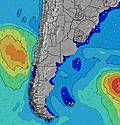 | 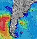 | 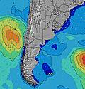 | 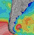 | 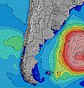 | 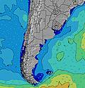 | 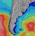 | 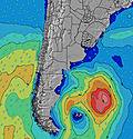 | |||||||||||||||
Oleaje Altura (m) Dirección Período (s) | E 7 | E 8 | E 8 | S 8 | S 8 | E 8 | S 9 | S 9 | S 8 | SSE 13 | SSE 13 | S 12 | S 14 | S 14 | S 14 | S 13 | S 12 | S 12 | S 11 | S 11 | S 11 | S 11 | S 14 | S 13 |
Gráfico Olas | ||||||||||||||||||||||||
40 | 42 | 33 | 33 | 34 | 37 | 38 | 37 | 35 | 56 | 53 | 77 | 148 | 200 | 181 | 163 | 106 | 101 | 66 | 63 | 37 | 37 | 100 | 87 | |
Viento (km/h) | ||||||||||||||||||||||||
Estado del Viento Viento de Mar Viento de Mar-Cruzado Cruzado Viento de Tierra-Cruzado Viento de Tierra Cristalino | cross | cross-off | cross-off | cross-off | cross-off | cross-off | cross | cross-off | cross-off | cross-off | cross-off | cross-off | cross-off | off | off | cross-off | off | off | off | cross-off | cross-off | cross-off | cross-off | cross-off |
Marea alta | 2:15PM1.12m | 3:12AM0.91m | 3:03PM1.11m | 4:15AM0.87m | 3:53PM1.12m | |||||||||||||||||||
Marea baja | 8:21AM0.47m | 9:17PM0.32m | 8:55AM0.54m | 10:13PM0.32m | 9:33AM0.58m | |||||||||||||||||||
— | — | 7:58 | — | — | — | — | — | — | — | 7:58 | — | — | — | — | — | — | — | 7:56 | — | — | — | — | — | |
— | — | — | — | — | 5:54 | — | — | — | — | — | — | — | 5:54 | — | — | — | — | — | — | — | 5:55 | — | — | |
mm | — | — | — | — | — | — | — | — | — | — | — | — | 3 | 4 | — | — | — | — | — | — | — | — | — | — |
Temp. °C | 5 | 5 | 5 | 5 | 7 | 9 | 9 | 9 | 8 | 9 | 9 | 9 | 9 | 10 | 11 | 12 | 12 | 12 | 11 | 11 | 12 | 14 | 14 | 13 |
Enfriamiento °C | 1 | 1 | 1 | 1 | 2 | 4 | 4 | 4 | 3 | 4 | 4 | 3 | 4 | 6 | 8 | 9 | 8 | 9 | 8 | 7 | 8 | 10 | 10 | 8 |
Oleaje 1 Altura (m) Dirección Período (s) | E 7 | E 8 | E 8 | S 8 | S 8 | E 8 | S 9 | S 9 | S 8 | S 8 | S 8 | S 12 | S 14 | S 14 | S 14 | S 13 | S 12 | S 12 | S 11 | S 11 | S 11 | E 8 | ENE 8 | E 8 |
40 | 42 | 29 | 33 | 33 | 37 | 38 | 37 | 35 | 34 | 35 | 77 | 148 | 200 | 181 | 163 | 106 | 101 | 66 | 63 | 37 | 21 | 44 | 35 | |
Oleaje 2 Altura (m) Dirección Período (s) | S 8 | S 8 | S 8 | E 8 | E 8 | S 8 | ENE 9 | ENE 8 | E 8 | SSE 13 | SSE 13 | S 9 | E 8 | ENE 5 | ENE 5 | ENE 5 | E 9 | ENE 8 | ENE 8 | E 8 | E 6 | S 11 | S 14 | S 13 |
34 | 33 | 33 | 32 | 34 | 30 | 25 | 24 | 12 | 56 | 53 | 23 | 6 | 25 | 19 | 17 | 6 | 40 | 40 | 35 | 6 | 37 | 100 | 87 | |
Oleaje 3 Altura (m) Dirección Período (s) | SSE 8 | SE 10 | SE 9 | SE 9 | SE 9 | SE 9 | SE 9 | SE 9 | SSE 13 | ENE 8 | E 8 | E 8 | SE 9 | E 8 | E 8 | E 9 | E 7 | NE 5 | E 6 | E 6 | E 8 | SSE 14 | — | S 9 |
6 | 15 | 14 | 22 | 22 | 14 | 13 | 3 | 34 | 14 | 12 | 5 | 3 | 6 | 6 | 6 | 4 | 9 | 3 | 7 | 12 | 21 | — | 6 | |
Olas de Viento Altura (m) Dirección Período (s) | — | — | — | — | NE 3 | NE 3 | NE 3 | ENE 4 | NE 4 | NE 4 | NE 5 | NE 5 | NE 5 | NNW 3 | NNE 5 | NE 5 | NE 5 | NW 3 | NW 3 | NNW 3 | N 2 | NNE 3 | N 3 | NNW 3 |
— | — | — | — | 1 | 2 | 5 | 11 | 19 | 21 | 23 | 34 | 37 | 1 | 51 | 34 | 13 | 2 | 1 | 1 | 1 | 3 | 3 | 2 | |
Viento del Tierra o Mar Limpio más proximo | ||||||||||||||||||||||||
Distancia (km) | 11 | 0 | 0 | 7 | 11 | 11 | 11 | 11 | 11 | 11 | 11 | 438 | 11 | 0 | 0 | 0 | 0 | 0 | 0 | 0 | 11 | 11 | 11 | 161 |
Mejores Olas Previstas en Provincia de Buenos Aires | ||||||||||||||||||||||||
Mejores Olas Previstas en Argentina | ||||||||||||||||||||||||
Busca-Olas Global | ||||||||||||||||||||||||
- Map Icons:
 Break
Break Live Wave Height (m)
 Live Wind Speed (km/h)
 Surf Rating (10 Max)
 Ocean Swells (m)
- Wind Speed (km/h)
GRÁTIS! Un widget de Surf-Forecast.com para tu sitio
Este widget grátis de previsiones de surf y tiempo puede ser añadido a cualquier otro sitio y da un resumen de previsiones de olas para Luna Roja. Solo necesita cortar y pegar el código HTML de abajo en su web. Puede elegir preferencias de idioma y de unidades (métricas o imperiales) para convenir a los usuarios de su sitio. Clica aquí para obtener el código.
 Nearest