
Previsiones:

Pronóstico Corto PlazoMayormente seco. Warm (max 23°C el lunes por la mañana, min 20°C el lunes por la noche). Mayormente vientos frescos. | |||||||||||||||||||||||
lunes 27 | martes 28 | miércoles 29 | |||||||||||||||||||||
3 AM | 6 AM | 9 AM | 12 PM | 3 PM | 6 PM | 9 PM | 12 AM | 3 AM | 6 AM | 9 AM | 12 PM | 3 PM | 6 PM | 9 PM | 12 AM | 3 AM | 6 AM | 9 AM | 12 PM | 3 PM | 6 PM | 9 PM | |
Mapa de Altura de Olas | 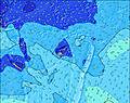 | 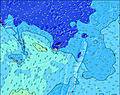 | 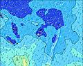 | 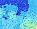 | 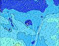 | 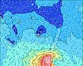 | 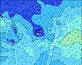 | 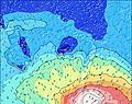 | 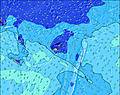 | ||||||||||||||
Oleaje Altura (m) Dirección Período (s) | SSW 18 | SSW 17 | SSW 16 | SSW 15 | SSW 15 | SSW 14 | SSW 14 | SSW 14 | SSW 13 | SSW 13 | SSW 13 | SSW 14 | SSW 14 | SSW 14 | SSW 14 | SSW 14 | SSW 13 | SSW 13 | SSW 12 | SSW 12 | SSW 12 | SSW 12 | SSW 13 |
Gráfico Olas | |||||||||||||||||||||||
1415 | 2204 | 2864 | 3204 | 2998 | 2736 | 2413 | 2194 | 1949 | 1708 | 1510 | 1388 | 1408 | 1680 | 1513 | 1126 | 1750 | 1532 | 1302 | 905 | 691 | 573 | 538 | |
Viento (km/h) | |||||||||||||||||||||||
Estado del Viento Viento de Mar Viento de Mar-Cruzado Cruzado Viento de Tierra-Cruzado Viento de Tierra Cristalino | cross-off | cross | cross | cross | cross | cross | cross | cross | cross | cross | cross | cross | cross | cross-off | cross-off | cross | cross-off | cross-off | cross-off | cross-off | cross-off | cross-off | cross-off |
Marea alta | 4:37AM1.46m | 5:32PM1.29m | 5:19AM1.50m | 6:11PM1.33m | 5:59AM1.54m | 6:49PM1.38m | |||||||||||||||||
Marea baja | 11:17AM0.28m | 11:13PM0.54m | 11:56AM0.24m | 11:54PM0.50m | 12:33PM0.20m | ||||||||||||||||||
— | 6:39 | — | — | — | — | — | — | — | 6:39 | — | — | — | — | — | — | — | 6:37 | — | — | — | — | — | |
— | — | — | — | 5:53 | — | — | — | — | — | — | — | 5:53 | — | — | — | — | — | — | — | 5:53 | — | — | |
mm | — | — | — | — | — | — | — | — | — | — | — | — | — | — | — | — | — | — | — | — | — | — | — |
Temp. °C | 21 | 21 | 22 | 23 | 23 | 21 | 21 | 20 | 20 | 20 | 21 | 23 | 23 | 21 | 20 | 20 | 21 | 21 | 22 | 23 | 23 | 22 | 21 |
Enfriamiento °C | 20 | 20 | 20 | 21 | 21 | 18 | 19 | 18 | 18 | 17 | 17 | 19 | 19 | 18 | 17 | 17 | 18 | 17 | 18 | 18 | 18 | 17 | 17 |
Oleaje 1 Altura (m) Dirección Período (s) | SSW 18 | SSW 17 | SSW 16 | SSW 15 | SSW 15 | SSW 14 | SSW 14 | SSW 14 | SSW 13 | SSW 13 | SSW 13 | SSW 14 | SSW 14 | SSW 14 | SSW 14 | SSW 14 | SSW 13 | SSW 13 | SSW 12 | SSW 12 | SSW 12 | SSW 12 | SSW 13 |
1415 | 2204 | 2864 | 3204 | 2998 | 2736 | 2413 | 2194 | 1949 | 1708 | 1510 | 1388 | 1408 | 1680 | 1513 | 1126 | 1750 | 1532 | 1302 | 905 | 691 | 573 | 538 | |
Oleaje 2 Altura (m) Dirección Período (s) | SSE 12 | SE 16 | SE 16 | SE 11 | SSE 11 | SE 11 | SE 14 | SE 13 | SSE 13 | SSE 13 | SSE 13 | SSE 12 | SSE 12 | SSE 12 | SSE 12 | SSE 13 | SSE 13 | SSE 13 | SSE 13 | SSE 12 | SSE 12 | SE 14 | SSE 14 |
169 | 40 | 38 | 126 | 82 | 121 | 200 | 144 | 118 | 114 | 111 | 103 | 99 | 99 | 104 | 118 | 118 | 120 | 114 | 136 | 175 | 211 | 131 | |
Oleaje 3 Altura (m) Dirección Período (s) | SE 16 | SSE 16 | — | — | — | — | — | E 7 | E 7 | E 6 | — | SSE 16 | — | — | — | — | — | — | S 11 | S 10 | S 11 | SSE 11 | SSE 13 |
41 | 25 | — | — | — | — | — | 4 | 4 | 3 | — | 24 | — | — | — | — | — | — | 9 | 8 | 21 | 42 | 54 | |
Olas de Viento Altura (m) Dirección Período (s) | SE 5 | SSE 11 | SSE 11 | SSE 11 | SE 11 | — | SE 4 | — | — | — | SE 4 | SSE 4 | SSE 4 | — | SE 5 | SSE 6 | ESE 5 | ESE 5 | ESE 5 | ESE 5 | SE 5 | SE 6 | SSE 8 |
23 | 261 | 251 | 247 | 198 | — | 24 | — | — | — | 26 | 32 | 34 | — | 67 | 98 | 64 | 69 | 90 | 44 | 89 | 223 | 414 | |
Viento del Tierra o Mar Limpio más proximo | |||||||||||||||||||||||
Distancia (km) | 37 | 824 | 1168 | 1168 | 1168 | 1168 | 1201 | 1209 | 1252 | 1255 | 1291 | 1310 | 1350 | 1310 | 40 | 1273 | 1241 | 1241 | 1273 | 40 | 40 | 40 | 30 |
Mejores Olas Previstas en Viti Levu | |||||||||||||||||||||||
Mejores Olas Previstas en Fiji | |||||||||||||||||||||||
Busca-Olas Global | |||||||||||||||||||||||
- Map Icons:
 Break
Break Live Wave Height (m)
 Live Wind Speed (km/h)
 Surf Rating (10 Max)
 Ocean Swells (m)
- Wind Speed (km/h)
GRÁTIS! Un widget de Surf-Forecast.com para tu sitio
Este widget grátis de previsiones de surf y tiempo puede ser añadido a cualquier otro sitio y da un resumen de previsiones de olas para Lulus Bend. Solo necesita cortar y pegar el código HTML de abajo en su web. Puede elegir preferencias de idioma y de unidades (métricas o imperiales) para convenir a los usuarios de su sitio. Clica aquí para obtener el código.
 Nearest