

Long Sands Surf Guide
Long Sands in Maine is an exposed beach break that has pretty consitent surf and can work at any time of the year. Offshore winds blow from the northwest with some shelter here from north winds. Windswells and groundswells in equal measure and the best swell direction is from the southeast. The beach break provides left and right handers. Surfable at all stages of the tide. It very rarely gets crowded here. Beware of rips, rocks and pollution.
Long Sands Spot Info
| Type: | Rating: | Reliability: | Todays Sea Temp*: |
|---|---|---|---|
| fairly consistent | 19.2°C*ocean temperature recorded from satellite |
Surfing Long Sands:
The best conditions reported for surf at Long Sands occur when a Southeast swell combines with an offshore wind direction from the Northwest.
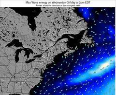
Energía de Olas (poder): 12 horas
Long Sands Surf:
Wednesday, 15 July 2026, 11:52 Local time| miércoles 15 | ||||
| 11AM | 2PM | 5PM | 8PM | |
| Wave (m) | ||||
| Período (s) | 9 | 9 | 9 | 9 |
| Viento (km/h) | ||||
| Estado del Viento | off | off | off | off |
- /breaks/Long-Sands/forecasts/latest
Long Sands Surf Guide
Long Sands in Maine is an exposed beach break that has pretty consitent surf and can work at any time of the year. Offshore winds blow from the northwest with some shelter here from north winds. Windswells and groundswells in equal measure and the best swell direction is from the southeast. The beach break provides left and right handers. Surfable at all stages of the tide. It very rarely gets crowded here. Beware of rips, rocks and pollution.
Long Sands Spot Info
Type: Rating: Reliability: Todays Sea Temp*:  Beach
Beach 1
1fairly consistent 19.2°C*ocean temperature recorded from satelliteSurfing Long Sands:
The best conditions reported for surf at Long Sands occur when a Southeast swell combines with an offshore wind direction from the Northwest.
Energía de Olas (poder): 12 horas
Usa la barra de navegación de arriba para ver la temperatura del mar en Long Sands, fotografías Long Sands, previsiones detalladas de olas para Long Sands, vientos y previsión del tiempo, webcams para Long Sands, viento actual desde estaciones meteorológicas en Maine y predicciones de marea para Long Sands. Las mapas de olas para United States enseñarán un mapa grande de United States y los mares que rodean. Los mapas de olas pueden ser animadas para mostrar diferentes componentes de olas, la altura de ola, la energía de ola, el período, junto con previsiones de viento y del tiempo. Previsiones actuales del tiempo y del estado del mar provienen de boyas marinas de United States, del barcos que transitan en la zona y de estaciones meteorológicas costeras. Cada página de previsiones tiene un Busca-Olas Regional y Global para localizar las mejores condiciones para surfear en el área de Long Sands.
Long Sands Surf:
Wednesday, 15 July 2026, 11:52 Local timemiércoles 15 11AM 2PM 5PM 8PM Wave (m) Período (s) 9 9 9 9 Viento (km/h) Estado del Viento off off off off - /breaks/Long-Sands/forecasts/latest
- /breaks/Long-Sands/forecasts/latest/six_day
Long Sands Surf Guide
Long Sands in Maine is an exposed beach break that has pretty consitent surf and can work at any time of the year. Offshore winds blow from the northwest with some shelter here from north winds. Windswells and groundswells in equal measure and the best swell direction is from the southeast. The beach break provides left and right handers. Surfable at all stages of the tide. It very rarely gets crowded here. Beware of rips, rocks and pollution.
Long Sands Spot Info
Type: Rating: Reliability: Todays Sea Temp*: Beach1fairly consistent 19.2°C*ocean temperature recorded from satelliteSurfing Long Sands:
The best conditions reported for surf at Long Sands occur when a Southeast swell combines with an offshore wind direction from the Northwest.
Energía de Olas (poder): 12 horas
Usa la barra de navegación de arriba para ver la temperatura del mar en Long Sands, fotografías Long Sands, previsiones detalladas de olas para Long Sands, vientos y previsión del tiempo, webcams para Long Sands, viento actual desde estaciones meteorológicas en Maine y predicciones de marea para Long Sands. Las mapas de olas para United States enseñarán un mapa grande de United States y los mares que rodean. Los mapas de olas pueden ser animadas para mostrar diferentes componentes de olas, la altura de ola, la energía de ola, el período, junto con previsiones de viento y del tiempo. Previsiones actuales del tiempo y del estado del mar provienen de boyas marinas de United States, del barcos que transitan en la zona y de estaciones meteorológicas costeras. Cada página de previsiones tiene un Busca-Olas Regional y Global para localizar las mejores condiciones para surfear en el área de Long Sands.
Long Sands Surf:
Wednesday, 15 July 2026, 11:52 Local timemiércoles 15 11AM 2PM 5PM 8PM Wave (m) Período (s) 9 9 9 9 Viento (km/h) Estado del Viento off off off off - /breaks/Long-Sands/forecasts/latest
Long Sands Surf Guide
Long Sands in Maine is an exposed beach break that has pretty consitent surf and can work at any time of the year. Offshore winds blow from the northwest with some shelter here from north winds. Windswells and groundswells in equal measure and the best swell direction is from the southeast. The beach break provides left and right handers. Surfable at all stages of the tide. It very rarely gets crowded here. Beware of rips, rocks and pollution.
Long Sands Spot Info
Type: Rating: Reliability: Todays Sea Temp*: Beach1fairly consistent 19.2°C*ocean temperature recorded from satelliteSurfing Long Sands:
The best conditions reported for surf at Long Sands occur when a Southeast swell combines with an offshore wind direction from the Northwest.
Energía de Olas (poder): 12 horas
Usa la barra de navegación de arriba para ver la temperatura del mar en Long Sands, fotografías Long Sands, previsiones detalladas de olas para Long Sands, vientos y previsión del tiempo, webcams para Long Sands, viento actual desde estaciones meteorológicas en Maine y predicciones de marea para Long Sands. Las mapas de olas para United States enseñarán un mapa grande de United States y los mares que rodean. Los mapas de olas pueden ser animadas para mostrar diferentes componentes de olas, la altura de ola, la energía de ola, el período, junto con previsiones de viento y del tiempo. Previsiones actuales del tiempo y del estado del mar provienen de boyas marinas de United States, del barcos que transitan en la zona y de estaciones meteorológicas costeras. Cada página de previsiones tiene un Busca-Olas Regional y Global para localizar las mejores condiciones para surfear en el área de Long Sands.
Long Sands Surf:
Wednesday, 15 July 2026, 11:52 Local timemiércoles 15 11AM 2PM 5PM 8PM Wave (m) Período (s) 9 9 9 9 Viento (km/h) Estado del Viento off off off off Tide Times:
Para Cape Neddick, Maine, a %{dist} %{km} de %{location}.
PROXIMA ES A LAS (hora local) quedan marea alta marea baja Long Sands Tide Times and Tide Chart
Live Weather:
At BUOY-SEIM1, 13 km from Long Sands.
- Air temperature
26.6°CCurrent weather near Long Sands
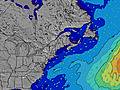
Buoy Data:
At Western Maine Shelf Buoy, 10 miles from Long Sands.
5AM 6AM 7AM 8AM Antigüedad de datos 5 hr 4 hr 3 hr 2 hr Altura de Olas (m) 

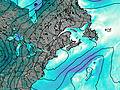
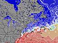
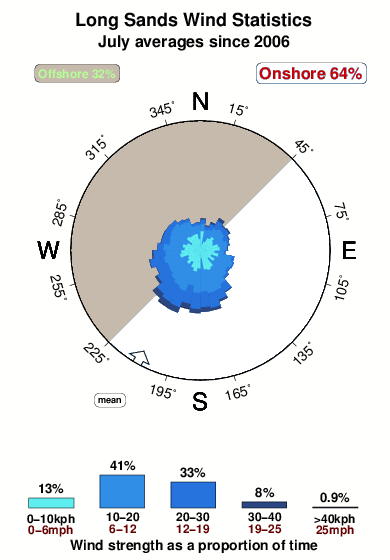
Overall Long Sands Surf Consistency and Wind Distribution in julio
Fotos de Surf
de la galeríaContornos: Carreteras y Ríos: Selecciona un spot desde el menú 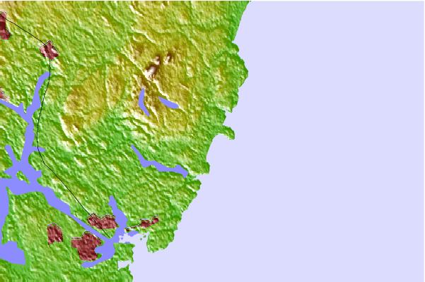
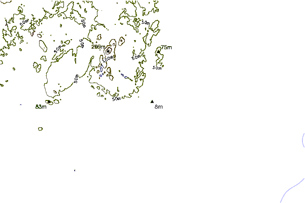
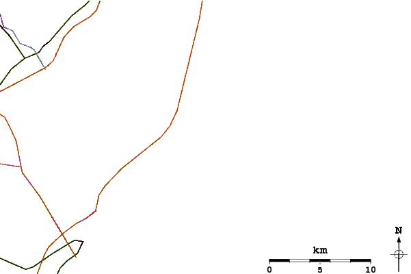
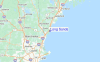
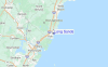
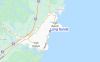
Usa este mapa para navegar hacia las playas de surf de Maine y estaciones de marea cercanas de Long Sands
Spots de Surf más cercanos a Long Sands:
(Clica la ubicación para más detalles)- Closest spot1 mi
- Second closest spot6 mi
- Third closest spot7 mi
- Fourth closest spot7 mi
- Fifth closest spot8 mi
Boyas marinas más cercanas a Long Sands:
- Closest Boya Marinas10 mi
- Second closest Boya Marinas34 mi
- Third closest Boya Marinas35 mi
- Fourth closest Boya Marinas45 mi
- Fifth closest Boya Marinas56 mi
Estaciones de marea más cercanas a Long Sands:
- Closest estación de mareaCape Neddick1 mi
- Second closest estación de mareaYork Harbor2 mi
- Third closest estación de mareaSeapoint, Cutts Island6 mi
- Fourth closest estación de mareaKittery Point, Portsmouth Harbor7 mi
- Fifth closest estación de mareaGerrish Island, Portsmouth Harbor7 mi
Airports
- The closest passenger airport to Long Sands is Portland International Jetport Airport (PWM) in USA, 59 km (37 miles) away (directly).
- The second nearest airport to Long Sands is Laurence G Hanscom Fld (Bedford) Airport (BED), also in USA, 94 km (58 miles) away.
- Third is General Edward Lawrence Logan International (Boston) Airport (BOS) in USA, 94 km (58 miles) away.
- Augusta State Airport (AUG) in USA is 145 km (90 miles) away.
- North Central State (Smithfield) Airport (SFZ), also in USA is the fifth nearest airport to Long Sands and is 155 km (96 miles) away.

- /breaks/Long-Sands/forecasts/latest


 Nearest