
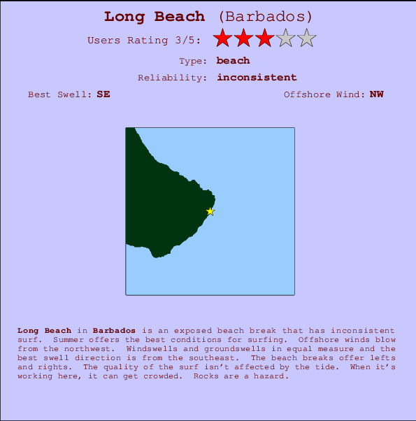
Long Beach Surf Guide
Long Beach on the South Coast is an exposed beach break that has unreliable waves. Summer offers the best conditions for surfing. Works best in offshore winds from the northwest. Windswells and groundswells in equal measure and the ideal swell angle is from the southeast. The beach break provides left and right handers. Good surf at all stages of the tide. Sometimes crowded. Take care of rocks in the line up.
Long Beach Spot Info
| Type: | Rating: | Reliability: | Todays Sea Temp*: |
|---|---|---|---|
| inconsistent | 27.9°C*ocean temperature recorded from satellite |
Surfing Long Beach:
The best conditions reported for surf at Long Beach occur when a Southeast swell combines with an offshore wind direction from the Northwest.

Energía de Olas (poder): 12 horas


Long Beach Surf:
Thursday, 16 July 2026, 03:45 Local time| miércoles 15 | jue | |||
| 5PM | 8PM | 11PM | 2AM | |
| Wave (m) | ||||
| Período (s) | 7 | 7 | 7 | 7 |
| Viento (km/h) | ||||
| Estado del Viento | cross- on |
cross- on |
cross- on |
cross- on |
- /breaks/Long-Beach_7/forecasts/latest
Long Beach Surf Guide
Long Beach on the South Coast is an exposed beach break that has unreliable waves. Summer offers the best conditions for surfing. Works best in offshore winds from the northwest. Windswells and groundswells in equal measure and the ideal swell angle is from the southeast. The beach break provides left and right handers. Good surf at all stages of the tide. Sometimes crowded. Take care of rocks in the line up.
Long Beach Spot Info
Type: Rating: Reliability: Todays Sea Temp*:  Beach
Beach 3
3inconsistent 27.9°C*ocean temperature recorded from satelliteSurfing Long Beach:
The best conditions reported for surf at Long Beach occur when a Southeast swell combines with an offshore wind direction from the Northwest.
Energía de Olas (poder): 12 horas
Usa la barra de navegación de arriba para ver la temperatura del mar en Long Beach, fotografías Long Beach, previsiones detalladas de olas para Long Beach, vientos y previsión del tiempo, webcams para Long Beach, viento actual desde estaciones meteorológicas en Barbados y predicciones de marea para Long Beach. Las mapas de olas para Barbados enseñarán un mapa grande de Barbados y los mares que rodean. Los mapas de olas pueden ser animadas para mostrar diferentes componentes de olas, la altura de ola, la energía de ola, el período, junto con previsiones de viento y del tiempo. Previsiones actuales del tiempo y del estado del mar provienen de boyas marinas de Barbados, del barcos que transitan en la zona y de estaciones meteorológicas costeras. Cada página de previsiones tiene un Busca-Olas Regional y Global para localizar las mejores condiciones para surfear en el área de Long Beach.
Long Beach Surf:
Thursday, 16 July 2026, 03:45 Local timemiércoles 15 jue 5PM 8PM 11PM 2AM Wave (m) Período (s) 7 7 7 7 Viento (km/h) Estado del Viento cross-
oncross-
oncross-
oncross-
on- /breaks/Long-Beach_7/forecasts/latest
- /breaks/Long-Beach_7/forecasts/latest/six_day
Long Beach Surf Guide
Long Beach on the South Coast is an exposed beach break that has unreliable waves. Summer offers the best conditions for surfing. Works best in offshore winds from the northwest. Windswells and groundswells in equal measure and the ideal swell angle is from the southeast. The beach break provides left and right handers. Good surf at all stages of the tide. Sometimes crowded. Take care of rocks in the line up.
Long Beach Spot Info
Type: Rating: Reliability: Todays Sea Temp*: Beach3inconsistent 27.9°C*ocean temperature recorded from satelliteSurfing Long Beach:
The best conditions reported for surf at Long Beach occur when a Southeast swell combines with an offshore wind direction from the Northwest.
Energía de Olas (poder): 12 horas
Usa la barra de navegación de arriba para ver la temperatura del mar en Long Beach, fotografías Long Beach, previsiones detalladas de olas para Long Beach, vientos y previsión del tiempo, webcams para Long Beach, viento actual desde estaciones meteorológicas en Barbados y predicciones de marea para Long Beach. Las mapas de olas para Barbados enseñarán un mapa grande de Barbados y los mares que rodean. Los mapas de olas pueden ser animadas para mostrar diferentes componentes de olas, la altura de ola, la energía de ola, el período, junto con previsiones de viento y del tiempo. Previsiones actuales del tiempo y del estado del mar provienen de boyas marinas de Barbados, del barcos que transitan en la zona y de estaciones meteorológicas costeras. Cada página de previsiones tiene un Busca-Olas Regional y Global para localizar las mejores condiciones para surfear en el área de Long Beach.
Long Beach Surf:
Thursday, 16 July 2026, 03:45 Local timemiércoles 15 jue 5PM 8PM 11PM 2AM Wave (m) Período (s) 7 7 7 7 Viento (km/h) Estado del Viento cross-
oncross-
oncross-
oncross-
on- /breaks/Long-Beach_7/forecasts/latest
Long Beach Surf Guide
Long Beach on the South Coast is an exposed beach break that has unreliable waves. Summer offers the best conditions for surfing. Works best in offshore winds from the northwest. Windswells and groundswells in equal measure and the ideal swell angle is from the southeast. The beach break provides left and right handers. Good surf at all stages of the tide. Sometimes crowded. Take care of rocks in the line up.
Long Beach Spot Info
Type: Rating: Reliability: Todays Sea Temp*: Beach3inconsistent 27.9°C*ocean temperature recorded from satelliteSurfing Long Beach:
The best conditions reported for surf at Long Beach occur when a Southeast swell combines with an offshore wind direction from the Northwest.
Energía de Olas (poder): 12 horas
Usa la barra de navegación de arriba para ver la temperatura del mar en Long Beach, fotografías Long Beach, previsiones detalladas de olas para Long Beach, vientos y previsión del tiempo, webcams para Long Beach, viento actual desde estaciones meteorológicas en Barbados y predicciones de marea para Long Beach. Las mapas de olas para Barbados enseñarán un mapa grande de Barbados y los mares que rodean. Los mapas de olas pueden ser animadas para mostrar diferentes componentes de olas, la altura de ola, la energía de ola, el período, junto con previsiones de viento y del tiempo. Previsiones actuales del tiempo y del estado del mar provienen de boyas marinas de Barbados, del barcos que transitan en la zona y de estaciones meteorológicas costeras. Cada página de previsiones tiene un Busca-Olas Regional y Global para localizar las mejores condiciones para surfear en el área de Long Beach.
Long Beach Surf:
Thursday, 16 July 2026, 03:45 Local timemiércoles 15 jue 5PM 8PM 11PM 2AM Wave (m) Período (s) 7 7 7 7 Viento (km/h) Estado del Viento cross-
oncross-
oncross-
oncross-
onTide Times:
Para Conset Point, a %{dist} %{km} de %{location}.
PROXIMA ES A LAS (hora local) quedan marea alta marea baja Long Beach Tide Times and Tide Chart
Live Weather:
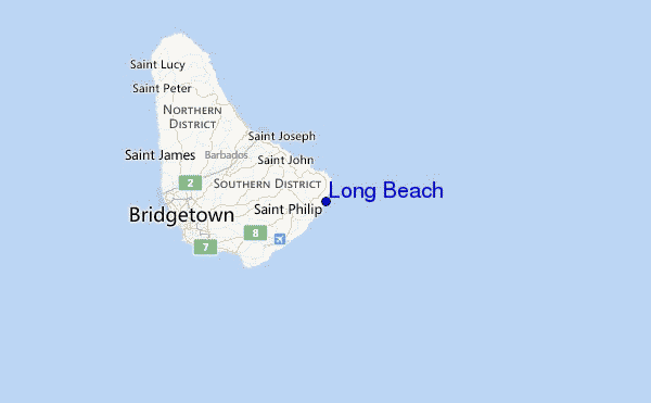
At Grantley Adams International Airport, 9 km from Long Beach.
moderate winds from the ENE
(km/h)
no reportAir temperature
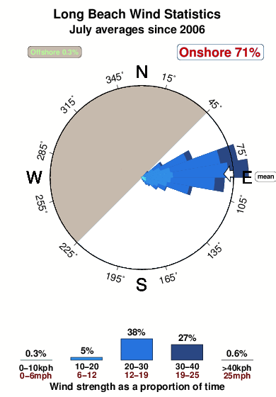
27.4°COverall Long Beach Surf Consistency and Wind Distribution in julio
Fotos de Surf
de la galeríaContornos: Carreteras y Ríos: Selecciona un spot desde el menú 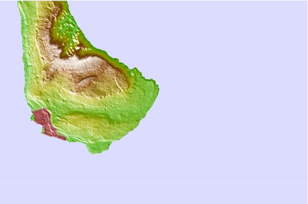
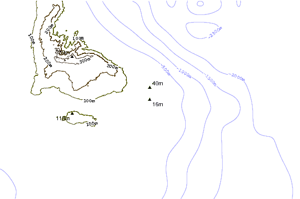
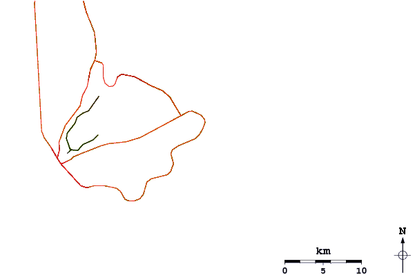
Usa este mapa para navegar hacia las playas de surf de Barbados y estaciones de marea cercanas de Long Beach
Spots de Surf más cercanos a Long Beach:
(Clica la ubicación para más detalles)- Closest spot2 mi
- Second closest spot2 mi
- Third closest spot4 mi
- Fourth closest spot6 mi
- Fifth closest spot7 mi
Boyas marinas más cercanas a Long Beach:
- Closest Boya Marinas239 mi
- Second closest Boya Marinas358 mi
- Third closest Boya Marinas441 mi
- Fourth closest Boya Marinas501 mi
- Fifth closest Boya Marinas536 mi
Estaciones de marea más cercanas a Long Beach:
- Closest estación de mareaBridgetown, Barbados14 mi
- Second closest estación de mareaVieux Fort Bay111 mi
- Third closest estación de mareaLe Robert117 mi
- Fourth closest estación de mareaBisee120 mi
- Fifth closest estación de mareaKingstown, Saint Vincent121 mi
Airports
- The closest passenger airport to Long Beach is Grantley Adams International (Bridgetown) Airport (BGI) in Barbados, 9 km (6 miles) away (directly).
- The second nearest airport to Long Beach is Hewanorra International (Hewandorra) Airport (UVF) in St. Lucia Island, 178 km (111 miles) away.
- Third is Mustique Airport (MQS) in St.vincent/grenadines, 192 km (119 miles) away.
- E T Joshua (Kingstown) Airport (SVD) in St.vincent/grenadines is 193 km (120 miles) away.
- George F L Charles (Castries) Airport (SLU) in St. Lucia Island is the fifth nearest airport to Long Beach and is 196 km (122 miles) away.
- /breaks/Long-Beach_7/forecasts/latest


 Nearest