
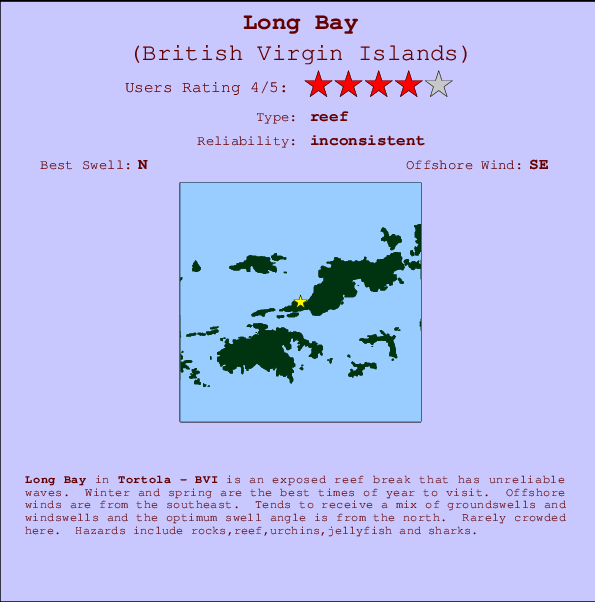
Long Bay Surf Guide
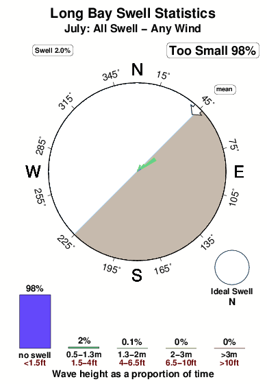
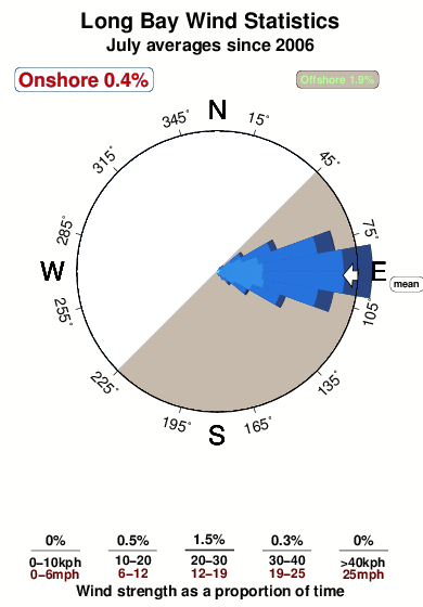
Long Bay in Tortola is an exposed reef break that does not work very often. Winter and spring are the optimum times of year to visit. Offshore winds are from the southeast. Tends to receive a mix of groundswells and windswells and the ideal swell direction is from the north. There are left and right breaking reefs. Unlikely to be too crowded, even when the surf is up. Beware of rocks,reef,urchins,jellyfish and sharks.
Long Bay Spot Info
| Type: | Rating: | Reliability: | Todays Sea Temp*: |
|---|---|---|---|
| inconsistent | 28.0°C*ocean temperature recorded from satellite |
Surfing Long Bay:
The best conditions reported for surf at Long Bay occur when a North swell combines with an offshore wind direction from the Southeast.

Energía de Olas (poder): 12 horas


Long Bay Surf:
Wednesday, 15 July 2026, 17:01 Local time| miércoles 15 | jue | |||
| 5PM | 8PM | 11PM | 2AM | |
| Wave (m) | ||||
| Período (s) | 7 | 7 | 7 | 6 |
| Viento (km/h) | ||||
| Estado del Viento | cross- off |
cross- off |
cross- off |
cross- off |
- /breaks/Long-Bay/forecasts/latest
Long Bay Surf Guide
Long Bay in Tortola is an exposed reef break that does not work very often. Winter and spring are the optimum times of year to visit. Offshore winds are from the southeast. Tends to receive a mix of groundswells and windswells and the ideal swell direction is from the north. There are left and right breaking reefs. Unlikely to be too crowded, even when the surf is up. Beware of rocks,reef,urchins,jellyfish and sharks.
Long Bay Spot Info
Type: Rating: Reliability: Todays Sea Temp*:  Reef
Reef 4
4inconsistent 28.0°C*ocean temperature recorded from satelliteSurfing Long Bay:
The best conditions reported for surf at Long Bay occur when a North swell combines with an offshore wind direction from the Southeast.
Energía de Olas (poder): 12 horas
Usa la barra de navegación de arriba para ver la temperatura del mar en Long Bay, fotografías Long Bay, previsiones detalladas de olas para Long Bay, vientos y previsión del tiempo, webcams para Long Bay, viento actual desde estaciones meteorológicas en Tortola y predicciones de marea para Long Bay. Las mapas de olas para British Virgin Islands enseñarán un mapa grande de British Virgin Islands y los mares que rodean. Los mapas de olas pueden ser animadas para mostrar diferentes componentes de olas, la altura de ola, la energía de ola, el período, junto con previsiones de viento y del tiempo. Previsiones actuales del tiempo y del estado del mar provienen de boyas marinas de British Virgin Islands, del barcos que transitan en la zona y de estaciones meteorológicas costeras. Cada página de previsiones tiene un Busca-Olas Regional y Global para localizar las mejores condiciones para surfear en el área de Long Bay.
Long Bay Surf:
Wednesday, 15 July 2026, 17:01 Local timemiércoles 15 jue 5PM 8PM 11PM 2AM Wave (m) Período (s) 7 7 7 6 Viento (km/h) Estado del Viento cross-
offcross-
offcross-
offcross-
off- /breaks/Long-Bay/forecasts/latest
- /breaks/Long-Bay/forecasts/latest/six_day
Long Bay Surf Guide
Long Bay in Tortola is an exposed reef break that does not work very often. Winter and spring are the optimum times of year to visit. Offshore winds are from the southeast. Tends to receive a mix of groundswells and windswells and the ideal swell direction is from the north. There are left and right breaking reefs. Unlikely to be too crowded, even when the surf is up. Beware of rocks,reef,urchins,jellyfish and sharks.
Long Bay Spot Info
Type: Rating: Reliability: Todays Sea Temp*: Reef4inconsistent 28.0°C*ocean temperature recorded from satelliteSurfing Long Bay:
The best conditions reported for surf at Long Bay occur when a North swell combines with an offshore wind direction from the Southeast.
Energía de Olas (poder): 12 horas
Usa la barra de navegación de arriba para ver la temperatura del mar en Long Bay, fotografías Long Bay, previsiones detalladas de olas para Long Bay, vientos y previsión del tiempo, webcams para Long Bay, viento actual desde estaciones meteorológicas en Tortola y predicciones de marea para Long Bay. Las mapas de olas para British Virgin Islands enseñarán un mapa grande de British Virgin Islands y los mares que rodean. Los mapas de olas pueden ser animadas para mostrar diferentes componentes de olas, la altura de ola, la energía de ola, el período, junto con previsiones de viento y del tiempo. Previsiones actuales del tiempo y del estado del mar provienen de boyas marinas de British Virgin Islands, del barcos que transitan en la zona y de estaciones meteorológicas costeras. Cada página de previsiones tiene un Busca-Olas Regional y Global para localizar las mejores condiciones para surfear en el área de Long Bay.
Long Bay Surf:
Wednesday, 15 July 2026, 17:01 Local timemiércoles 15 jue 5PM 8PM 11PM 2AM Wave (m) Período (s) 7 7 7 6 Viento (km/h) Estado del Viento cross-
offcross-
offcross-
offcross-
off- /breaks/Long-Bay/forecasts/latest
Long Bay Surf Guide
Long Bay in Tortola is an exposed reef break that does not work very often. Winter and spring are the optimum times of year to visit. Offshore winds are from the southeast. Tends to receive a mix of groundswells and windswells and the ideal swell direction is from the north. There are left and right breaking reefs. Unlikely to be too crowded, even when the surf is up. Beware of rocks,reef,urchins,jellyfish and sharks.
Long Bay Spot Info
Type: Rating: Reliability: Todays Sea Temp*: Reef4inconsistent 28.0°C*ocean temperature recorded from satelliteSurfing Long Bay:
The best conditions reported for surf at Long Bay occur when a North swell combines with an offshore wind direction from the Southeast.
Energía de Olas (poder): 12 horas
Usa la barra de navegación de arriba para ver la temperatura del mar en Long Bay, fotografías Long Bay, previsiones detalladas de olas para Long Bay, vientos y previsión del tiempo, webcams para Long Bay, viento actual desde estaciones meteorológicas en Tortola y predicciones de marea para Long Bay. Las mapas de olas para British Virgin Islands enseñarán un mapa grande de British Virgin Islands y los mares que rodean. Los mapas de olas pueden ser animadas para mostrar diferentes componentes de olas, la altura de ola, la energía de ola, el período, junto con previsiones de viento y del tiempo. Previsiones actuales del tiempo y del estado del mar provienen de boyas marinas de British Virgin Islands, del barcos que transitan en la zona y de estaciones meteorológicas costeras. Cada página de previsiones tiene un Busca-Olas Regional y Global para localizar las mejores condiciones para surfear en el área de Long Bay.
Long Bay Surf:
Wednesday, 15 July 2026, 17:01 Local timemiércoles 15 jue 5PM 8PM 11PM 2AM Wave (m) Período (s) 7 7 7 6 Viento (km/h) Estado del Viento cross-
offcross-
offcross-
offcross-
offTide Times:
Para Coral Harbor, Saint Johns Island, Virgin Islands, a %{dist} %{km} de %{location}.
PROXIMA ES A LAS (hora local) quedan marea alta marea baja Long Bay Tide Times and Tide Chart
Live Weather:
At BUOY-LAMV3, 9 km from Long Bay.
- Air temperature
-°COverall Long Bay Surf Consistency and Wind Distribution in julio
Fotos de Surf
de la galeríaContornos: Carreteras y Ríos: Selecciona un spot desde el menú 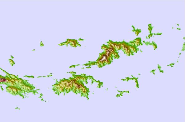
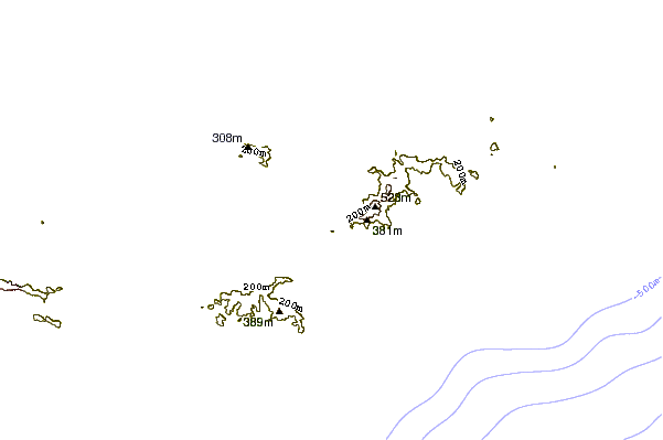
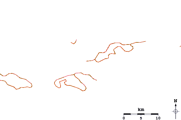
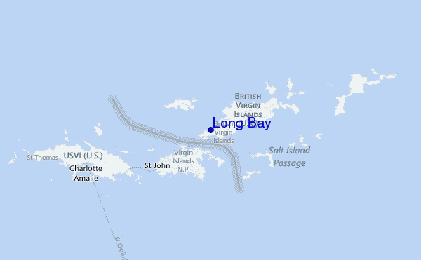
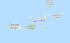
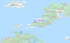
Usa este mapa para navegar hacia las playas de surf de Tortola y estaciones de marea cercanas de Long Bay
Spots de Surf más cercanos a Long Bay:
(Clica la ubicación para más detalles)- Closest spot1 mi
- Second closest spot1 mi
- Third closest spot1 mi
- Fourth closest spot2 mi
- Fifth closest spot3 mi
Boyas marinas más cercanas a Long Bay:
- Closest Boya Marinas11 mi
- Second closest Boya Marinas52 mi
- Third closest Boya Marinas93 mi
- Fourth closest Boya Marinas126 mi
- Fifth closest Boya Marinas153 mi
Estaciones de marea más cercanas a Long Bay:
- Closest estación de mareaCoral Harbor, Saint Johns Island4 mi
- Second closest estación de mareaRoad Town6 mi
- Third closest estación de mareaLameshur Bay, Saint Johns6 mi
- Fourth closest estación de mareaRedhook Bay, Saint Thomas Island12 mi
- Fifth closest estación de mareaBenner Bay, Saint Thomas13 mi
Airports
- The closest passenger airport to Long Bay is Terrance B Lettsome International (Roadtown/beef Island) Airport (EIS) in Virgin Isl., 16 km (10 miles) away (directly).
- The second nearest airport to Long Bay is Cyril E King (St. Thomas) Airport (STT), also in Virgin Isl., 31 km (19 miles) away.
- Third is Henry E Rohlsen (St. Criox Island) Airport (STX) in Virgin Isl., 78 km (48 miles) away.
- Roosevelt Roads Ns Airport (NRR) in Puerto Rico is 102 km (63 miles) away.
- Diego Jimenez Torres (Fajardo) Airport (FAJ), also in Puerto Rico is the fifth nearest airport to Long Bay and is 103 km (64 miles) away.
- /breaks/Long-Bay/forecasts/latest


 Nearest