
Previsiones:

Pronóstico Corto PlazoLluvia moderada (totál 16mm), más pesada el domingo por la noche. Warm (max 30°C el sábado por la tarde, min 26°C el domingo por la noche). El viento será generalmente ligero. | |||||||||||||||||||||||
sábado 1 | domingo 2 | lunes 3 | |||||||||||||||||||||
3 AM | 6 AM | 9 AM | 12 PM | 3 PM | 6 PM | 9 PM | 12 AM | 3 AM | 6 AM | 9 AM | 12 PM | 3 PM | 6 PM | 9 PM | 12 AM | 3 AM | 6 AM | 9 AM | 12 PM | 3 PM | 6 PM | 9 PM | |
Mapa de Altura de Olas |  |  |  |  |  |  |  | 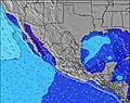 |  | ||||||||||||||
Oleaje Altura (m) Dirección Período (s) | SSW 12 | SSW 12 | SSW 12 | SSW 12 | SSW 12 | SSW 12 | SW 14 | SW 14 | SW 14 | SW 14 | SW 14 | SW 14 | SW 13 | SW 13 | SW 13 | SW 13 | SW 13 | SW 13 | SSW 13 | SSW 13 | SSW 13 | SSW 12 | SSW 12 |
Gráfico Olas | |||||||||||||||||||||||
138 | 196 | 129 | 133 | 138 | 131 | 189 | 116 | 116 | 65 | 64 | 64 | 140 | 140 | 138 | 134 | 101 | 128 | 108 | 106 | 106 | 104 | 103 | |
Viento (km/h) | |||||||||||||||||||||||
Estado del Viento Viento de Mar Viento de Mar-Cruzado Cruzado Viento de Tierra-Cruzado Viento de Tierra Cristalino | off | cross-off | glassy | cross-on | cross-on | cross | glassy | cross-off | glassy | cross-off | glassy | cross-on | cross-on | on | glassy | glassy | glassy | cross-off | glassy | on | cross-on | on | glassy |
Marea alta | 11:17AM1.37m | 10:45PM1.44m | 11:39AM1.39m | 11:22PM1.32m | 12:04PM1.41m | ||||||||||||||||||
Marea baja | 4:50AM0.25m | 4:52PM0.64m | 5:12AM0.35m | 5:32PM0.62m | 5:34AM0.48m | 6:20PM0.62m | |||||||||||||||||
— | 6:33 | — | — | — | — | — | — | — | 6:33 | — | — | — | — | — | — | — | 6:35 | — | — | — | — | — | |
— | — | — | — | — | 7:38 | — | — | — | — | — | — | — | 7:38 | — | — | — | — | — | — | — | 7:37 | — | |
mm | — | — | — | — | — | — | — | — | — | 1 | 1 | — | — | — | 1 | 11 | 2 | — | — | — | — | — | — |
Temp. °C | 27 | 27 | 28 | 29 | 30 | 30 | 29 | 29 | 27 | 27 | 28 | 29 | 30 | 30 | 29 | 28 | 26 | 26 | 27 | 29 | 30 | 30 | 29 |
Enfriamiento °C | 31 | 31 | 32 | 31 | 34 | 34 | 34 | 34 | 32 | 32 | 33 | 33 | 34 | 35 | 35 | 33 | 31 | 30 | 31 | 32 | 33 | 34 | 34 |
Oleaje 1 Altura (m) Dirección Período (s) | SSW 12 | SSW 12 | SSW 12 | SSW 12 | SSW 12 | SSW 12 | SW 14 | SW 14 | SW 14 | W 10 | W 9 | SW 14 | SW 13 | SW 13 | SW 13 | SW 13 | SW 13 | SW 13 | SSW 13 | SSW 13 | SSW 13 | SSW 12 | SSW 12 |
138 | 196 | 129 | 133 | 138 | 131 | 189 | 116 | 116 | 45 | 41 | 64 | 140 | 140 | 138 | 134 | 101 | 128 | 108 | 106 | 106 | 104 | 103 | |
Oleaje 2 Altura (m) Dirección Período (s) | W 9 | W 8 | W 8 | W 8 | SW 15 | SW 15 | WSW 8 | SSW 11 | SSW 12 | SSW 12 | SW 14 | SSW 12 | SW 18 | W 9 | W 8 | W 8 | W 6 | WNW 6 | W 6 | W 6 | SW 16 | SW 16 | W 5 |
37 | 37 | 33 | 21 | 77 | 75 | 12 | 49 | 53 | 53 | 64 | 54 | 50 | 36 | 49 | 47 | 16 | 10 | 9 | 9 | 67 | 66 | 13 | |
Oleaje 3 Altura (m) Dirección Período (s) | SW 16 | NNW 3 | SW 15 | SW 15 | SW 20 | WSW 8 | SW 20 | NW 3 | W 8 | SW 14 | SSW 11 | W 9 | S 16 | SW 18 | SW 18 | SW 18 | W 8 | W 8 | W 8 | SW 16 | W 8 | W 7 | SW 16 |
62 | 1 | 76 | 77 | 15 | 21 | 15 | 3 | 28 | 65 | 51 | 25 | 5 | 49 | 49 | 80 | 12 | 11 | 11 | 42 | 10 | 9 | 66 | |
Olas de Viento Altura (m) Dirección Período (s) | — | — | — | WNW 3 | W 8 | NW 3 | NW 3 | — | — | — | — | WNW 4 | W 9 | — | — | — | — | — | — | — | W 5 | W 5 | — |
— | — | — | 1 | 32 | 2 | 2 | — | — | — | — | 3 | 55 | — | — | — | — | — | — | — | 8 | 8 | — | |
Viento del Tierra o Mar Limpio más proximo | |||||||||||||||||||||||
Distancia (km) | 22 | 22 | 22 | 49 | 51 | 49 | 49 | 43 | 23 | 23 | 23 | 49 | 49 | 50 | 22 | 22 | 22 | 22 | 22 | 511 | 378 | 73 | 22 |
Mejores Olas Previstas en Nayarit | |||||||||||||||||||||||
Mejores Olas Previstas en Mexico | |||||||||||||||||||||||
Busca-Olas Global | |||||||||||||||||||||||
- Map Icons:
 Break
Break Live Wave Height (m)
 Live Wind Speed (km/h)
 Surf Rating (10 Max)
 Ocean Swells (m)
- Wind Speed (km/h)
GRÁTIS! Un widget de Surf-Forecast.com para tu sitio
Este widget grátis de previsiones de surf y tiempo puede ser añadido a cualquier otro sitio y da un resumen de previsiones de olas para Lolas. Solo necesita cortar y pegar el código HTML de abajo en su web. Puede elegir preferencias de idioma y de unidades (métricas o imperiales) para convenir a los usuarios de su sitio. Clica aquí para obtener el código.
 Nearest