
Previsiones:

Pronóstico Corto PlazoLluvia ligera (totál 5mm), cayendo mayormente el lunes por la tarde. Warm (max 33°C el martes por la tarde, min 26°C el lunes por la noche). El viento será generalmente ligero. | |||||||||||||||||||||
lun 3 | martes 4 | miércoles 5 | |||||||||||||||||||
11 AM | 2 PM | 5 PM | 8 PM | 11 PM | 2 AM | 5 AM | 8 AM | 11 AM | 2 PM | 5 PM | 8 PM | 11 PM | 2 AM | 5 AM | 8 AM | 11 AM | 2 PM | 5 PM | 8 PM | 11 PM | |
Mapa de Altura de Olas | 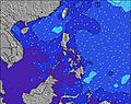 | 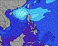 | 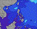 | 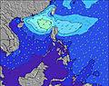 | 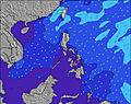 | 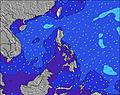 | 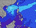 | 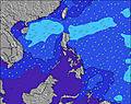 | |||||||||||||
Oleaje Altura (m) Dirección Período (s) | ENE 15 | ENE 14 | ENE 14 | ENE 16 | ENE 16 | ENE 16 | ENE 16 | ENE 16 | ENE 16 | ENE 16 | ENE 15 | ENE 15 | ENE 18 | ENE 17 | ENE 17 | ENE 16 | ENE 16 | ENE 16 | ENE 16 | NE 17 | NE 17 |
Gráfico Olas | |||||||||||||||||||||
284 | 280 | 280 | 547 | 669 | 714 | 803 | 929 | 793 | 806 | 630 | 681 | 1645 | 1254 | 1599 | 881 | 1633 | 859 | 1425 | 1638 | 1717 | |
Viento (km/h) | |||||||||||||||||||||
Estado del Viento Viento de Mar Viento de Mar-Cruzado Cruzado Viento de Tierra-Cruzado Viento de Tierra Cristalino | cross | off | off | off | off | off | off | off | cross-off | cross-off | off | off | off | off | off | off | cross-off | off | off | off | off |
Marea alta | 8:12AM1.73m | 8:42PM1.77m | 8:55AM1.62m | 9:15PM1.75m | 9:46AM1.50m | 9:54PM1.72m | |||||||||||||||
Marea baja | 2:24PM0.38m | 2:53AM0.49m | 2:57PM0.51m | 3:40AM0.49m | 3:35PM0.66m | ||||||||||||||||
— | — | — | — | — | — | 5:24 | — | — | — | — | — | — | — | 5:26 | — | — | — | — | — | — | |
— | — | 6:01 | — | — | — | — | — | — | — | 6:00 | — | — | — | — | — | — | — | 6:00 | — | — | |
mm | — | 1 | 1 | 1 | 1 | 1 | — | — | — | — | — | — | — | — | — | — | — | — | — | — | — |
Temp. °C | 31 | 31 | 30 | 27 | 26 | 26 | 26 | 28 | 32 | 33 | 31 | 28 | 27 | 26 | 26 | 29 | 32 | 33 | 31 | 28 | 27 |
Enfriamiento °C | 34 | 34 | 34 | 31 | 30 | 30 | 30 | 31 | 35 | 35 | 34 | 31 | 31 | 29 | 29 | 32 | 34 | 35 | 34 | 31 | 30 |
Oleaje 1 Altura (m) Dirección Período (s) | ENE 15 | ENE 14 | ENE 14 | ENE 16 | ENE 16 | ENE 16 | ENE 16 | ENE 16 | ENE 16 | ENE 16 | ENE 15 | ENE 15 | ENE 18 | ENE 17 | ENE 17 | ENE 16 | ENE 16 | ENE 16 | ENE 16 | NE 17 | NE 17 |
284 | 280 | 280 | 547 | 669 | 714 | 803 | 929 | 793 | 806 | 604 | 596 | 1645 | 1254 | 1599 | 881 | 1633 | 859 | 1425 | 1638 | 1717 | |
Oleaje 2 Altura (m) Dirección Período (s) | E 18 | ENE 18 | ENE 18 | SSE 7 | SSE 7 | SSE 7 | SSE 8 | SSE 8 | ENE 20 | ENE 20 | ENE 18 | ENE 18 | SSE 7 | NE 21 | SSE 7 | NE 18 | S 8 | NE 18 | S 7 | ESE 9 | ESE 9 |
167 | 182 | 251 | 34 | 35 | 30 | 32 | 41 | 360 | 349 | 630 | 681 | 19 | 348 | 16 | 752 | 31 | 642 | 28 | 8 | 8 | |
Oleaje 3 Altura (m) Dirección Período (s) | SSE 7 | NNE 9 | SSE 7 | ESE 9 | ESE 9 | ESE 9 | ENE 22 | NE 22 | SSE 8 | ESE 9 | ESE 9 | SSE 7 | ESE 10 | SSE 7 | ESE 10 | S 7 | ESE 10 | SSE 8 | ESE 9 | ESE 9 | ESE 9 |
20 | 8 | 30 | 8 | 9 | 9 | 91 | 118 | 45 | 8 | 8 | 29 | 9 | 16 | 9 | 28 | 9 | 33 | 9 | 8 | 8 | |
Olas de Viento Altura (m) Dirección Período (s) | — | SSE 7 | S 7 | S 7 | — | — | WSW 3 | SW 4 | S 8 | SSE 8 | SSE 8 | S 7 | — | S 7 | S 7 | S 7 | S 8 | S 8 | S 7 | S 7 | S 7 |
— | 31 | 131 | 150 | — | — | 3 | 6 | 169 | 47 | 44 | 127 | — | 68 | 82 | 107 | 137 | 138 | 130 | 39 | 38 | |
Viento del Tierra o Mar Limpio más proximo | |||||||||||||||||||||
Distancia (km) | 58 | 0 | 0 | 0 | 0 | 0 | 0 | 0 | 0 | 20 | 0 | 0 | 0 | 0 | 0 | 0 | 0 | 0 | 0 | 0 | 0 |
Mejores Olas Previstas en Samar | |||||||||||||||||||||
Mejores Olas Previstas en Philippines | |||||||||||||||||||||
Busca-Olas Global | |||||||||||||||||||||
- Map Icons:
 Break
Break Live Wave Height (m)
 Live Wind Speed (km/h)
 Surf Rating (10 Max)
 Ocean Swells (m)
- Wind Speed (km/h)
GRÁTIS! Un widget de Surf-Forecast.com para tu sitio
Este widget grátis de previsiones de surf y tiempo puede ser añadido a cualquier otro sitio y da un resumen de previsiones de olas para Llorente. Solo necesita cortar y pegar el código HTML de abajo en su web. Puede elegir preferencias de idioma y de unidades (métricas o imperiales) para convenir a los usuarios de su sitio. Clica aquí para obtener el código.
 Nearest