
Previsiones:

Pronóstico Corto PlazoMayormente seco. Warm (max 21°C el martes por la tarde, min 16°C el martes por la noche). Vientos crecientes (Vientos ligeros desde el ONO el martes por la noche, vientos frescos desde el O por la tarde de jueves). | ||||||||||||||||||||||||
martes 28 | miércoles 29 | jueves 30 | ||||||||||||||||||||||
1 AM | 4 AM | 7 AM | 10 AM | 1 PM | 4 PM | 7 PM | 10 PM | 1 AM | 4 AM | 7 AM | 10 AM | 1 PM | 4 PM | 7 PM | 10 PM | 1 AM | 4 AM | 7 AM | 10 AM | 1 PM | 4 PM | 7 PM | 10 PM | |
Mapa de Altura de Olas |  | 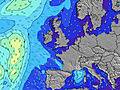 |  |  |  |  |  |  |  | |||||||||||||||
Oleaje Altura (m) Dirección Período (s) | W 6 | W 6 | W 6 | W 6 | W 6 | W 5 | W 5 | W 5 | W 5 | W 5 | W 5 | W 5 | W 5 | W 3 | W 4 | W 10 | W 10 | W 5 | W 5 | W 6 | W 6 | W 6 | W 6 | W 6 |
Gráfico Olas | ||||||||||||||||||||||||
25 | 33 | 35 | 24 | 15 | 14 | 13 | 8 | 8 | 8 | 8 | 8 | 8 | 7 | 9 | 8 | 8 | 10 | 20 | 39 | 50 | 46 | 43 | 30 | |
Viento (km/h) | ||||||||||||||||||||||||
Estado del Viento Viento de Mar Viento de Mar-Cruzado Cruzado Viento de Tierra-Cruzado Viento de Tierra Cristalino | on | on | on | cross-on | cross | cross-on | cross-on | cross | cross | cross-on | cross | cross-on | cross | cross-on | cross-on | cross-on | cross-on | on | cross | cross-on | cross-on | cross-on | cross-on | cross-on |
Marea alta | 6:52AM7.78m | 7:11PM8.20m | 7:30AM8.21m | 7:47PM8.65m | 8:05AM8.58m | 8:22PM9.02m | ||||||||||||||||||
Marea baja | 00:48AM2.27m | 1:05PM2.08m | 1:30AM1.82m | 1:43PM1.66m | 2:06AM1.44m | 2:17PM1.32m | ||||||||||||||||||
— | 5:31 | — | — | — | — | — | — | — | 5:31 | — | — | — | — | — | — | — | 5:33 | — | — | — | — | — | — | |
— | — | — | — | — | — | 9:07 | — | — | — | — | — | — | — | 9:07 | — | — | — | — | — | — | — | 9:05 | — | |
mm | — | — | — | — | — | — | — | — | — | — | — | — | — | — | — | — | — | — | — | — | — | — | — | — |
Temp. °C | 18 | 17 | 17 | 19 | 20 | 21 | 19 | 18 | 17 | 17 | 16 | 19 | 19 | 20 | 19 | 17 | 17 | 17 | 16 | 16 | 17 | 17 | 17 | 16 |
Enfriamiento °C | 18 | 17 | 17 | 19 | 19 | 19 | 17 | 18 | 17 | 18 | 16 | 18 | 16 | 16 | 15 | 16 | 16 | 16 | 13 | 11 | 12 | 11 | 12 | 13 |
Oleaje 1 Altura (m) Dirección Período (s) | W 6 | W 6 | W 6 | W 6 | W 6 | W 5 | W 8 | W 5 | W 5 | W 5 | W 5 | W 5 | W 10 | — | W 10 | W 5 | W 10 | W 5 | W 10 | W 10 | — | W 10 | W 10 | W 9 |
25 | 33 | 35 | 24 | 15 | 14 | 1 | 8 | 8 | 8 | 8 | 8 | 2 | — | 2 | 2 | 8 | 10 | 7 | 2 | — | 2 | 2 | 2 | |
Oleaje 2 Altura (m) Dirección Período (s) | — | — | — | — | W 9 | W 8 | — | W 8 | W 8 | W 8 | W 8 | W 8 | — | — | — | W 10 | W 6 | W 10 | — | — | — | — | — | — |
— | — | — | — | 1 | 1 | — | 1 | 1 | 1 | 1 | 1 | — | — | — | 8 | 3 | 7 | — | — | — | — | — | — | |
Oleaje 3 Altura (m) Dirección Período (s) | — | — | — | — | — | — | — | — | W 11 | W 11 | W 11 | W 11 | — | — | — | — | — | — | — | — | — | — | — | — |
— | — | — | — | — | — | — | — | 2 | 2 | 2 | 2 | — | — | — | — | — | — | — | — | — | — | — | — | |
Olas de Viento Altura (m) Dirección Período (s) | — | — | — | — | — | — | W 5 | — | — | — | — | — | W 5 | W 3 | W 4 | W 4 | W 4 | — | W 5 | W 6 | W 6 | W 6 | W 6 | W 6 |
— | — | — | — | — | — | 13 | — | — | — | — | — | 8 | 7 | 9 | 4 | 5 | — | 20 | 39 | 50 | 46 | 43 | 30 | |
Viento del Tierra o Mar Limpio más proximo | ||||||||||||||||||||||||
Distancia (km) | 108 | 108 | 126 | 152 | 165 | 170 | 152 | 143 | 143 | 144 | 144 | 191 | 191 | 349 | 271 | 261 | 300 | 300 | 300 | 348 | 349 | 885 | 885 | 184 |
Mejores Olas Previstas en Wales - South East | ||||||||||||||||||||||||
Mejores Olas Previstas en United Kingdom | ||||||||||||||||||||||||
Busca-Olas Global | ||||||||||||||||||||||||
- Map Icons:
 Break
Break Live Wave Height (m)
 Live Wind Speed (km/h)
 Surf Rating (10 Max)
 Ocean Swells (m)
- Wind Speed (km/h)
GRÁTIS! Un widget de Surf-Forecast.com para tu sitio
Este widget grátis de previsiones de surf y tiempo puede ser añadido a cualquier otro sitio y da un resumen de previsiones de olas para Llantwit Major. Solo necesita cortar y pegar el código HTML de abajo en su web. Puede elegir preferencias de idioma y de unidades (métricas o imperiales) para convenir a los usuarios de su sitio. Clica aquí para obtener el código.
 Nearest