
Previsiones:

Pronóstico Corto PlazoFuerte lluvia (totál 59mm), más pesada durante la tarde de lunes. Warm (max 27°C el sábado por la tarde, min 22°C el lunes por la tarde). Mayormente vientos frescos. | |||||||||||||||||||||
sáb 1 | domingo 2 | lunes 3 | |||||||||||||||||||
11 AM | 2 PM | 5 PM | 8 PM | 11 PM | 2 AM | 5 AM | 8 AM | 11 AM | 2 PM | 5 PM | 8 PM | 11 PM | 2 AM | 5 AM | 8 AM | 11 AM | 2 PM | 5 PM | 8 PM | 11 PM | |
Mapa de Altura de Olas |  | 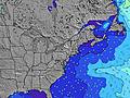 |  | 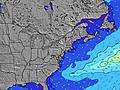 | 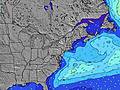 |  | 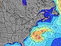 |  | |||||||||||||
Oleaje Altura (m) Dirección Período (s) | SSE 8 | SSE 8 | SSE 4 | SSE 4 | SSE 4 | SSE 4 | SSE 4 | SSE 4 | SSE 4 | SSE 4 | SSE 5 | SSE 5 | SSE 6 | SSE 6 | SSE 7 | SSE 7 | S 8 | S 8 | SSE 8 | SSE 8 | S 8 |
Gráfico Olas | |||||||||||||||||||||
27 | 50 | 15 | 20 | 17 | 19 | 21 | 19 | 26 | 37 | 64 | 71 | 118 | 144 | 239 | 319 | 652 | 579 | 264 | 237 | 472 | |
Viento (km/h) | |||||||||||||||||||||
Estado del Viento Viento de Mar Viento de Mar-Cruzado Cruzado Viento de Tierra-Cruzado Viento de Tierra Cristalino | cross | cross-on | cross-on | cross | cross | cross | cross | cross | cross-on | cross-on | cross-on | cross | cross | cross | cross | cross | cross-off | cross-off | cross-off | cross-off | cross-off |
Marea alta | 9:47AM1.33m | 9:54PM1.45m | 10:26AM1.36m | 10:35PM1.40m | 11:10AM1.40m | ||||||||||||||||
Marea baja | 3:58PM0.19m | 4:24AM0.05m | 4:37PM0.20m | 4:56AM0.06m | 5:19PM0.23m | ||||||||||||||||
— | — | — | — | — | — | 5:54 | — | — | — | — | — | — | — | 5:56 | — | — | — | — | — | — | |
— | — | — | 8:09 | — | — | — | — | — | — | — | 8:08 | — | — | — | — | — | — | — | 8:07 | — | |
mm | — | — | — | — | — | — | — | — | — | — | — | 2 | 6 | 2 | 2 | 2 | 11 | 26 | 2 | 4 | 1 |
Temp. °C | 27 | 27 | 26 | 25 | 24 | 24 | 24 | 25 | 25 | 25 | 26 | 27 | 23 | 25 | 25 | 25 | 23 | 22 | 25 | 26 | 24 |
Enfriamiento °C | 27 | 25 | 25 | 25 | 24 | 25 | 24 | 25 | 25 | 25 | 26 | 27 | 25 | 26 | 24 | 24 | 22 | 25 | 27 | 27 | 26 |
Oleaje 1 Altura (m) Dirección Período (s) | SSE 8 | ESE 9 | ESE 9 | ESE 9 | ESE 8 | ESE 8 | SE 7 | SE 6 | E 5 | E 5 | E 9 | — | E 6 | — | — | — | SSE 8 | SSE 8 | SSE 8 | SSE 8 | SSE 8 |
27 | 8 | 8 | 7 | 7 | 7 | 7 | 7 | 1 | 1 | 2 | — | 1 | — | — | — | 353 | 306 | 264 | 237 | 234 | |
Oleaje 2 Altura (m) Dirección Período (s) | E 6 | E 6 | E 6 | E 6 | SE 6 | SSE 7 | ESE 8 | ESE 8 | — | — | E 5 | — | — | — | — | — | — | — | — | — | — |
1 | 1 | 1 | 1 | 2 | 9 | 7 | 7 | — | — | 1 | — | — | — | — | — | — | — | — | — | — | |
Oleaje 3 Altura (m) Dirección Período (s) | ENE 6 | E 6 | E 6 | E 6 | E 6 | E 6 | E 6 | E 6 | — | — | — | — | — | — | — | — | — | — | — | — | — |
3 | 1 | 1 | 1 | 1 | 1 | 1 | 1 | — | — | — | — | — | — | — | — | — | — | — | — | — | |
Olas de Viento Altura (m) Dirección Período (s) | SSE 4 | SSE 8 | SSE 4 | SSE 4 | SSE 4 | SSE 4 | SSE 4 | SSE 4 | SSE 4 | SSE 4 | SSE 5 | SSE 5 | SSE 6 | SSE 6 | SSE 7 | SSE 7 | S 8 | S 8 | — | — | S 8 |
3 | 50 | 15 | 20 | 17 | 19 | 21 | 19 | 26 | 37 | 64 | 71 | 118 | 144 | 239 | 319 | 652 | 579 | — | — | 472 | |
Viento del Tierra o Mar Limpio más proximo | |||||||||||||||||||||
Distancia (km) | 222 | 247 | 881 | 881 | 466 | 466 | 881 | 1014 | 1464 | 1630 | 3188 | 101 | 33 | 1058 | 247 | 418 | 1073 | 0 | 11 | 50 | 0 |
Mejores Olas Previstas en New Jersey | |||||||||||||||||||||
Mejores Olas Previstas en United States | |||||||||||||||||||||
Busca-Olas Global | |||||||||||||||||||||
- Map Icons:
 Break
Break Live Wave Height (m)
 Live Wind Speed (km/h)
 Surf Rating (10 Max)
 Ocean Swells (m)
- Wind Speed (km/h)
GRÁTIS! Un widget de Surf-Forecast.com para tu sitio
Este widget grátis de previsiones de surf y tiempo puede ser añadido a cualquier otro sitio y da un resumen de previsiones de olas para Lavallette. Solo necesita cortar y pegar el código HTML de abajo en su web. Puede elegir preferencias de idioma y de unidades (métricas o imperiales) para convenir a los usuarios de su sitio. Clica aquí para obtener el código.
 Nearest