
Previsiones:

Pronóstico Corto PlazoLluvia ligera (totál 7mm), cayendo mayormente el domingo por la tarde. Warm (max 27°C el domingo por la tarde, min 24°C el martes por la noche). Vientos crecientes (calma el lunes por la mañana, vientos frescos desde el SSE por la noche de martes). | |||||||||||||||||||
dom 2 | lunes 3 | martes 4 | |||||||||||||||||
4 PM | 7 PM | 10 PM | 1 AM | 4 AM | 7 AM | 10 AM | 1 PM | 4 PM | 7 PM | 10 PM | 1 AM | 4 AM | 7 AM | 10 AM | 1 PM | 4 PM | 7 PM | 10 PM | |
Mapa de Altura de Olas |  |  |  | 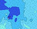 | 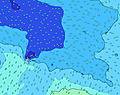 | 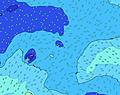 | 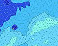 | ||||||||||||
Oleaje Altura (m) Dirección Período (s) | SSE 11 | SW 14 | SW 14 | SW 14 | SW 14 | SW 13 | SW 13 | SW 13 | SW 13 | SW 13 | SW 13 | SW 13 | SSW 14 | SSW 14 | S 13 | SSW 13 | SSW 13 | SSW 12 | SSW 12 |
Gráfico Olas | |||||||||||||||||||
261 | 256 | 248 | 241 | 227 | 257 | 286 | 286 | 286 | 286 | 282 | 315 | 280 | 317 | 361 | 444 | 484 | 861 | 494 | |
Viento (km/h) | |||||||||||||||||||
Estado del Viento Viento de Mar Viento de Mar-Cruzado Cruzado Viento de Tierra-Cruzado Viento de Tierra Cristalino | cross | cross | cross | cross-off | cross-off | glassy | glassy | cross-on | cross-on | cross-on | on | on | on | on | on | on | on | on | on |
Marea alta | 10:13PM0.75m | 10:30AM0.75m | 11:06PM0.76m | 11:27AM0.72m | |||||||||||||||
Marea baja | 3:54PM0.08m | 4:19AM0.11m | 4:42PM0.09m | 5:18AM0.12m | 5:35PM0.09m | ||||||||||||||
— | — | — | — | 6:43 | — | — | — | — | — | — | — | 6:43 | — | — | — | — | — | — | |
6:13 | — | — | — | — | — | — | — | 6:14 | — | — | — | — | — | — | — | 6:14 | — | — | |
mm | 1 | 1 | — | 1 | 1 | — | — | — | — | — | 1 | — | 1 | — | — | — | 1 | — | — |
Temp. °C | 26 | 27 | 26 | 26 | 26 | 26 | 26 | 26 | 26 | 25 | 25 | 25 | 25 | 25 | 25 | 25 | 25 | 25 | 25 |
Enfriamiento °C | 29 | 30 | 28 | 28 | 29 | 30 | 30 | 29 | 28 | 26 | 25 | 26 | 26 | 26 | 25 | 25 | 25 | 24 | 24 |
Oleaje 1 Altura (m) Dirección Período (s) | E 8 | SSE 11 | SSE 11 | SSE 11 | SSE 11 | SE 12 | SW 13 | SW 13 | SW 13 | SW 13 | SW 13 | SW 13 | SW 12 | SW 12 | S 13 | SSW 13 | SSW 12 | SSW 12 | SSW 12 |
135 | 256 | 215 | 219 | 227 | 195 | 286 | 286 | 286 | 286 | 282 | 315 | 256 | 252 | 361 | 444 | 412 | 861 | 494 | |
Oleaje 2 Altura (m) Dirección Período (s) | SSE 11 | E 8 | E 8 | E 8 | E 8 | E 8 | E 8 | E 8 | SE 10 | E 8 | E 8 | S 15 | SSW 14 | SSW 14 | SW 12 | SW 12 | SSW 13 | E 8 | SW 12 |
261 | 114 | 93 | 90 | 93 | 95 | 78 | 78 | 110 | 74 | 60 | 275 | 280 | 317 | 252 | 203 | 484 | 44 | 190 | |
Oleaje 3 Altura (m) Dirección Período (s) | SW 14 | SW 14 | SW 14 | SW 14 | SW 14 | SW 13 | SSE 10 | SSE 10 | E 8 | SE 10 | SE 10 | NE 9 | E 8 | E 8 | SSW 6 | E 8 | E 8 | SW 19 | SW 18 |
203 | 248 | 248 | 241 | 224 | 257 | 86 | 86 | 78 | 110 | 110 | 21 | 58 | 80 | 31 | 74 | 60 | 293 | 269 | |
Olas de Viento Altura (m) Dirección Período (s) | — | — | — | — | — | — | — | — | — | SSE 3 | SSE 4 | SE 8 | SSE 4 | S 5 | E 8 | S 6 | SE 9 | SE 9 | SSE 5 |
— | — | — | — | — | — | — | — | — | 4 | 10 | 187 | 20 | 29 | 76 | 38 | 20 | 22 | 52 | |
Viento del Tierra o Mar Limpio más proximo | |||||||||||||||||||
Distancia (km) | 1 | 1 | 1 | 0 | 0 | 0 | 0 | 20 | 20 | 20 | 20 | 1355 | 20 | 20 | 20 | 20 | 899 | 1391 | 1391 |
Mejores Olas Previstas en American-Samoa - Tutuila | |||||||||||||||||||
Mejores Olas Previstas en American Samoa | |||||||||||||||||||
Busca-Olas Global | |||||||||||||||||||
- Map Icons:
 Break
Break Live Wave Height (m)
 Live Wind Speed (km/h)
 Surf Rating (10 Max)
 Ocean Swells (m)
- Wind Speed (km/h)
GRÁTIS! Un widget de Surf-Forecast.com para tu sitio
Este widget grátis de previsiones de surf y tiempo puede ser añadido a cualquier otro sitio y da un resumen de previsiones de olas para Lauli'i Tuai Rights. Solo necesita cortar y pegar el código HTML de abajo en su web. Puede elegir preferencias de idioma y de unidades (métricas o imperiales) para convenir a los usuarios de su sitio. Clica aquí para obtener el código.
 Nearest