
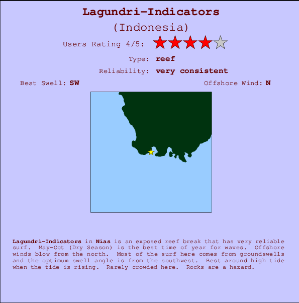
Lagundri-Indicators Surf Guide
Lagundri-Indicators in Nias, Hinako Islands is an exposed reef break that is usually a safe bet. May-Oct (Dry Season) is the optimum time of year for waves. The best wind direction is from the north. Tends to receive distant groundswells and the best swell direction is from the southwest. There is a right breaking reef. Best around high tide when the tide is rising. Unlikely to be too crowded, even when the surf is up. Take care of rocks in the line up.
Lagundri-Indicators Spot Info
| Type: | Rating: | Reliability: | Todays Sea Temp*: |
|---|---|---|---|
| very consistent | 29.9°C*ocean temperature recorded from satellite |
Surfing Lagundri-Indicators:
The best conditions reported for surf at Lagundri-Indicators occur when a Southwest swell combines with an offshore wind direction from the North.

Energía de Olas (poder): 12 horas


Lagundri-Indicators Surf:
Wednesday, 15 July 2026, 18:20 Local time| miércoles 15 | jue | |||
| 4PM | 7PM | 10PM | 1AM | |
| Wave (m) | ||||
| Período (s) | 15 | 15 | 15 | 15 |
| Viento (km/h) | ||||
| Estado del Viento | cross- on |
cross- on |
glass | glass |
- /breaks/Lagundri-Indicators/forecasts/latest
Lagundri-Indicators Surf Guide
Lagundri-Indicators in Nias, Hinako Islands is an exposed reef break that is usually a safe bet. May-Oct (Dry Season) is the optimum time of year for waves. The best wind direction is from the north. Tends to receive distant groundswells and the best swell direction is from the southwest. There is a right breaking reef. Best around high tide when the tide is rising. Unlikely to be too crowded, even when the surf is up. Take care of rocks in the line up.
Lagundri-Indicators Spot Info
Type: Rating: Reliability: Todays Sea Temp*:  Reef
Reef 4
4very consistent 29.9°C*ocean temperature recorded from satelliteSurfing Lagundri-Indicators:
The best conditions reported for surf at Lagundri-Indicators occur when a Southwest swell combines with an offshore wind direction from the North.
Energía de Olas (poder): 12 horas
Usa la barra de navegación de arriba para ver la temperatura del mar en Lagundri-Indicators, fotografías Lagundri-Indicators, previsiones detalladas de olas para Lagundri-Indicators, vientos y previsión del tiempo, webcams para Lagundri-Indicators, viento actual desde estaciones meteorológicas en Nias y predicciones de marea para Lagundri-Indicators. Las mapas de olas para Indonesia enseñarán un mapa grande de Indonesia y los mares que rodean. Los mapas de olas pueden ser animadas para mostrar diferentes componentes de olas, la altura de ola, la energía de ola, el período, junto con previsiones de viento y del tiempo. Previsiones actuales del tiempo y del estado del mar provienen de boyas marinas de Indonesia, del barcos que transitan en la zona y de estaciones meteorológicas costeras. Cada página de previsiones tiene un Busca-Olas Regional y Global para localizar las mejores condiciones para surfear en el área de Lagundri-Indicators.
Lagundri-Indicators Surf:
Wednesday, 15 July 2026, 18:20 Local timemiércoles 15 jue 4PM 7PM 10PM 1AM Wave (m) Período (s) 15 15 15 15 Viento (km/h) Estado del Viento cross-
oncross-
onglass glass - /breaks/Lagundri-Indicators/forecasts/latest
- /breaks/Lagundri-Indicators/forecasts/latest/six_day
Lagundri-Indicators Surf Guide
Lagundri-Indicators in Nias, Hinako Islands is an exposed reef break that is usually a safe bet. May-Oct (Dry Season) is the optimum time of year for waves. The best wind direction is from the north. Tends to receive distant groundswells and the best swell direction is from the southwest. There is a right breaking reef. Best around high tide when the tide is rising. Unlikely to be too crowded, even when the surf is up. Take care of rocks in the line up.
Lagundri-Indicators Spot Info
Type: Rating: Reliability: Todays Sea Temp*: Reef4very consistent 29.9°C*ocean temperature recorded from satelliteSurfing Lagundri-Indicators:
The best conditions reported for surf at Lagundri-Indicators occur when a Southwest swell combines with an offshore wind direction from the North.
Energía de Olas (poder): 12 horas
Usa la barra de navegación de arriba para ver la temperatura del mar en Lagundri-Indicators, fotografías Lagundri-Indicators, previsiones detalladas de olas para Lagundri-Indicators, vientos y previsión del tiempo, webcams para Lagundri-Indicators, viento actual desde estaciones meteorológicas en Nias y predicciones de marea para Lagundri-Indicators. Las mapas de olas para Indonesia enseñarán un mapa grande de Indonesia y los mares que rodean. Los mapas de olas pueden ser animadas para mostrar diferentes componentes de olas, la altura de ola, la energía de ola, el período, junto con previsiones de viento y del tiempo. Previsiones actuales del tiempo y del estado del mar provienen de boyas marinas de Indonesia, del barcos que transitan en la zona y de estaciones meteorológicas costeras. Cada página de previsiones tiene un Busca-Olas Regional y Global para localizar las mejores condiciones para surfear en el área de Lagundri-Indicators.
Lagundri-Indicators Surf:
Wednesday, 15 July 2026, 18:20 Local timemiércoles 15 jue 4PM 7PM 10PM 1AM Wave (m) Período (s) 15 15 15 15 Viento (km/h) Estado del Viento cross-
oncross-
onglass glass - /breaks/Lagundri-Indicators/forecasts/latest
Lagundri-Indicators Surf Guide
Lagundri-Indicators in Nias, Hinako Islands is an exposed reef break that is usually a safe bet. May-Oct (Dry Season) is the optimum time of year for waves. The best wind direction is from the north. Tends to receive distant groundswells and the best swell direction is from the southwest. There is a right breaking reef. Best around high tide when the tide is rising. Unlikely to be too crowded, even when the surf is up. Take care of rocks in the line up.
Lagundri-Indicators Spot Info
Type: Rating: Reliability: Todays Sea Temp*: Reef4very consistent 29.9°C*ocean temperature recorded from satelliteSurfing Lagundri-Indicators:
The best conditions reported for surf at Lagundri-Indicators occur when a Southwest swell combines with an offshore wind direction from the North.
Energía de Olas (poder): 12 horas
Usa la barra de navegación de arriba para ver la temperatura del mar en Lagundri-Indicators, fotografías Lagundri-Indicators, previsiones detalladas de olas para Lagundri-Indicators, vientos y previsión del tiempo, webcams para Lagundri-Indicators, viento actual desde estaciones meteorológicas en Nias y predicciones de marea para Lagundri-Indicators. Las mapas de olas para Indonesia enseñarán un mapa grande de Indonesia y los mares que rodean. Los mapas de olas pueden ser animadas para mostrar diferentes componentes de olas, la altura de ola, la energía de ola, el período, junto con previsiones de viento y del tiempo. Previsiones actuales del tiempo y del estado del mar provienen de boyas marinas de Indonesia, del barcos que transitan en la zona y de estaciones meteorológicas costeras. Cada página de previsiones tiene un Busca-Olas Regional y Global para localizar las mejores condiciones para surfear en el área de Lagundri-Indicators.
Lagundri-Indicators Surf:
Wednesday, 15 July 2026, 18:20 Local timemiércoles 15 jue 4PM 7PM 10PM 1AM Wave (m) Período (s) 15 15 15 15 Viento (km/h) Estado del Viento cross-
oncross-
onglass glass Tide Times:
En Lagundri-Indicators (0 km).
PROXIMA ES A LAS (hora local) quedan marea alta marea baja Lagundri-Indicators Tide Times and Tide Chart
Live Weather:
At Minangkabau Airport, 323 km from Lagundri-Indicators.
calm
(km/h)
Dry and partly cloudyAir temperature
30°COverall Lagundri-Indicators Surf Consistency and Wind Distribution in julio


Wind stats for Lagundri-Indicators: see the variation in direction and stength by month.
Fotos de Surf
de la galeríaContornos: Carreteras y Ríos: Selecciona un spot desde el menú 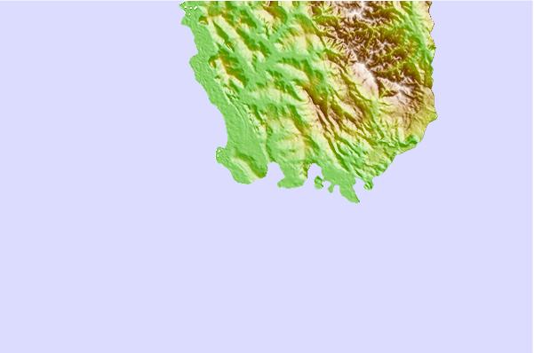
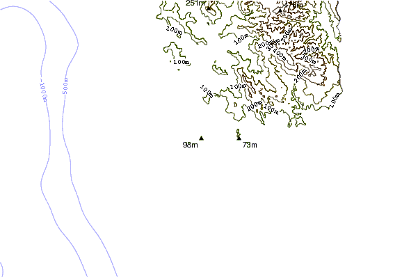
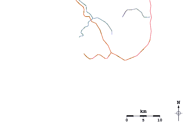
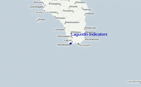
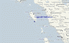
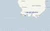
Usa este mapa para navegar hacia las playas de surf de Nias y estaciones de marea cercanas de Lagundri-Indicators
Spots de Surf más cercanos a Lagundri-Indicators:
(Clica la ubicación para más detalles)- Closest spot1 mi
- Second closest spot1 mi
- Third closest spot7 mi
- Fourth closest spot9 mi
- Fifth closest spot12 mi
Boyas marinas más cercanas a Lagundri-Indicators:
- Closest Boya Marinas2414 mi
- Second closest Boya Marinas2491 mi
- Third closest Boya Marinas2669 mi
- Fourth closest Boya Marinas2684 mi
- Fifth closest Boya Marinas2853 mi
Estaciones de marea más cercanas a Lagundri-Indicators:
- Closest estación de mareaSibolga109 mi
- Second closest estación de mareaSinabang161 mi
- Third closest estación de mareaPariaman185 mi
- Fourth closest estación de mareaTeluk Nibung222 mi
- Fifth closest estación de mareaBelawan236 mi
Airports
- The nearest passenger airport to Lagundri-Indicators is Binaka (Gunung Sitoli) Airport (GNS) in Indonesia, which is 66 km (41 miles) away (directly).
- The second closest airport to Lagundri-Indicators is Tabing (Padang) Airport (PDG), also in Indonesia, 334 km (207 miles) away.
- /breaks/Lagundri-Indicators/forecasts/latest


 Nearest