
Previsiones:

Pronóstico Corto PlazoMayormente seco. Warm (max 25°C el martes por la mañana, min 23°C el lunes por la noche). El viento será generalmente ligero. | |||||||||||||||||||||||
lunes 3 | martes 4 | miércoles 5 | |||||||||||||||||||||
3 AM | 6 AM | 9 AM | 12 PM | 3 PM | 6 PM | 9 PM | 12 AM | 3 AM | 6 AM | 9 AM | 12 PM | 3 PM | 6 PM | 9 PM | 12 AM | 3 AM | 6 AM | 9 AM | 12 PM | 3 PM | 6 PM | 9 PM | |
Mapa de Altura de Olas | 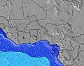 | 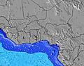 | 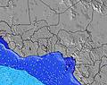 | 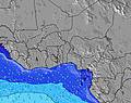 | 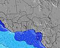 | 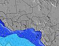 | 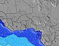 | 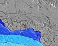 | 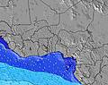 | ||||||||||||||
Oleaje Altura (m) Dirección Período (s) | SSW 14 | SSW 13 | SSW 13 | SSW 13 | SSW 13 | SSW 13 | SSW 12 | SSW 12 | SSW 12 | SSW 12 | SSW 12 | S 10 | SSW 11 | S 9 | SSW 11 | SSW 11 | SSW 11 | SSW 11 | S 9 | S 9 | SSW 14 | SSW 14 | SSW 14 |
Gráfico Olas | |||||||||||||||||||||||
213 | 198 | 198 | 273 | 219 | 181 | 167 | 167 | 164 | 164 | 125 | 148 | 115 | 106 | 81 | 79 | 78 | 66 | 78 | 76 | 71 | 71 | 104 | |
Viento (km/h) | |||||||||||||||||||||||
Estado del Viento Viento de Mar Viento de Mar-Cruzado Cruzado Viento de Tierra-Cruzado Viento de Tierra Cristalino | on | on | on | on | on | on | on | on | on | cross-on | on | on | on | on | on | on | cross-on | cross-on | on | on | on | on | on |
Marea alta | 7:41AM1.04m | 7:51PM0.93m | 8:18AM1.03m | 8:41PM0.90m | 9:01AM1.00m | ||||||||||||||||||
Marea baja | 1:05AM0.36m | 1:42PM0.43m | 1:44AM0.40m | 2:30PM0.44m | 2:29AM0.46m | 3:27PM0.45m | |||||||||||||||||
— | 6:11 | — | — | — | — | — | — | — | 6:11 | — | — | — | — | — | — | — | 6:11 | — | — | — | — | — | |
— | — | — | — | — | 6:30 | — | — | — | — | — | — | — | 6:30 | — | — | — | — | — | — | — | 6:30 | — | |
mm | — | — | — | — | — | — | — | — | — | — | — | — | — | — | — | — | — | — | — | — | — | — | — |
Temp. °C | 23 | 24 | 24 | 24 | 24 | 24 | 24 | 23 | 23 | 24 | 25 | 25 | 25 | 25 | 24 | 24 | 23 | 23 | 24 | 24 | 24 | 24 | 23 |
Enfriamiento °C | 24 | 26 | 26 | 25 | 25 | 26 | 27 | 25 | 25 | 26 | 27 | 25 | 25 | 26 | 24 | 25 | 24 | 25 | 26 | 25 | 24 | 25 | 24 |
Oleaje 1 Altura (m) Dirección Período (s) | SSW 14 | S 7 | S 6 | S 6 | S 6 | S 6 | S 6 | S 6 | S 6 | S 6 | S 6 | S 10 | S 9 | S 9 | S 9 | S 9 | S 9 | SSE 9 | S 9 | S 9 | SSW 11 | SSW 14 | SSW 14 |
213 | 171 | 143 | 158 | 132 | 112 | 76 | 89 | 86 | 67 | 52 | 148 | 113 | 106 | 81 | 79 | 78 | 62 | 78 | 76 | 44 | 71 | 104 | |
Oleaje 2 Altura (m) Dirección Período (s) | SSE 11 | SSW 13 | SSW 13 | SSW 13 | SSW 13 | SSW 13 | SSW 12 | SSW 12 | SSW 12 | SSW 12 | SSW 12 | SSW 12 | SSW 11 | SSW 11 | SSW 11 | SSW 11 | SSW 11 | SSW 11 | SSW 11 | SSW 11 | SSW 13 | SSW 10 | SSW 10 |
44 | 198 | 198 | 273 | 219 | 181 | 167 | 167 | 164 | 164 | 125 | 121 | 115 | 82 | 81 | 79 | 78 | 66 | 65 | 45 | 60 | 41 | 38 | |
Oleaje 3 Altura (m) Dirección Período (s) | — | SSE 10 | SSE 10 | SSE 10 | SE 7 | SSE 10 | SSE 10 | S 16 | S 16 | S 16 | S 16 | S 16 | SW 16 | SSW 15 | SSW 15 | SSW 15 | SSW 15 | SSW 14 | SSW 14 | SSW 13 | SSW 14 | SSW 10 | — |
— | 42 | 58 | 39 | 46 | 56 | 56 | 5 | 5 | 5 | 5 | 5 | 10 | 21 | 21 | 21 | 21 | 20 | 36 | 60 | 71 | 40 | — | |
Olas de Viento Altura (m) Dirección Período (s) | S 6 | — | — | — | — | — | — | — | — | — | — | — | — | — | — | — | WSW 5 | WSW 5 | — | — | S 7 | S 7 | S 6 |
166 | — | — | — | — | — | — | — | — | — | — | — | — | — | — | — | 2 | 2 | — | — | 58 | 56 | 67 | |
Viento del Tierra o Mar Limpio más proximo | |||||||||||||||||||||||
Distancia (km) | 1553 | 190 | 2381 | 190 | 190 | 190 | 190 | 190 | 190 | 190 | 190 | 190 | 2399 | 190 | 190 | 190 | 774 | 340 | 231 | 190 | 1818 | 190 | 190 |
Mejores Olas Previstas en Ivory Coast | |||||||||||||||||||||||
Mejores Olas Previstas en Côte d'Ivoire | |||||||||||||||||||||||
Busca-Olas Global | |||||||||||||||||||||||
- Map Icons:
 Break
Break Live Wave Height (m)
 Live Wind Speed (km/h)
 Surf Rating (10 Max)
 Ocean Swells (m)
- Wind Speed (km/h)
GRÁTIS! Un widget de Surf-Forecast.com para tu sitio
Este widget grátis de previsiones de surf y tiempo puede ser añadido a cualquier otro sitio y da un resumen de previsiones de olas para La Passe. Solo necesita cortar y pegar el código HTML de abajo en su web. Puede elegir preferencias de idioma y de unidades (métricas o imperiales) para convenir a los usuarios de su sitio. Clica aquí para obtener el código.
 Nearest