
La Isla Surf Guide
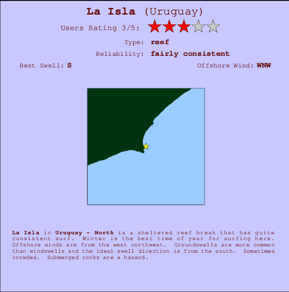
La Isla in West Uruguay is a sheltered reef break that has quite reliable surf. Winter is the best time of year for surfing here. The best wind direction is from the northwest. Groundswells more frequent than windswells and the ideal swell angle is from the south. A reef breaks right. Sometimes crowded. Rocks are a hazard.
La Isla Spot Info
| Type: | Rating: | Reliability: | Todays Sea Temp*: |
|---|---|---|---|
| fairly consistent | 11.0°C*ocean temperature recorded from satellite |
Surfing La Isla:
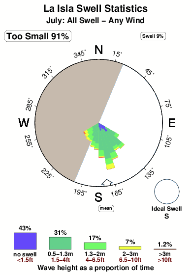
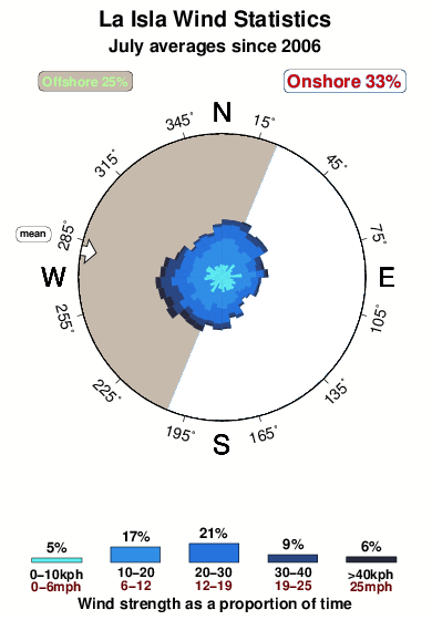
The best conditions reported for surf at La Isla occur when a South swell combines with an offshore wind direction from the West-northwest.
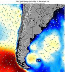
Energía de Olas (poder): 12 horas


La Isla Surf:
Wednesday, 15 July 2026, 03:32 Local time| miércoles 15 | ||||
| 0AM | 3AM | 6AM | 9AM | |
| Wave (m) | ||||
| Período (s) | 9 | 9 | 9 | 7 |
| Viento (km/h) | ||||
| Estado del Viento | cross | cross- off |
cross- off |
cross- off |
- /breaks/La-Isla_2/forecasts/latest
La Isla Surf Guide
La Isla in West Uruguay is a sheltered reef break that has quite reliable surf. Winter is the best time of year for surfing here. The best wind direction is from the northwest. Groundswells more frequent than windswells and the ideal swell angle is from the south. A reef breaks right. Sometimes crowded. Rocks are a hazard.
La Isla Spot Info
Type: Rating: Reliability: Todays Sea Temp*:  Reef
Reef 3
3fairly consistent 11.0°C*ocean temperature recorded from satelliteSurfing La Isla:
The best conditions reported for surf at La Isla occur when a South swell combines with an offshore wind direction from the West-northwest.
Energía de Olas (poder): 12 horas
Usa la barra de navegación de arriba para ver la temperatura del mar en La Isla, fotografías La Isla, previsiones detalladas de olas para La Isla, vientos y previsión del tiempo, webcams para La Isla, viento actual desde estaciones meteorológicas en North y predicciones de marea para La Isla. Las mapas de olas para Uruguay enseñarán un mapa grande de Uruguay y los mares que rodean. Los mapas de olas pueden ser animadas para mostrar diferentes componentes de olas, la altura de ola, la energía de ola, el período, junto con previsiones de viento y del tiempo. Previsiones actuales del tiempo y del estado del mar provienen de boyas marinas de Uruguay, del barcos que transitan en la zona y de estaciones meteorológicas costeras. Cada página de previsiones tiene un Busca-Olas Regional y Global para localizar las mejores condiciones para surfear en el área de La Isla.
La Isla Surf:
Wednesday, 15 July 2026, 03:32 Local timemiércoles 15 0AM 3AM 6AM 9AM Wave (m) Período (s) 9 9 9 7 Viento (km/h) Estado del Viento cross cross-
offcross-
offcross-
off- /breaks/La-Isla_2/forecasts/latest
- /breaks/La-Isla_2/forecasts/latest/six_day
La Isla Surf Guide
La Isla in West Uruguay is a sheltered reef break that has quite reliable surf. Winter is the best time of year for surfing here. The best wind direction is from the northwest. Groundswells more frequent than windswells and the ideal swell angle is from the south. A reef breaks right. Sometimes crowded. Rocks are a hazard.
La Isla Spot Info
Type: Rating: Reliability: Todays Sea Temp*: Reef3fairly consistent 11.0°C*ocean temperature recorded from satelliteSurfing La Isla:
The best conditions reported for surf at La Isla occur when a South swell combines with an offshore wind direction from the West-northwest.
Energía de Olas (poder): 12 horas
Usa la barra de navegación de arriba para ver la temperatura del mar en La Isla, fotografías La Isla, previsiones detalladas de olas para La Isla, vientos y previsión del tiempo, webcams para La Isla, viento actual desde estaciones meteorológicas en North y predicciones de marea para La Isla. Las mapas de olas para Uruguay enseñarán un mapa grande de Uruguay y los mares que rodean. Los mapas de olas pueden ser animadas para mostrar diferentes componentes de olas, la altura de ola, la energía de ola, el período, junto con previsiones de viento y del tiempo. Previsiones actuales del tiempo y del estado del mar provienen de boyas marinas de Uruguay, del barcos que transitan en la zona y de estaciones meteorológicas costeras. Cada página de previsiones tiene un Busca-Olas Regional y Global para localizar las mejores condiciones para surfear en el área de La Isla.
La Isla Surf:
Wednesday, 15 July 2026, 03:32 Local timemiércoles 15 0AM 3AM 6AM 9AM Wave (m) Período (s) 9 9 9 7 Viento (km/h) Estado del Viento cross cross-
offcross-
offcross-
off- /breaks/La-Isla_2/forecasts/latest
La Isla Surf Guide
La Isla in West Uruguay is a sheltered reef break that has quite reliable surf. Winter is the best time of year for surfing here. The best wind direction is from the northwest. Groundswells more frequent than windswells and the ideal swell angle is from the south. A reef breaks right. Sometimes crowded. Rocks are a hazard.
La Isla Spot Info
Type: Rating: Reliability: Todays Sea Temp*: Reef3fairly consistent 11.0°C*ocean temperature recorded from satelliteSurfing La Isla:
The best conditions reported for surf at La Isla occur when a South swell combines with an offshore wind direction from the West-northwest.
Energía de Olas (poder): 12 horas
Usa la barra de navegación de arriba para ver la temperatura del mar en La Isla, fotografías La Isla, previsiones detalladas de olas para La Isla, vientos y previsión del tiempo, webcams para La Isla, viento actual desde estaciones meteorológicas en North y predicciones de marea para La Isla. Las mapas de olas para Uruguay enseñarán un mapa grande de Uruguay y los mares que rodean. Los mapas de olas pueden ser animadas para mostrar diferentes componentes de olas, la altura de ola, la energía de ola, el período, junto con previsiones de viento y del tiempo. Previsiones actuales del tiempo y del estado del mar provienen de boyas marinas de Uruguay, del barcos que transitan en la zona y de estaciones meteorológicas costeras. Cada página de previsiones tiene un Busca-Olas Regional y Global para localizar las mejores condiciones para surfear en el área de La Isla.
La Isla Surf:
Wednesday, 15 July 2026, 03:32 Local timemiércoles 15 0AM 3AM 6AM 9AM Wave (m) Período (s) 9 9 9 7 Viento (km/h) Estado del Viento cross cross-
offcross-
offcross-
offTide Times:
Para Cocoloco, a %{dist} %{km} de %{location}.
PROXIMA ES A LAS (hora local) quedan marea alta marea baja La Isla Tide Times and Tide Chart
Live Weather:
At Rocha, 24 km from La Isla.
calm
(km/h)
no reportAir temperature
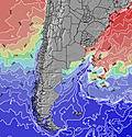
11.1°COverall La Isla Surf Consistency and Wind Distribution in julio
Fotos de Surf
de la galeríaContornos: Carreteras y Ríos: Selecciona un spot desde el menú 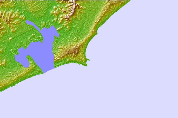
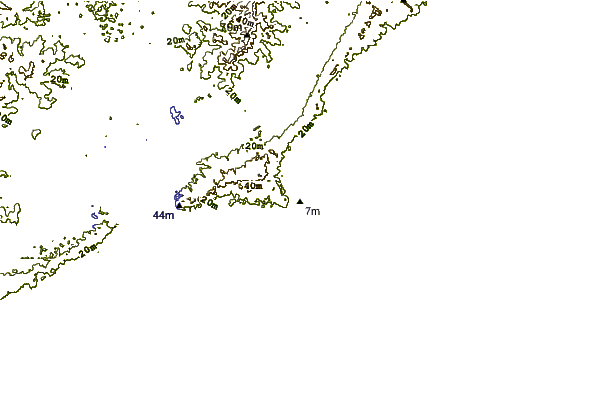
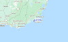
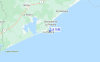
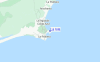
Usa este mapa para navegar hacia las playas de surf de North y estaciones de marea cercanas de La Isla
Spots de Surf más cercanos a La Isla:
(Clica la ubicación para más detalles)- Closest spot0 mi
- Second closest spot1 mi
- Third closest spot1 mi
- Fourth closest spot1 mi
- Fifth closest spot1 mi
Boyas marinas más cercanas a La Isla:
- Closest Boya Marinas329 mi
- Second closest Boya Marinas2163 mi
- Third closest Boya Marinas3397 mi
- Fourth closest Boya Marinas3408 mi
- Fifth closest Boya Marinas3430 mi
Estaciones de marea más cercanas a La Isla:
- Closest estación de mareaMaldonado49 mi
- Second closest estación de mareaPunta del Este50 mi
- Third closest estación de mareaPiriapolis66 mi
- Fourth closest estación de mareaPaso de Carrasco109 mi
- Fifth closest estación de mareaMontevideo119 mi
Airports
- The closest passenger airport to La Isla is El Jaguel International (Punta Del Este) Airport (PDP) in Uruguay, which is 77 km (48 miles) away (directly).
- The second nearest airport to La Isla is Carrasco International (Montevideo) Airport (MVD), also in Uruguay, 174 km (108 miles) away.
- The third closest airport is Angel S Adami (Montevideo) Airport (MVD), also in Uruguay, 194 km (120 miles) away.
- /breaks/La-Isla_2/forecasts/latest


 Nearest