
Previsiones:

Pronóstico Corto PlazoMayormente seco. Very mild (max 14°C el martes por la mañana, min 9°C el miércoles por la noche). Vientos crecientes (Vientos ligeros desde el ESE el miércoles por la noche, vientos frescos desde el NE por la noche de jueves). | ||||||||||||||||||||||
martes 28 | miércoles 29 | jueves 30 | ||||||||||||||||||||
6 AM | 9 AM | 12 PM | 3 PM | 6 PM | 9 PM | 12 AM | 3 AM | 6 AM | 9 AM | 12 PM | 3 PM | 6 PM | 9 PM | 12 AM | 3 AM | 6 AM | 9 AM | 12 PM | 3 PM | 6 PM | 9 PM | |
Mapa de Altura de Olas |  | 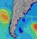 | 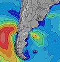 | 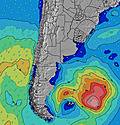 |  | 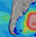 | 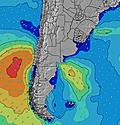 | 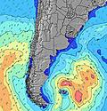 | ||||||||||||||
Oleaje Altura (m) Dirección Período (s) | SSE 11 | S 10 | S 10 | S 9 | S 9 | S 8 | SSE 10 | SSE 9 | SSE 9 | SSE 4 | SSE 5 | SSE 5 | SSE 8 | SSE 8 | SSE 8 | SSE 8 | SSE 13 | SSE 13 | SSE 12 | SSE 12 | SSE 11 | SSE 11 |
Gráfico Olas | ||||||||||||||||||||||
37 | 49 | 46 | 42 | 26 | 13 | 31 | 28 | 28 | 21 | 24 | 25 | 87 | 63 | 58 | 58 | 63 | 64 | 155 | 145 | 133 | 93 | |
Viento (km/h) | ||||||||||||||||||||||
Estado del Viento Viento de Mar Viento de Mar-Cruzado Cruzado Viento de Tierra-Cruzado Viento de Tierra Cristalino | cross-off | cross-off | cross | cross-on | cross-on | cross-on | cross-on | cross-on | cross-on | cross-on | cross-on | cross-on | cross-on | on | cross-on | on | on | cross-on | cross-on | cross-on | cross-on | cross-on |
Marea alta | 6:13AM0.22m | 12:41PM0.25m | 6:17PM0.38m | 11:45PM0.19m | 6:57AM0.22m | 1:18PM0.25m | 7:03PM0.39m | 00:35AM0.20m | 7:39AM0.23m | 1:53PM0.25m | 7:47PM0.38m | |||||||||||
Marea baja | 9:07AM0.14m | 2:30PM0.23m | 10:35PM0.18m | 3:24AM0.07m | 9:52AM0.13m | 3:20PM0.22m | 11:08PM0.18m | 4:08AM0.07m | 10:36AM0.13m | 4:08PM0.21m | ||||||||||||
7:33 | — | — | — | — | — | — | — | 7:33 | — | — | — | — | — | — | — | 7:31 | — | — | — | — | — | |
— | — | — | 5:52 | — | — | — | — | — | — | — | 5:52 | — | — | — | — | — | — | — | 5:53 | — | — | |
mm | — | — | — | — | — | — | — | — | — | — | — | — | — | — | — | — | — | — | — | — | — | — |
Temp. °C | 14 | 14 | 14 | 12 | 10 | 10 | 10 | 10 | 10 | 10 | 10 | 10 | 10 | 9 | 9 | 9 | 10 | 10 | 12 | 13 | 12 | 12 |
Enfriamiento °C | 13 | 13 | 12 | 10 | 8 | 8 | 6 | 7 | 7 | 7 | 6 | 6 | 7 | 7 | 7 | 6 | 7 | 7 | 8 | 8 | 7 | 7 |
Oleaje 1 Altura (m) Dirección Período (s) | E 8 | E 8 | E 8 | E 8 | E 8 | E 8 | E 8 | E 8 | E 8 | E 8 | SSE 8 | SSE 8 | SSE 8 | SSE 8 | SSE 8 | SSE 8 | SSE 7 | SSE 7 | SSE 12 | SSE 12 | SSE 11 | SSE 11 |
43 | 30 | 30 | 31 | 30 | 29 | 28 | 18 | 18 | 18 | 24 | 23 | 87 | 63 | 58 | 58 | 42 | 47 | 155 | 145 | 133 | 93 | |
Oleaje 2 Altura (m) Dirección Período (s) | SSE 11 | S 10 | S 10 | S 9 | S 9 | S 4 | SSE 10 | SSE 9 | SSE 9 | SSE 9 | E 8 | E 8 | E 8 | E 8 | SSE 14 | SSE 13 | SSE 13 | SSE 13 | SSE 12 | SSW 7 | SE 8 | E 8 |
37 | 49 | 46 | 42 | 25 | 9 | 31 | 28 | 28 | 16 | 18 | 10 | 10 | 11 | 36 | 35 | 63 | 64 | 86 | 5 | 2 | 5 | |
Oleaje 3 Altura (m) Dirección Período (s) | S 5 | — | SE 13 | SSE 12 | SSE 12 | S 8 | SSE 10 | SE 12 | SSE 12 | SSE 12 | S 12 | S 16 | S 10 | SSE 14 | E 8 | E 8 | E 8 | E 8 | SSE 8 | — | SE 8 | S 8 |
2 | — | 7 | 14 | 26 | 12 | 21 | 6 | 14 | 13 | 3 | 5 | 8 | 20 | 11 | 11 | 5 | 5 | 6 | — | 2 | 1 | |
Olas de Viento Altura (m) Dirección Período (s) | — | SSW 2 | SSW 3 | S 3 | S 4 | S 4 | S 4 | SSE 4 | SSE 5 | SSE 4 | SSE 5 | SSE 5 | — | — | — | — | — | NE 7 | E 3 | ENE 4 | ENE 4 | ENE 4 |
— | 1 | 1 | 2 | 5 | 13 | 13 | 19 | 22 | 21 | 22 | 25 | — | — | — | — | — | 2 | 8 | 19 | 31 | 42 | |
Viento del Tierra o Mar Limpio más proximo | ||||||||||||||||||||||
Distancia (km) | 1 | 1 | 1 | 581 | 486 | 485 | 485 | 486 | 472 | 472 | 472 | 472 | 602 | 37 | 86 | 8 | 37 | 37 | 37 | 37 | 79 | 82 |
Mejores Olas Previstas en Uruguay - North | ||||||||||||||||||||||
Mejores Olas Previstas en Uruguay | ||||||||||||||||||||||
Busca-Olas Global | ||||||||||||||||||||||
- Map Icons:
 Break
Break Live Wave Height (m)
 Live Wind Speed (km/h)
 Surf Rating (10 Max)
 Ocean Swells (m)
- Wind Speed (km/h)
GRÁTIS! Un widget de Surf-Forecast.com para tu sitio
Este widget grátis de previsiones de surf y tiempo puede ser añadido a cualquier otro sitio y da un resumen de previsiones de olas para La Derecha del Medio. Solo necesita cortar y pegar el código HTML de abajo en su web. Puede elegir preferencias de idioma y de unidades (métricas o imperiales) para convenir a los usuarios de su sitio. Clica aquí para obtener el código.
 Nearest