
Previsiones:

Pronóstico Corto PlazoMayormente seco. Warm (max 29°C el martes por la tarde, min 17°C el martes por la mañana). El viento será generalmente ligero. | |||||||||||||||||||||||
martes 28 | miércoles 29 | jueves 30 | |||||||||||||||||||||
5 AM | 8 AM | 11 AM | 2 PM | 5 PM | 8 PM | 11 PM | 2 AM | 5 AM | 8 AM | 11 AM | 2 PM | 5 PM | 8 PM | 11 PM | 2 AM | 5 AM | 8 AM | 11 AM | 2 PM | 5 PM | 8 PM | 11 PM | |
Mapa de Altura de Olas |  |  |  |  | 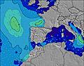 |  |  | 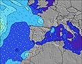 |  | ||||||||||||||
Oleaje Altura (m) Dirección Período (s) | NNW 10 | NNW 10 | NNW 10 | NNW 10 | NNW 10 | NNW 10 | NNW 10 | NNW 10 | NNW 9 | NW 9 | NW 9 | NW 9 | NW 9 | NW 9 | NW 9 | NW 9 | NW 8 | NW 8 | NW 8 | NW 8 | NW 9 | NW 9 | NW 8 |
Gráfico Olas | |||||||||||||||||||||||
394 | 401 | 347 | 360 | 267 | 240 | 200 | 161 | 151 | 123 | 120 | 97 | 95 | 76 | 74 | 59 | 45 | 44 | 82 | 69 | 74 | 73 | 84 | |
Viento (km/h) | |||||||||||||||||||||||
Estado del Viento Viento de Mar Viento de Mar-Cruzado Cruzado Viento de Tierra-Cruzado Viento de Tierra Cristalino | off | off | cross-off | cross | cross-on | glassy | off | glassy | cross | cross-off | cross-on | on | on | cross-on | cross-on | cross | cross | glassy | on | on | cross-on | on | on |
Marea alta | 4:48AM3.09m | 5:03PM3.36m | 5:23AM3.22m | 5:37PM3.51m | 5:57AM3.33m | 6:10PM3.62m | |||||||||||||||||
Marea baja | 10:43AM0.74m | 11:10PM0.59m | 11:19AM0.58m | 11:46PM0.45m | 11:53AM0.46m | ||||||||||||||||||
6:56 | — | — | — | — | — | — | — | 6:58 | — | — | — | — | — | — | — | 6:58 | — | — | — | — | — | — | |
— | — | — | — | — | 9:38 | — | — | — | — | — | — | — | 9:37 | — | — | — | — | — | — | — | 9:37 | — | |
mm | — | — | — | — | — | — | — | — | — | — | — | — | — | — | — | — | — | — | — | — | — | — | — |
Temp. °C | 16 | 17 | 25 | 29 | 29 | 27 | 24 | 23 | 21 | 20 | 25 | 26 | 24 | 23 | 19 | 19 | 18 | 18 | 21 | 24 | 23 | 21 | 20 |
Enfriamiento °C | 16 | 17 | 25 | 28 | 30 | 28 | 24 | 23 | 22 | 20 | 26 | 27 | 24 | 24 | 20 | 21 | 19 | 19 | 22 | 25 | 23 | 22 | 21 |
Oleaje 1 Altura (m) Dirección Período (s) | NNW 10 | NNW 10 | NNW 10 | NNW 10 | NNW 10 | NNW 10 | NNW 10 | NNW 10 | NNW 9 | NW 9 | NW 9 | NW 9 | NW 9 | NW 9 | NW 9 | NW 9 | NW 5 | NW 8 | NW 8 | NW 8 | NW 9 | NW 9 | NW 8 |
394 | 401 | 347 | 360 | 267 | 240 | 200 | 161 | 151 | 123 | 120 | 97 | 95 | 76 | 74 | 59 | 23 | 44 | 82 | 69 | 74 | 73 | 84 | |
Oleaje 2 Altura (m) Dirección Período (s) | — | — | — | — | — | — | — | — | — | — | — | — | — | — | — | — | NW 8 | WNW 5 | NW 5 | — | — | — | — |
— | — | — | — | — | — | — | — | — | — | — | — | — | — | — | — | 45 | 15 | 12 | — | — | — | — | |
Oleaje 3 Altura (m) Dirección Período (s) | — | — | — | — | — | — | — | — | — | — | — | — | — | — | — | — | — | — | — | — | — | — | — |
— | — | — | — | — | — | — | — | — | — | — | — | — | — | — | — | — | — | — | — | — | — | — | |
Olas de Viento Altura (m) Dirección Período (s) | — | — | — | — | NE 3 | — | — | — | — | WSW 2 | — | NW 3 | NW 3 | NW 3 | NW 4 | NW 4 | — | — | — | — | — | — | — |
— | — | — | — | 4 | — | — | — | — | 1 | — | 2 | 5 | 6 | 15 | 20 | — | — | — | — | — | — | — | |
Viento del Tierra o Mar Limpio más proximo | |||||||||||||||||||||||
Distancia (km) | 0 | 0 | 0 | 13 | 13 | 0 | 0 | 0 | 9 | 0 | 17 | 500 | 75 | 75 | 17 | 9 | 9 | 0 | 75 | 76 | 36 | 36 | 44 |
Mejores Olas Previstas en Pais Vasco | |||||||||||||||||||||||
Mejores Olas Previstas en Spain (Europe) | |||||||||||||||||||||||
Busca-Olas Global | |||||||||||||||||||||||
- Map Icons:
 Break
Break Live Wave Height (m)
 Live Wind Speed (km/h)
 Surf Rating (10 Max)
 Ocean Swells (m)
- Wind Speed (km/h)
GRÁTIS! Un widget de Surf-Forecast.com para tu sitio
Este widget grátis de previsiones de surf y tiempo puede ser añadido a cualquier otro sitio y da un resumen de previsiones de olas para La Arena. Solo necesita cortar y pegar el código HTML de abajo en su web. Puede elegir preferencias de idioma y de unidades (métricas o imperiales) para convenir a los usuarios de su sitio. Clica aquí para obtener el código.
 Nearest