
Previsiones:

Pronóstico Corto PlazoLluvia moderada (totál 18mm), más pesada el lunes por la tarde. Warm (max 28°C el lunes por la mañana, min 26°C el miércoles por la noche). El viento será generalmente ligero. | ||||||||||||||||||||||
lunes 3 | martes 4 | miércoles 5 | ||||||||||||||||||||
8 AM | 11 AM | 2 PM | 5 PM | 8 PM | 11 PM | 2 AM | 5 AM | 8 AM | 11 AM | 2 PM | 5 PM | 8 PM | 11 PM | 2 AM | 5 AM | 8 AM | 11 AM | 2 PM | 5 PM | 8 PM | 11 PM | |
Mapa de Altura de Olas |  | 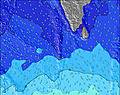 | 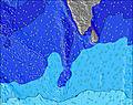 | 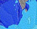 | 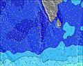 |  | 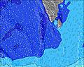 | 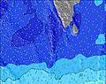 | ||||||||||||||
Oleaje Altura (m) Dirección Período (s) | SW 16 | SW 16 | SW 16 | SSW 16 | SSW 16 | SSW 16 | SSW 15 | SSW 15 | SSW 15 | SSW 15 | SSW 15 | SSW 15 | SSW 15 | SW 15 | SW 15 | SW 15 | S 19 | SSW 18 | S 18 | S 18 | SSW 17 | SSW 16 |
Gráfico Olas | ||||||||||||||||||||||
558 | 565 | 565 | 798 | 674 | 666 | 730 | 702 | 693 | 683 | 674 | 576 | 576 | 496 | 503 | 447 | 465 | 897 | 448 | 498 | 776 | 705 | |
Viento (km/h) | ||||||||||||||||||||||
Estado del Viento Viento de Mar Viento de Mar-Cruzado Cruzado Viento de Tierra-Cruzado Viento de Tierra Cristalino | cross | cross-off | cross-off | cross-off | cross-off | cross-off | cross-off | off | cross-off | off | off | off | cross-off | cross-off | cross-off | cross-off | cross-off | cross-off | cross-off | cross-off | cross-off | cross-off |
Marea alta | 4:01PM1.01m | 4:36AM0.91m | 4:25PM0.94m | 5:19AM0.86m | 4:50PM0.86m | |||||||||||||||||
Marea baja | 9:50AM0.23m | 10:21PM0.15m | 10:23AM0.31m | 10:53PM0.15m | 11:00AM0.39m | |||||||||||||||||
6:07 | — | — | — | — | — | — | 6:07 | — | — | — | — | — | — | — | 6:07 | — | — | — | — | — | — | |
— | — | — | 6:16 | — | — | — | — | — | — | — | 6:15 | — | — | — | — | — | — | — | 6:15 | — | — | |
mm | — | — | 1 | 2 | 1 | 1 | 2 | — | — | — | — | — | — | — | 1 | 2 | 1 | 2 | 2 | 1 | — | 1 |
Temp. °C | 28 | 28 | 28 | 28 | 27 | 27 | 27 | 27 | 27 | 27 | 28 | 28 | 28 | 28 | 27 | 27 | 27 | 27 | 27 | 27 | 27 | 27 |
Enfriamiento °C | 31 | 31 | 31 | 31 | 30 | 31 | 30 | 30 | 30 | 30 | 31 | 31 | 30 | 31 | 29 | 29 | 30 | 30 | 29 | 28 | 29 | 29 |
Oleaje 1 Altura (m) Dirección Período (s) | SSE 8 | SSE 8 | SSE 8 | SSW 16 | SSW 16 | SSW 16 | SSW 15 | SSW 15 | SSW 15 | SSW 15 | SSW 15 | SSW 15 | SSW 15 | SW 15 | SW 15 | S 10 | S 10 | SSE 10 | SSE 9 | S 9 | S 9 | S 9 |
217 | 212 | 192 | 798 | 674 | 666 | 730 | 702 | 693 | 683 | 674 | 576 | 576 | 496 | 503 | 223 | 277 | 370 | 340 | 380 | 372 | 430 | |
Oleaje 2 Altura (m) Dirección Período (s) | SW 16 | SW 16 | SW 16 | SSE 8 | SSE 8 | SSE 8 | WNW 8 | WNW 8 | WNW 8 | WNW 8 | WNW 8 | S 8 | S 9 | S 9 | S 9 | SW 15 | SW 15 | SSW 18 | SW 16 | S 18 | SSW 17 | SSW 16 |
558 | 565 | 565 | 192 | 149 | 149 | 120 | 86 | 84 | 82 | 80 | 74 | 127 | 122 | 162 | 447 | 459 | 897 | 448 | 498 | 776 | 705 | |
Oleaje 3 Altura (m) Dirección Período (s) | NW 9 | WNW 9 | WNW 9 | WNW 9 | WNW 9 | WNW 8 | S 8 | S 8 | S 8 | S 8 | S 8 | NW 8 | NW 8 | NW 8 | NW 8 | S 20 | S 19 | NW 8 | S 18 | SW 17 | NW 8 | NW 8 |
173 | 145 | 138 | 135 | 129 | 120 | 72 | 72 | 72 | 55 | 74 | 65 | 62 | 60 | 59 | 365 | 465 | 45 | 398 | 429 | 46 | 45 | |
Olas de Viento Altura (m) Dirección Período (s) | — | — | — | — | — | — | — | — | — | — | — | — | — | — | — | — | — | — | — | — | — | — |
— | — | — | — | — | — | — | — | — | — | — | — | — | — | — | — | — | — | — | — | — | — | |
Viento del Tierra o Mar Limpio más proximo | ||||||||||||||||||||||
Distancia (km) | 118 | 0 | 0 | 0 | 0 | 0 | 0 | 0 | 0 | 0 | 0 | 0 | 0 | 0 | 0 | 0 | 0 | 0 | 144 | 144 | 144 | 1154 |
Mejores Olas Previstas en Huvadhoo Atoll | ||||||||||||||||||||||
Mejores Olas Previstas en Maldives | ||||||||||||||||||||||
Busca-Olas Global | ||||||||||||||||||||||
- Map Icons:
 Break
Break Live Wave Height (m)
 Live Wind Speed (km/h)
 Surf Rating (10 Max)
 Ocean Swells (m)
- Wind Speed (km/h)
GRÁTIS! Un widget de Surf-Forecast.com para tu sitio
Este widget grátis de previsiones de surf y tiempo puede ser añadido a cualquier otro sitio y da un resumen de previsiones de olas para Koodhoo. Solo necesita cortar y pegar el código HTML de abajo en su web. Puede elegir preferencias de idioma y de unidades (métricas o imperiales) para convenir a los usuarios de su sitio. Clica aquí para obtener el código.
 Nearest