
Previsiones:

Pronóstico Corto PlazoLluvia moderada (totál 13mm), más pesada el lunes por la tarde. Warm (max 27°C el lunes por la noche, min 23°C el lunes por la noche). El viento será generalmente ligero. | ||||||||||||||||||||||||
lunes 3 | martes 4 | miércoles 5 | ||||||||||||||||||||||
2 AM | 5 AM | 8 AM | 11 AM | 2 PM | 5 PM | 8 PM | 11 PM | 2 AM | 5 AM | 8 AM | 11 AM | 2 PM | 5 PM | 8 PM | 11 PM | 2 AM | 5 AM | 8 AM | 11 AM | 2 PM | 5 PM | 8 PM | 11 PM | |
Mapa de Altura de Olas | 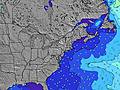 | 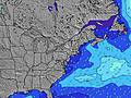 |  | 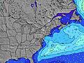 | 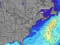 |  | 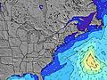 |  |  | |||||||||||||||
Oleaje Altura (m) Dirección Período (s) | E 6 | SSE 8 | SSE 8 | SSE 8 | SSE 8 | S 8 | SSE 8 | SSE 8 | NE 3 | NE 4 | E 4 | E 5 | SE 7 | ESE 7 | ESE 7 | ESE 7 | SE 7 | SE 7 | SE 7 | ESE 6 | SE 7 | SE 7 | SE 7 | E 10 |
Gráfico Olas | ||||||||||||||||||||||||
1 | 0 | 0 | 0 | 0 | 0 | 0 | 0 | 3 | 6 | 17 | 20 | 42 | 62 | 84 | 47 | 60 | 62 | 59 | 35 | 37 | 22 | 16 | 2 | |
Viento (km/h) | ||||||||||||||||||||||||
Estado del Viento Viento de Mar Viento de Mar-Cruzado Cruzado Viento de Tierra-Cruzado Viento de Tierra Cristalino | cross | cross | cross | cross | cross | cross | cross | cross-off | cross | cross | cross-on | cross | cross | cross | cross | cross | cross-on | cross | cross-on | on | cross | cross | cross | cross |
Marea alta | 11:45PM1.20m | 12:17PM1.16m | 00:29AM1.14m | 1:03PM1.20m | 1:18AM1.08m | 1:53PM1.23m | ||||||||||||||||||
Marea baja | 6:02AM0.08m | 6:24PM0.19m | 6:45AM0.09m | 7:22PM0.21m | 7:31AM0.10m | 8:23PM0.22m | ||||||||||||||||||
— | 5:58 | — | — | — | — | — | — | — | 5:58 | — | — | — | — | — | — | — | 6:00 | — | — | — | — | — | — | |
— | — | — | — | — | — | 8:07 | — | — | — | — | — | — | — | 8:06 | — | — | — | — | — | — | — | 8:05 | — | |
mm | 2 | 2 | 3 | 2 | 4 | 1 | 1 | — | — | — | — | — | — | — | — | — | — | — | — | 1 | — | 1 | — | — |
Temp. °C | 25 | 24 | 24 | 24 | 24 | 26 | 27 | 25 | 24 | 23 | 23 | 24 | 24 | 24 | 23 | 23 | 23 | 23 | 23 | 23 | 25 | 26 | 26 | 26 |
Enfriamiento °C | 25 | 24 | 24 | 24 | 26 | 28 | 29 | 26 | 23 | 22 | 21 | 22 | 21 | 22 | 22 | 24 | 26 | 26 | 25 | 26 | 28 | 29 | 28 | 28 |
Oleaje 1 Altura (m) Dirección Período (s) | E 6 | — | — | SSE 8 | SSE 8 | SSE 8 | SSE 8 | SSE 8 | SSE 8 | SSE 8 | SSE 7 | SSE 7 | SE 7 | SSE 7 | ESE 7 | ESE 7 | SE 7 | SE 7 | SE 7 | SE 7 | SSE 7 | SE 7 | SE 7 | — |
1 | — | — | 275 | 239 | 239 | 228 | 176 | 116 | 88 | 62 | 46 | 50 | 18 | 47 | 47 | 60 | 62 | 59 | 47 | 15 | 22 | 16 | — | |
Oleaje 2 Altura (m) Dirección Período (s) | — | — | — | — | — | — | — | — | — | — | — | — | SE 7 | S 7 | S 7 | SSE 7 | — | — | ESE 7 | ESE 6 | SE 7 | S 6 | E 4 | E 10 |
— | — | — | — | — | — | — | — | — | — | — | — | 42 | 47 | 28 | 16 | — | — | 40 | 35 | 37 | 12 | 1 | 2 | |
Oleaje 3 Altura (m) Dirección Período (s) | — | — | — | — | — | — | — | — | — | — | — | — | — | E 8 | — | E 9 | — | E 9 | E 12 | E 11 | E 10 | — | E 10 | — |
— | — | — | — | — | — | — | — | — | — | — | — | — | 1 | — | 2 | — | 2 | 3 | 2 | 2 | — | 2 | — | |
Olas de Viento Altura (m) Dirección Período (s) | SSE 6 | SSE 8 | SSE 8 | — | — | S 8 | — | — | NE 3 | NE 4 | E 4 | E 5 | ENE 4 | ESE 7 | ESE 7 | — | — | — | — | — | — | S 6 | S 6 | SSE 6 |
130 | 344 | 299 | — | — | 737 | — | — | 3 | 6 | 17 | 20 | 15 | 62 | 84 | — | — | — | — | — | — | 39 | 12 | 39 | |
Viento del Tierra o Mar Limpio más proximo | ||||||||||||||||||||||||
Distancia (km) | 1011 | 1057 | 1011 | 117 | 39 | 24 | 14 | 2 | 58 | 136 | 118 | 159 | 279 | 304 | 159 | 139 | 18 | 18 | 73 | 38 | 27 | 23 | 34 | 34 |
Mejores Olas Previstas en New Jersey | ||||||||||||||||||||||||
Mejores Olas Previstas en United States | ||||||||||||||||||||||||
Busca-Olas Global | ||||||||||||||||||||||||
- Map Icons:
 Break
Break Live Wave Height (m)
 Live Wind Speed (km/h)
 Surf Rating (10 Max)
 Ocean Swells (m)
- Wind Speed (km/h)
GRÁTIS! Un widget de Surf-Forecast.com para tu sitio
Este widget grátis de previsiones de surf y tiempo puede ser añadido a cualquier otro sitio y da un resumen de previsiones de olas para Kirbys Point. Solo necesita cortar y pegar el código HTML de abajo en su web. Puede elegir preferencias de idioma y de unidades (métricas o imperiales) para convenir a los usuarios de su sitio. Clica aquí para obtener el código.
 Nearest