
Previsiones:

Pronóstico Corto PlazoMayormente seco. Warm (max 27°C el viernes por la tarde, min 19°C el viernes por la noche). Mayormente vientos frescos. | ||||||||||||||||||
jue 23 | viernes 24 | sábado 25 | ||||||||||||||||
6 PM | 9 PM | 12 AM | 3 AM | 6 AM | 9 AM | 12 PM | 3 PM | 6 PM | 9 PM | 12 AM | 3 AM | 6 AM | 9 AM | 12 PM | 3 PM | 6 PM | 9 PM | |
Mapa de Altura de Olas | 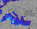 | 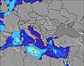 | 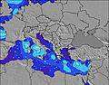 | 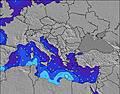 | 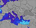 | 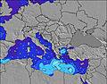 | 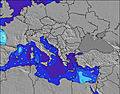 | |||||||||||
Oleaje Altura (m) Dirección Período (s) | NW 5 | NW 4 | WNW 4 | NW 4 | WNW 4 | SW 5 | SW 5 | SW 5 | NW 4 | NW 6 | NW 7 | WNW 7 | WNW 7 | WNW 6 | WNW 5 | WNW 6 | NW 3 | NW 4 |
Gráfico Olas | ||||||||||||||||||
41 | 29 | 12 | 12 | 2 | 1 | 1 | 1 | 31 | 0 | 0 | 0 | 0 | 0 | 9 | 23 | 12 | 24 | |
Viento (km/h) | ||||||||||||||||||
Estado del Viento Viento de Mar Viento de Mar-Cruzado Cruzado Viento de Tierra-Cruzado Viento de Tierra Cristalino | cross-on | cross-on | cross | off | off | glassy | cross-on | on | cross-on | cross-on | cross-off | cross-off | cross-off | cross-off | on | on | cross-on | cross-on |
Marea alta | 2:19AM0.09m | 2:06PM0.14m | 3:16AM0.10m | 2:52PM0.15m | ||||||||||||||
Marea baja | 8:29PM0.06m | 7:12AM0.07m | 9:17PM0.05m | 8:19AM0.07m | ||||||||||||||
— | — | — | — | 6:30 | — | — | — | — | — | — | — | 6:31 | — | — | — | — | — | |
8:58 | — | — | — | — | — | — | — | 8:57 | — | — | — | — | — | — | — | 8:57 | — | |
mm | — | — | — | — | — | — | — | — | — | — | — | — | — | — | — | — | — | — |
Temp. °C | 28 | 26 | 24 | 22 | 22 | 24 | 26 | 26 | 27 | 24 | 22 | 20 | 19 | 22 | 25 | 26 | 26 | 25 |
Enfriamiento °C | 23 | 24 | 24 | 21 | 22 | 25 | 25 | 23 | 22 | 19 | 20 | 18 | 17 | 21 | 22 | 23 | 23 | 23 |
Oleaje 1 Altura (m) Dirección Período (s) | SW 5 | SW 5 | SW 4 | WNW 4 | WNW 4 | WNW 3 | WNW 4 | SW 5 | SW 4 | — | NW 7 | WNW 7 | WNW 7 | WNW 6 | W 7 | — | — | — |
1 | 1 | 1 | 6 | 2 | 1 | 1 | 1 | 1 | — | 198 | 83 | 42 | 12 | 1 | — | — | — | |
Oleaje 2 Altura (m) Dirección Período (s) | — | — | W 6 | SW 6 | SW 6 | SW 5 | SW 5 | — | — | — | — | — | — | — | ENE 3 | — | — | — |
— | — | 1 | 1 | 1 | 1 | 1 | — | — | — | — | — | — | — | 1 | — | — | — | |
Oleaje 3 Altura (m) Dirección Período (s) | — | — | — | W 6 | — | — | — | — | — | — | — | — | — | — | — | — | — | — |
— | — | — | 1 | — | — | — | — | — | — | — | — | — | — | — | — | — | — | |
Olas de Viento Altura (m) Dirección Período (s) | NW 5 | NW 4 | WNW 4 | NW 4 | — | — | — | — | NW 4 | NW 6 | NW 7 | NE 3 | ENE 3 | ENE 3 | WNW 5 | WNW 6 | NW 3 | NW 4 |
41 | 29 | 12 | 12 | — | — | — | — | 31 | 320 | 447 | 2 | 1 | 2 | 9 | 23 | 12 | 24 | |
Viento del Tierra o Mar Limpio más proximo | ||||||||||||||||||
Distancia (km) | 2094 | 496 | 573 | 1482 | 496 | 808 | 2311 | 649 | 1967 | 3 | 3 | 3 | 238 | 2437 | 547 | 547 | 511 | |
Mejores Olas Previstas en Ionian Sea | ||||||||||||||||||
Mejores Olas Previstas en Greece | ||||||||||||||||||
Busca-Olas Global | ||||||||||||||||||
- Map Icons:
 Break
Break Live Wave Height (m)
 Live Wind Speed (km/h)
 Surf Rating (10 Max)
 Ocean Swells (m)
- Wind Speed (km/h)
GRÁTIS! Un widget de Surf-Forecast.com para tu sitio
Este widget grátis de previsiones de surf y tiempo puede ser añadido a cualquier otro sitio y da un resumen de previsiones de olas para Kerentza. Solo necesita cortar y pegar el código HTML de abajo en su web. Puede elegir preferencias de idioma y de unidades (métricas o imperiales) para convenir a los usuarios de su sitio. Clica aquí para obtener el código.
 Nearest