
Previsiones:

Pronóstico Corto PlazoMayormente seco. Warm (max 34°C el jueves por la tarde, min 27°C el viernes por la noche). Vientos decreciente (vientos frescos desde el OSO el jueves por la tarde, calma por la noche de viernes). | ||||||||||||||||||||
jue 30 | viernes 31 | sábado 1 | ||||||||||||||||||
12 PM | 3 PM | 6 PM | 9 PM | 12 AM | 3 AM | 6 AM | 9 AM | 12 PM | 3 PM | 6 PM | 9 PM | 12 AM | 3 AM | 6 AM | 9 AM | 12 PM | 3 PM | 6 PM | 9 PM | |
Mapa de Altura de Olas |  |  |  | 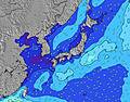 |  |  | 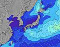 |  | ||||||||||||
Oleaje Altura (m) Dirección Período (s) | SE 10 | SE 10 | ESE 10 | SE 10 | SW 6 | ESE 9 | ESE 9 | SE 9 | SE 9 | SW 6 | SW 6 | ESE 9 | SW 5 | ESE 9 | SE 9 | ESE 15 | E 11 | SE 17 | SE 16 | SE 16 |
Gráfico Olas | ||||||||||||||||||||
14 | 15 | 9 | 15 | 100 | 17 | 17 | 22 | 22 | 69 | 67 | 17 | 60 | 8 | 12 | 22 | 22 | 47 | 125 | 125 | |
Viento (km/h) | ||||||||||||||||||||
Estado del Viento Viento de Mar Viento de Mar-Cruzado Cruzado Viento de Tierra-Cruzado Viento de Tierra Cristalino | cross-off | cross-off | cross-off | cross-off | cross-off | glassy | glassy | glassy | cross-on | cross-on | cross | glassy | cross | cross-off | glassy | cross-on | cross-on | cross-on | cross-on | glassy |
Marea alta | 6:40PM1.67m | 5:56AM1.68m | 7:05PM1.70m | 6:37AM1.67m | 7:32PM1.72m | |||||||||||||||
Marea baja | 12:06PM0.25m | 00:26AM0.86m | 12:36PM0.29m | 1:00AM0.78m | 1:07PM0.36m | |||||||||||||||
— | — | — | — | — | 4:54 | — | — | — | — | — | — | — | 4:56 | — | — | — | — | — | — | |
— | — | 6:51 | — | — | — | — | — | — | — | 6:51 | — | — | — | — | — | — | — | 6:50 | — | |
mm | — | — | — | — | — | — | — | — | — | — | — | — | — | — | — | — | — | — | — | — |
Temp. °C | 34 | 34 | 32 | 31 | 29 | 28 | 28 | 29 | 31 | 32 | 30 | 29 | 28 | 27 | 27 | 29 | 30 | 30 | 30 | 29 |
Enfriamiento °C | 33 | 32 | 31 | 34 | 33 | 32 | 32 | 33 | 34 | 34 | 34 | 34 | 32 | 31 | 31 | 32 | 32 | 32 | 33 | 33 |
Oleaje 1 Altura (m) Dirección Período (s) | SE 10 | SE 10 | ESE 10 | SE 10 | SE 10 | SW 6 | SW 6 | SW 6 | SW 6 | SE 9 | ESE 9 | SW 5 | SW 5 | SW 5 | SSW 6 | SW 6 | SW 6 | E 11 | SSW 5 | SSW 5 |
14 | 15 | 9 | 14 | 14 | 67 | 65 | 72 | 62 | 22 | 17 | 55 | 39 | 42 | 43 | 35 | 34 | 21 | 19 | 18 | |
Oleaje 2 Altura (m) Dirección Período (s) | SE 12 | SE 12 | SE 12 | ESE 12 | ESE 12 | ESE 9 | ESE 9 | SE 9 | SE 9 | SE 11 | E 12 | ESE 9 | SSW 7 | SSW 7 | SE 9 | E 11 | E 11 | SE 17 | SE 16 | SE 16 |
6 | 6 | 6 | 15 | 15 | 17 | 17 | 22 | 22 | 5 | 3 | 17 | 9 | 9 | 12 | 9 | 21 | 47 | 125 | 125 | |
Oleaje 3 Altura (m) Dirección Período (s) | E 9 | E 9 | E 9 | E 9 | E 9 | SE 12 | SE 13 | E 12 | SE 11 | E 13 | SE 11 | SE 11 | ESE 9 | ESE 9 | E 11 | ESE 15 | ESE 15 | ESE 9 | E 11 | ESE 11 |
6 | 6 | 2 | 2 | 1 | 6 | 7 | 3 | 5 | 3 | 5 | 5 | 8 | 8 | 9 | 22 | 22 | 8 | 20 | 23 | |
Olas de Viento Altura (m) Dirección Período (s) | WSW 5 | SW 5 | SW 5 | SW 6 | SW 6 | WNW 4 | NW 4 | WSW 6 | SW 6 | SW 6 | SW 6 | — | SW 5 | — | — | ENE 2 | — | SSW 6 | — | — |
100 | 134 | 126 | 136 | 100 | 21 | 19 | 96 | 85 | 69 | 67 | — | 60 | — | — | 1 | — | 28 | — | — | |
Viento del Tierra o Mar Limpio más proximo | ||||||||||||||||||||
Distancia (km) | 208 | 208 | 103 | 2 | 2 | 2 | 2 | 104 | 104 | 65 | 208 | 13 | 13 | 104 | 13 | 161 | 104 | 65 | 65 | 2 |
Mejores Olas Previstas en Shizuoka | ||||||||||||||||||||
Mejores Olas Previstas en Japan | ||||||||||||||||||||
Busca-Olas Global | ||||||||||||||||||||
- Map Icons:
 Break
Break Live Wave Height (m)
 Live Wind Speed (km/h)
 Surf Rating (10 Max)
 Ocean Swells (m)
- Wind Speed (km/h)
GRÁTIS! Un widget de Surf-Forecast.com para tu sitio
Este widget grátis de previsiones de surf y tiempo puede ser añadido a cualquier otro sitio y da un resumen de previsiones de olas para Katahama. Solo necesita cortar y pegar el código HTML de abajo en su web. Puede elegir preferencias de idioma y de unidades (métricas o imperiales) para convenir a los usuarios de su sitio. Clica aquí para obtener el código.
 Nearest