
Previsiones:

Pronóstico Corto PlazoLluvia moderada (totál 11mm), más pesada el miércoles por la mañana. Warm (max 24°C el martes por la mañana, min 17°C el jueves por la noche). El viento será generalmente ligero. | |||||||||||||||||||||||
martes 28 | miércoles 29 | jueves 30 | |||||||||||||||||||||
5 AM | 8 AM | 11 AM | 2 PM | 5 PM | 8 PM | 11 PM | 2 AM | 5 AM | 8 AM | 11 AM | 2 PM | 5 PM | 8 PM | 11 PM | 2 AM | 5 AM | 8 AM | 11 AM | 2 PM | 5 PM | 8 PM | 11 PM | |
Mapa de Altura de Olas |  |  | 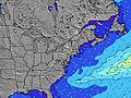 |  | 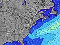 |  |  | 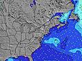 |  | ||||||||||||||
Oleaje Altura (m) Dirección Período (s) | SE 8 | SE 8 | SSE 7 | SSW 5 | SSW 5 | S 5 | S 5 | S 5 | SSE 5 | SSE 5 | SE 5 | SSE 6 | SSE 6 | SSE 8 | ESE 8 | SSE 8 | SSE 8 | SSE 8 | SSE 9 | S 8 | S 8 | SSE 8 | SSE 8 |
Gráfico Olas | |||||||||||||||||||||||
39 | 36 | 37 | 26 | 29 | 40 | 50 | 65 | 69 | 93 | 74 | 119 | 156 | 504 | 264 | 163 | 159 | 144 | 162 | 147 | 137 | 109 | 104 | |
Viento (km/h) | |||||||||||||||||||||||
Estado del Viento Viento de Mar Viento de Mar-Cruzado Cruzado Viento de Tierra-Cruzado Viento de Tierra Cristalino | cross-on | cross-on | cross-on | cross-on | cross-on | cross-on | cross-on | cross | cross | cross | cross-off | cross | cross-off | off | off | cross-off | cross-off | cross-off | cross-off | cross-off | cross-off | cross-off | cross-off |
Marea alta | 7:36AM0.87m | 7:54PM1.06m | 8:18AM0.91m | 8:35PM1.08m | 8:58AM0.95m | 9:14PM1.08m | |||||||||||||||||
Marea baja | 1:36PM0.10m | 2:25AM0.06m | 2:12PM0.08m | 2:53AM0.03m | 2:47PM0.06m | ||||||||||||||||||
5:35 | — | — | — | — | — | — | — | 5:37 | — | — | — | — | — | — | — | 5:37 | — | — | — | — | — | — | |
— | — | — | — | — | 8:07 | — | — | — | — | — | — | — | 8:06 | — | — | — | — | — | — | — | 8:05 | — | |
mm | — | 1 | — | — | — | — | — | 1 | 1 | 2 | 1 | 2 | 1 | 1 | — | — | — | — | — | — | — | — | — |
Temp. °C | 21 | 23 | 24 | 24 | 23 | 22 | 22 | 21 | 21 | 21 | 21 | 22 | 20 | 20 | 19 | 18 | 18 | 18 | 20 | 21 | 22 | 21 | 19 |
Enfriamiento °C | 21 | 23 | 23 | 23 | 22 | 22 | 21 | 20 | 20 | 21 | 22 | 23 | 21 | 19 | 17 | 15 | 15 | 16 | 17 | 18 | 20 | 21 | 18 |
Oleaje 1 Altura (m) Dirección Período (s) | SE 8 | SE 8 | SSE 7 | SE 7 | SE 7 | SSE 9 | E 6 | E 6 | E 6 | SSW 6 | SSW 6 | SSW 6 | SSE 6 | SSE 8 | ESE 8 | SSE 8 | SSE 8 | SSE 8 | SSE 9 | S 8 | S 8 | SSE 8 | SSE 8 |
39 | 36 | 37 | 26 | 26 | 8 | 1 | 1 | 3 | 34 | 12 | 3 | 156 | 504 | 264 | 163 | 159 | 144 | 162 | 147 | 137 | 109 | 104 | |
Oleaje 2 Altura (m) Dirección Período (s) | E 6 | E 6 | E 6 | E 6 | SE 9 | E 6 | E 9 | E 8 | E 8 | — | — | — | SSW 9 | SSE 8 | S 8 | E 6 | ESE 6 | E 6 | ESE 6 | E 6 | E 6 | E 6 | WSW 4 |
3 | 3 | 3 | 3 | 3 | 1 | 6 | 6 | 6 | — | — | — | 17 | 207 | 234 | 95 | 70 | 20 | 13 | 7 | 3 | 3 | 18 | |
Oleaje 3 Altura (m) Dirección Período (s) | — | — | — | E 9 | E 6 | E 9 | — | — | E 8 | — | — | — | — | — | — | SE 7 | ESE 7 | — | — | — | — | — | SE 10 |
— | — | — | 2 | 1 | 6 | — | — | 6 | — | — | — | — | — | — | 104 | 18 | — | — | — | — | — | 4 | |
Olas de Viento Altura (m) Dirección Período (s) | SSW 4 | SSW 4 | SSW 4 | SSW 5 | SSW 5 | S 5 | S 5 | S 5 | SSE 5 | SSE 5 | SE 5 | SSE 6 | E 5 | E 7 | ENE 7 | N 4 | NW 4 | WNW 4 | WNW 4 | W 4 | WSW 4 | WSW 4 | W 4 |
7 | 12 | 22 | 24 | 29 | 40 | 50 | 65 | 69 | 93 | 74 | 119 | 54 | 388 | 234 | 12 | 15 | 17 | 14 | 13 | 19 | 17 | 7 | |
Viento del Tierra o Mar Limpio más proximo | |||||||||||||||||||||||
Distancia (km) | 114 | 114 | 748 | 628 | 989 | 187 | 615 | 239 | 248 | 236 | 0 | 22 | 0 | 0 | 0 | 3 | 3 | 3 | 3 | 3 | 3 | 0 | 0 |
Mejores Olas Previstas en Rhode Island | |||||||||||||||||||||||
Mejores Olas Previstas en United States | |||||||||||||||||||||||
Busca-Olas Global | |||||||||||||||||||||||
- Map Icons:
 Break
Break Live Wave Height (m)
 Live Wind Speed (km/h)
 Surf Rating (10 Max)
 Ocean Swells (m)
- Wind Speed (km/h)
GRÁTIS! Un widget de Surf-Forecast.com para tu sitio
Este widget grátis de previsiones de surf y tiempo puede ser añadido a cualquier otro sitio y da un resumen de previsiones de olas para K38 and 39. Solo necesita cortar y pegar el código HTML de abajo en su web. Puede elegir preferencias de idioma y de unidades (métricas o imperiales) para convenir a los usuarios de su sitio. Clica aquí para obtener el código.
 Nearest