
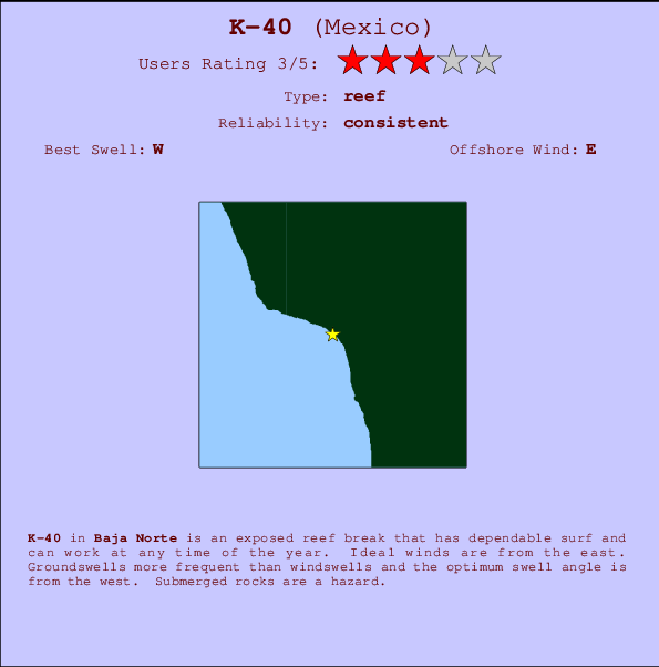
K-40 Surf Guide
K-40 in Baja Norte is an exposed reef break that has consistent surf and can work at any time of the year. Offshore winds blow from the east. Groundswells more frequent than windswells and the ideal swell angle is from the west. A choice of left and right reefs. Submerged rocks are a hazard.
K-40 Spot Info
| Type: | Rating: | Reliability: | Todays Sea Temp*: |
|---|---|---|---|
| consistent | 21.6°C*ocean temperature recorded from satellite |
Surfing K-40:
The best conditions reported for surf at K-40 occur when a West swell combines with an offshore wind direction from the East.
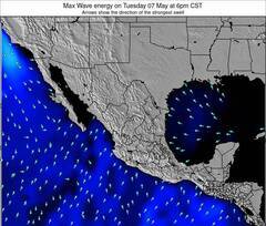
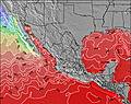
Energía de Olas (poder): 12 horas


K-40 Surf:
Sunday, 2 August 2026, 21:59 Local time| dom | lun | |||
| 8PM | 11PM | 2AM | 5AM | |
| Wave (m) | ||||
| Período (s) | 13 | 13 | 13 | 9 |
| Viento (km/h) | ||||
| Estado del Viento | cross- on |
cross- on |
cross- on |
cross- on |
- /breaks/K-40/forecasts/latest
K-40 Surf Guide
K-40 in Baja Norte is an exposed reef break that has consistent surf and can work at any time of the year. Offshore winds blow from the east. Groundswells more frequent than windswells and the ideal swell angle is from the west. A choice of left and right reefs. Submerged rocks are a hazard.
K-40 Spot Info
Type: Rating: Reliability: Todays Sea Temp*:  Reef
Reef 3
3consistent 21.6°C*ocean temperature recorded from satelliteSurfing K-40:
The best conditions reported for surf at K-40 occur when a West swell combines with an offshore wind direction from the East.
Energía de Olas (poder): 12 horas
Usa la barra de navegación de arriba para ver la temperatura del mar en K-40, fotografías K-40, previsiones detalladas de olas para K-40, vientos y previsión del tiempo, webcams para K-40, viento actual desde estaciones meteorológicas en Baja Norte y predicciones de marea para K-40. Las mapas de olas para Mexico enseñarán un mapa grande de Mexico y los mares que rodean. Los mapas de olas pueden ser animadas para mostrar diferentes componentes de olas, la altura de ola, la energía de ola, el período, junto con previsiones de viento y del tiempo. Previsiones actuales del tiempo y del estado del mar provienen de boyas marinas de Mexico, del barcos que transitan en la zona y de estaciones meteorológicas costeras. Cada página de previsiones tiene un Busca-Olas Regional y Global para localizar las mejores condiciones para surfear en el área de K-40.
K-40 Surf:
Sunday, 2 August 2026, 21:59 Local timedom lun 8PM 11PM 2AM 5AM Wave (m) Período (s) 13 13 13 9 Viento (km/h) Estado del Viento cross-
oncross-
oncross-
oncross-
on- /breaks/K-40/forecasts/latest
- /breaks/K-40/forecasts/latest/six_day
K-40 Surf Guide
K-40 in Baja Norte is an exposed reef break that has consistent surf and can work at any time of the year. Offshore winds blow from the east. Groundswells more frequent than windswells and the ideal swell angle is from the west. A choice of left and right reefs. Submerged rocks are a hazard.
K-40 Spot Info
Type: Rating: Reliability: Todays Sea Temp*: Reef3consistent 21.6°C*ocean temperature recorded from satelliteSurfing K-40:
The best conditions reported for surf at K-40 occur when a West swell combines with an offshore wind direction from the East.
Energía de Olas (poder): 12 horas
Usa la barra de navegación de arriba para ver la temperatura del mar en K-40, fotografías K-40, previsiones detalladas de olas para K-40, vientos y previsión del tiempo, webcams para K-40, viento actual desde estaciones meteorológicas en Baja Norte y predicciones de marea para K-40. Las mapas de olas para Mexico enseñarán un mapa grande de Mexico y los mares que rodean. Los mapas de olas pueden ser animadas para mostrar diferentes componentes de olas, la altura de ola, la energía de ola, el período, junto con previsiones de viento y del tiempo. Previsiones actuales del tiempo y del estado del mar provienen de boyas marinas de Mexico, del barcos que transitan en la zona y de estaciones meteorológicas costeras. Cada página de previsiones tiene un Busca-Olas Regional y Global para localizar las mejores condiciones para surfear en el área de K-40.
K-40 Surf:
Sunday, 2 August 2026, 21:59 Local timedom lun 8PM 11PM 2AM 5AM Wave (m) Período (s) 13 13 13 9 Viento (km/h) Estado del Viento cross-
oncross-
oncross-
oncross-
on- /breaks/K-40/forecasts/latest
K-40 Surf Guide
K-40 in Baja Norte is an exposed reef break that has consistent surf and can work at any time of the year. Offshore winds blow from the east. Groundswells more frequent than windswells and the ideal swell angle is from the west. A choice of left and right reefs. Submerged rocks are a hazard.
K-40 Spot Info
Type: Rating: Reliability: Todays Sea Temp*: Reef3consistent 21.6°C*ocean temperature recorded from satelliteSurfing K-40:
The best conditions reported for surf at K-40 occur when a West swell combines with an offshore wind direction from the East.
Energía de Olas (poder): 12 horas
Usa la barra de navegación de arriba para ver la temperatura del mar en K-40, fotografías K-40, previsiones detalladas de olas para K-40, vientos y previsión del tiempo, webcams para K-40, viento actual desde estaciones meteorológicas en Baja Norte y predicciones de marea para K-40. Las mapas de olas para Mexico enseñarán un mapa grande de Mexico y los mares que rodean. Los mapas de olas pueden ser animadas para mostrar diferentes componentes de olas, la altura de ola, la energía de ola, el período, junto con previsiones de viento y del tiempo. Previsiones actuales del tiempo y del estado del mar provienen de boyas marinas de Mexico, del barcos que transitan en la zona y de estaciones meteorológicas costeras. Cada página de previsiones tiene un Busca-Olas Regional y Global para localizar las mejores condiciones para surfear en el área de K-40.
K-40 Surf:
Sunday, 2 August 2026, 21:59 Local timedom lun 8PM 11PM 2AM 5AM Wave (m) Período (s) 13 13 13 9 Viento (km/h) Estado del Viento cross-
oncross-
oncross-
oncross-
onTide Times:
Para Primo Tapia, a %{dist} %{km} de %{location}.
PROXIMA ES A LAS (hora local) quedan marea alta marea baja K-40 Tide Times and Tide Chart
Live Weather:
At SHIP435, 25 km from K-40.
- Air temperature
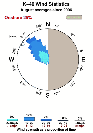
-°COverall K-40 Surf Consistency and Wind Distribution in agosto
Fotos de Surf
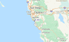
de la galeríaContornos: Carreteras y Ríos: Selecciona un spot desde el menú 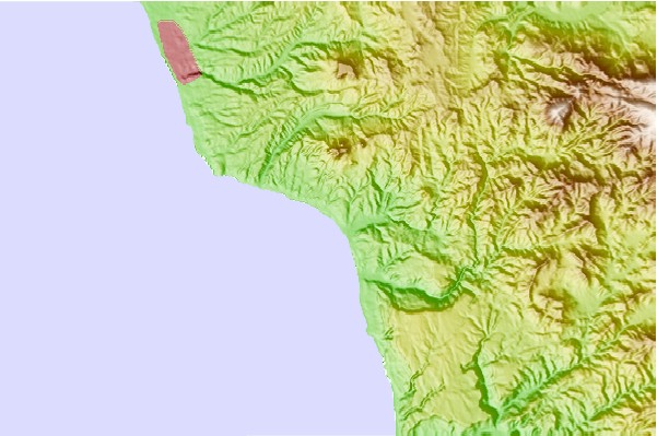
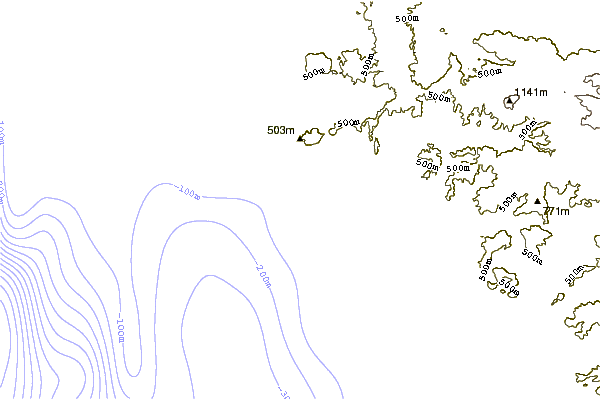
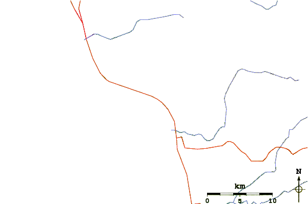
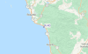
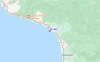
Usa este mapa para navegar hacia las playas de surf de Baja Norte y estaciones de marea cercanas de K-40
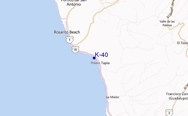
Spots de Surf más cercanos a K-40:
(Clica la ubicación para más detalles)- Closest spot1 mi
- Second closest spot2 mi
- Third closest spot2 mi
- Fourth closest spot3 mi
- Fifth closest spot4 mi
Boyas marinas más cercanas a K-40:
- Closest Boya Marinas27 mi
- Second closest Boya Marinas35 mi
- Third closest Boya Marinas47 mi
- Fourth closest Boya Marinas48 mi
- Fifth closest Boya Marinas48 mi
Estaciones de marea más cercanas a K-40:
- Closest estación de mareaPrimo Tapia2 mi
- Second closest estación de mareaRosarito9 mi
- Third closest estación de mareaTijuana20 mi
- Fourth closest estación de mareaChula Vista26 mi
- Fifth closest estación de mareaImperial Beach26 mi
Airports
- The closest passenger airport to K-40 is General Abelardo L Rodriguez International (Tijuana) Airport (TIJ) in Mexico, 34 km (21 miles) away (directly).
- The second nearest airport to K-40 is North Island Nas (San Diego) Airport (NZY) in USA, 57 km (35 miles) away.
- Third is General Alberto L Salinas C International (Ensenada) Airport (ESE) in Mexico, 59 km (37 miles) away.
- San Diego International Lindbergh Fld Airport (SAN) in USA is 60 km (37 miles) away.
- Miramar Mcas Airport (NKX), also in USA is the fifth nearest airport to K-40 and is 72 km (45 miles) away.
- /breaks/K-40/forecasts/latest


 Nearest