

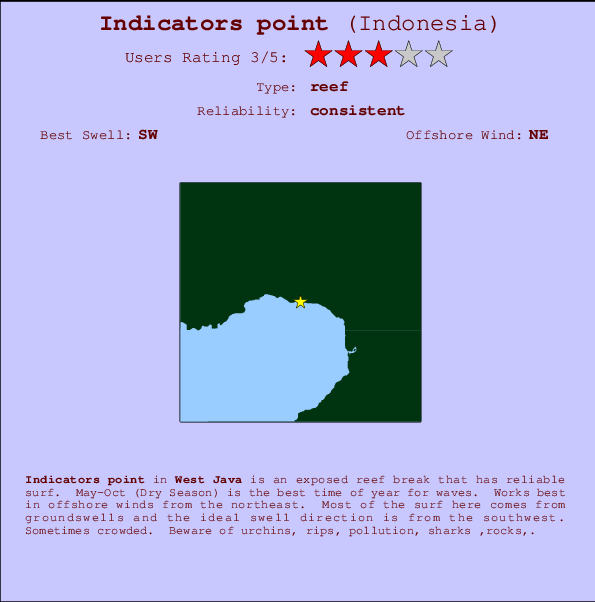
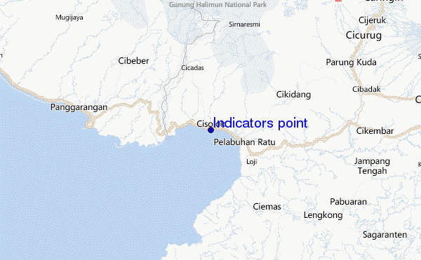
Indicators point Surf Guide
Indicators point in West Java is an exposed reef break that has reliable surf. May-Oct (Dry Season) is the best time of year for waves. Works best in offshore winds from the northeast. Tends to receive distant groundswells and the optimum swell angle is from the southwest. A reef breaks right. Sometimes crowded. Take care of urchins, rips, pollution, sharks ,rocks,.
Indicators point Spot Info
| Type: | Rating: | Reliability: | Todays Sea Temp*: |
|---|---|---|---|
| consistent | 27.7°C*ocean temperature recorded from satellite |
Surfing Indicators point:
The best conditions reported for surf at Indicators point occur when a Southwest swell combines with an offshore wind direction from the Northeast.

Energía de Olas (poder): 12 horas


Indicators point Surf:
Saturday, 18 July 2026, 03:57 Local time| sábado 18 | ||||
| 4AM | 7AM | 10AM | 1PM | |
| Wave (m) | ||||
| Período (s) | 14 | 14 | 14 | 14 |
| Viento (km/h) | ||||
| Estado del Viento | cross- off |
cross- off |
glass | on |
- /breaks/Indicatorspoint/forecasts/latest
Indicators point Surf Guide
Indicators point in West Java is an exposed reef break that has reliable surf. May-Oct (Dry Season) is the best time of year for waves. Works best in offshore winds from the northeast. Tends to receive distant groundswells and the optimum swell angle is from the southwest. A reef breaks right. Sometimes crowded. Take care of urchins, rips, pollution, sharks ,rocks,.
Indicators point Spot Info
Type: Rating: Reliability: Todays Sea Temp*:  Reef
Reef 3
3consistent 27.7°C*ocean temperature recorded from satelliteSurfing Indicators point:
The best conditions reported for surf at Indicators point occur when a Southwest swell combines with an offshore wind direction from the Northeast.
Energía de Olas (poder): 12 horas
Usa la barra de navegación de arriba para ver la temperatura del mar en Indicators point, fotografías Indicators point, previsiones detalladas de olas para Indicators point, vientos y previsión del tiempo, webcams para Indicators point, viento actual desde estaciones meteorológicas en Java - West y predicciones de marea para Indicators point. Las mapas de olas para Indonesia enseñarán un mapa grande de Indonesia y los mares que rodean. Los mapas de olas pueden ser animadas para mostrar diferentes componentes de olas, la altura de ola, la energía de ola, el período, junto con previsiones de viento y del tiempo. Previsiones actuales del tiempo y del estado del mar provienen de boyas marinas de Indonesia, del barcos que transitan en la zona y de estaciones meteorológicas costeras. Cada página de previsiones tiene un Busca-Olas Regional y Global para localizar las mejores condiciones para surfear en el área de Indicators point.
Indicators point Surf:
Saturday, 18 July 2026, 03:57 Local timesábado 18 4AM 7AM 10AM 1PM Wave (m) Período (s) 14 14 14 14 Viento (km/h) Estado del Viento cross-
offcross-
offglass on - /breaks/Indicatorspoint/forecasts/latest
- /breaks/Indicatorspoint/forecasts/latest/six_day
Indicators point Surf Guide
Indicators point in West Java is an exposed reef break that has reliable surf. May-Oct (Dry Season) is the best time of year for waves. Works best in offshore winds from the northeast. Tends to receive distant groundswells and the optimum swell angle is from the southwest. A reef breaks right. Sometimes crowded. Take care of urchins, rips, pollution, sharks ,rocks,.
Indicators point Spot Info
Type: Rating: Reliability: Todays Sea Temp*: Reef3consistent 27.7°C*ocean temperature recorded from satelliteSurfing Indicators point:
The best conditions reported for surf at Indicators point occur when a Southwest swell combines with an offshore wind direction from the Northeast.
Energía de Olas (poder): 12 horas
Usa la barra de navegación de arriba para ver la temperatura del mar en Indicators point, fotografías Indicators point, previsiones detalladas de olas para Indicators point, vientos y previsión del tiempo, webcams para Indicators point, viento actual desde estaciones meteorológicas en Java - West y predicciones de marea para Indicators point. Las mapas de olas para Indonesia enseñarán un mapa grande de Indonesia y los mares que rodean. Los mapas de olas pueden ser animadas para mostrar diferentes componentes de olas, la altura de ola, la energía de ola, el período, junto con previsiones de viento y del tiempo. Previsiones actuales del tiempo y del estado del mar provienen de boyas marinas de Indonesia, del barcos que transitan en la zona y de estaciones meteorológicas costeras. Cada página de previsiones tiene un Busca-Olas Regional y Global para localizar las mejores condiciones para surfear en el área de Indicators point.
Indicators point Surf:
Saturday, 18 July 2026, 03:57 Local timesábado 18 4AM 7AM 10AM 1PM Wave (m) Período (s) 14 14 14 14 Viento (km/h) Estado del Viento cross-
offcross-
offglass on - /breaks/Indicatorspoint/forecasts/latest
Indicators point Surf Guide
Indicators point in West Java is an exposed reef break that has reliable surf. May-Oct (Dry Season) is the best time of year for waves. Works best in offshore winds from the northeast. Tends to receive distant groundswells and the optimum swell angle is from the southwest. A reef breaks right. Sometimes crowded. Take care of urchins, rips, pollution, sharks ,rocks,.
Indicators point Spot Info
Type: Rating: Reliability: Todays Sea Temp*: Reef3consistent 27.7°C*ocean temperature recorded from satelliteSurfing Indicators point:
The best conditions reported for surf at Indicators point occur when a Southwest swell combines with an offshore wind direction from the Northeast.
Energía de Olas (poder): 12 horas
Usa la barra de navegación de arriba para ver la temperatura del mar en Indicators point, fotografías Indicators point, previsiones detalladas de olas para Indicators point, vientos y previsión del tiempo, webcams para Indicators point, viento actual desde estaciones meteorológicas en Java - West y predicciones de marea para Indicators point. Las mapas de olas para Indonesia enseñarán un mapa grande de Indonesia y los mares que rodean. Los mapas de olas pueden ser animadas para mostrar diferentes componentes de olas, la altura de ola, la energía de ola, el período, junto con previsiones de viento y del tiempo. Previsiones actuales del tiempo y del estado del mar provienen de boyas marinas de Indonesia, del barcos que transitan en la zona y de estaciones meteorológicas costeras. Cada página de previsiones tiene un Busca-Olas Regional y Global para localizar las mejores condiciones para surfear en el área de Indicators point.
Indicators point Surf:
Saturday, 18 July 2026, 03:57 Local timesábado 18 4AM 7AM 10AM 1PM Wave (m) Período (s) 14 14 14 14 Viento (km/h) Estado del Viento cross-
offcross-
offglass on Tide Times:
Para Karang Haji - Ocean Queen Hotel, a %{dist} %{km} de %{location}.
PROXIMA ES A LAS (hora local) quedan marea alta marea baja Indicators point Tide Times and Tide Chart
Live Weather:
At Genteng wx, 50 km from Indicators point.
calm
(km/h)Air temperature
-°COverall Indicators point Surf Consistency and Wind Distribution in julio


Wind stats for Indicators point: see the variation in direction and stength by month.
Fotos de Surf
de la galeríaContornos: Carreteras y Ríos: Selecciona un spot desde el menú 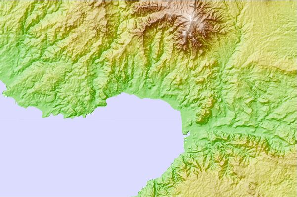
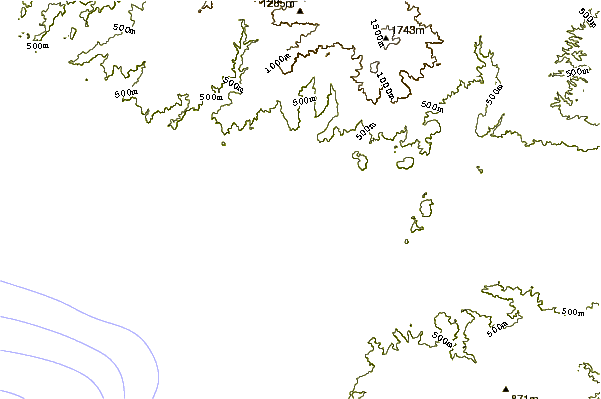
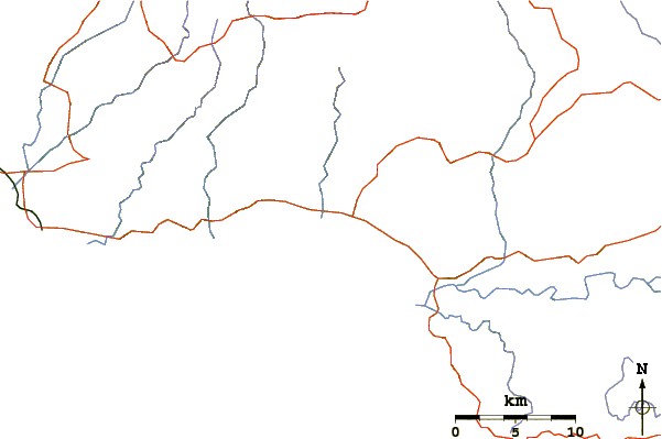
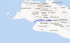
Usa este mapa para navegar hacia las playas de surf de Java - West y estaciones de marea cercanas de Indicators point
Spots de Surf más cercanos a Indicators point:
(Clica la ubicación para más detalles)- Closest spot1 mi
- Second closest spot2 mi
- Third closest spot4 mi
- Fourth closest spot6 mi
- Fifth closest spot17 mi
Boyas marinas más cercanas a Indicators point:
- Closest Boya Marinas2428 mi
- Second closest Boya Marinas2470 mi
- Third closest Boya Marinas2536 mi
- Fourth closest Boya Marinas2700 mi
- Fifth closest Boya Marinas2711 mi
Estaciones de marea más cercanas a Indicators point:
- Closest estación de mareaPelabuhanratu5 mi
- Second closest estación de mareaJakarta60 mi
- Third closest estación de mareaLabuhan61 mi
- Fourth closest estación de mareaTanjung Priok65 mi
- Fifth closest estación de mareaBandar Lampung132 mi
Airports
- The closest passenger airport to Indicators point is Pondok Cabe (Jakarta) Airport (PCB) in Indonesia, 76 km (47 miles) away (directly).
- The second nearest airport to Indicators point is Halim Perdanakusuma International (Jakarta) Airport (HLP), also in Indonesia, 90 km (56 miles) away.
- Third is Soekarno Hatta International (Jakarta) Airport (CGK) in Indonesia, 95 km (59 miles) away.
- Husein Sastranegara (Bandung) Airport (BDO) in Indonesia is 121 km (75 miles) away.
- Penggung (Cirebon) Airport (CBN), also in Indonesia is the fifth nearest airport to Indicators point and is 228 km (142 miles) away.
- /breaks/Indicatorspoint/forecasts/latest


 Nearest