
Previsiones:

Pronóstico Corto PlazoLluvia moderada (totál 10mm), más pesada el lunes por la tarde. Very mild (max 19°C el lunes por la mañana, min 14°C el domingo por la noche). Vientos crecientes (Vientos ligeros desde el SSE el lunes por la tarde, vientos frescos desde el ONO por la mañana de miércoles). | ||||||||||||||||||||||||
lunes 3 | martes 4 | miércoles 5 | ||||||||||||||||||||||
1 AM | 4 AM | 7 AM | 10 AM | 1 PM | 4 PM | 7 PM | 10 PM | 1 AM | 4 AM | 7 AM | 10 AM | 1 PM | 4 PM | 7 PM | 10 PM | 1 AM | 4 AM | 7 AM | 10 AM | 1 PM | 4 PM | 7 PM | 10 PM | |
Mapa de Altura de Olas |  | 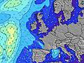 |  |  |  |  |  |  |  | |||||||||||||||
Oleaje Altura (m) Dirección Período (s) | SW 9 | SSW 9 | SW 8 | SSW 8 | SSW 8 | S 7 | SSW 7 | SSW 7 | SSW 7 | SSW 7 | SSW 7 | SW 7 | SW 7 | W 6 | W 7 | SW 15 | SW 14 | SW 14 | SW 13 | SSW 13 | SSW 13 | SSW 13 | W 7 | W 10 |
Gráfico Olas | ||||||||||||||||||||||||
281 | 258 | 206 | 175 | 163 | 131 | 94 | 72 | 38 | 75 | 102 | 111 | 124 | 100 | 263 | 8 | 8 | 7 | 7 | 18 | 17 | 17 | 92 | 18 | |
Viento (km/h) | ||||||||||||||||||||||||
Estado del Viento Viento de Mar Viento de Mar-Cruzado Cruzado Viento de Tierra-Cruzado Viento de Tierra Cristalino | cross-off | cross-off | cross-off | cross-off | cross-off | cross-off | cross | cross | cross-on | cross | cross | cross-on | on | on | cross-on | cross-on | cross-on | cross-on | cross-on | cross-on | cross-on | cross-on | cross-on | cross-on |
Marea alta | 8:22AM3.13m | 8:31PM3.20m | 9:01AM3.04m | 9:13PM3.06m | 9:46AM2.93m | |||||||||||||||||||
Marea baja | 1:59AM0.31m | 2:11PM0.56m | 2:35AM0.41m | 2:51PM0.66m | 3:17AM0.56m | 3:39PM0.79m | ||||||||||||||||||
— | 6:03 | — | — | — | — | — | — | — | 6:03 | — | — | — | — | — | — | — | 6:05 | — | — | — | — | — | — | |
— | — | — | — | — | — | 9:27 | — | — | — | — | — | — | — | 9:25 | — | — | — | — | — | — | — | 9:23 | — | |
mm | — | — | — | — | — | 1 | 1 | 1 | 1 | — | — | — | — | — | 1 | 1 | 1 | 1 | 1 | — | — | 1 | — | — |
Temp. °C | 14 | 14 | 15 | 17 | 19 | 18 | 18 | 18 | 17 | 16 | 16 | 18 | 19 | 17 | 16 | 15 | 15 | 14 | 14 | 15 | 15 | 16 | 15 | 14 |
Enfriamiento °C | 13 | 13 | 13 | 16 | 18 | 18 | 19 | 19 | 17 | 15 | 15 | 17 | 17 | 15 | 14 | 12 | 11 | 9 | 8 | 9 | 9 | 10 | 10 | 10 |
Oleaje 1 Altura (m) Dirección Período (s) | SW 9 | SSW 9 | SW 8 | SSW 8 | SSW 8 | N 9 | SSW 7 | N 9 | SSW 7 | N 9 | N 9 | N 9 | N 9 | SSW 7 | SW 15 | SW 15 | SW 14 | SW 14 | SW 13 | SSW 13 | SSW 13 | SSW 13 | NW 10 | W 10 |
281 | 258 | 206 | 175 | 163 | 24 | 94 | 25 | 38 | 40 | 40 | 39 | 40 | 53 | 8 | 8 | 8 | 7 | 7 | 18 | 17 | 17 | 1280 | 18 | |
Oleaje 2 Altura (m) Dirección Período (s) | N 9 | N 9 | N 9 | N 9 | N 9 | NNW 7 | N 9 | WSW 9 | N 9 | WSW 9 | W 9 | SW 15 | SW 15 | N 9 | SW 15 | SW 14 | — | — | — | — | — | — | W 10 | SSW 13 |
41 | 41 | 39 | 25 | 24 | 5 | 23 | 8 | 25 | 8 | 15 | 8 | 8 | 40 | 8 | 8 | — | — | — | — | — | — | 18 | 17 | |
Oleaje 3 Altura (m) Dirección Período (s) | NNW 8 | NW 8 | NW 8 | NNW 8 | NNW 8 | W 10 | WSW 9 | NNW 7 | WSW 9 | NW 7 | NW 7 | W 11 | W 11 | SW 15 | — | — | — | — | — | — | — | — | SSW 13 | — |
28 | 17 | 16 | 13 | 11 | 8 | 17 | 5 | 8 | 2 | 2 | 2 | 3 | 8 | — | — | — | — | — | — | — | — | 17 | — | |
Olas de Viento Altura (m) Dirección Período (s) | ESE 4 | SE 4 | SE 4 | SE 4 | ESE 4 | S 7 | — | SSW 7 | SW 4 | SSW 7 | SSW 7 | SW 7 | SW 7 | W 6 | W 7 | WNW 7 | NW 10 | NW 9 | NW 9 | NW 10 | NW 10 | NW 10 | W 7 | NNW 10 |
11 | 15 | 28 | 25 | 13 | 131 | — | 72 | 9 | 75 | 102 | 111 | 124 | 100 | 263 | 516 | 1375 | 1328 | 1681 | 1876 | 1749 | 1553 | 92 | 1071 | |
Viento del Tierra o Mar Limpio más proximo | ||||||||||||||||||||||||
Distancia (km) | 0 | 0 | 0 | 0 | 0 | 0 | 5 | 148 | 136 | 240 | 5 | 240 | 240 | 245 | 357 | 136 | 586 | 586 | 136 | 572 | 649 | 755 | 630 | 562 |
Mejores Olas Previstas en Kerry | ||||||||||||||||||||||||
Mejores Olas Previstas en Ireland | ||||||||||||||||||||||||
Busca-Olas Global | ||||||||||||||||||||||||
- Map Icons:
 Break
Break Live Wave Height (m)
 Live Wind Speed (km/h)
 Surf Rating (10 Max)
 Ocean Swells (m)
- Wind Speed (km/h)
GRÁTIS! Un widget de Surf-Forecast.com para tu sitio
Este widget grátis de previsiones de surf y tiempo puede ser añadido a cualquier otro sitio y da un resumen de previsiones de olas para Inch Strand. Solo necesita cortar y pegar el código HTML de abajo en su web. Puede elegir preferencias de idioma y de unidades (métricas o imperiales) para convenir a los usuarios de su sitio. Clica aquí para obtener el código.
 Nearest