
Previsiones:

Pronóstico Corto PlazoMayormente seco. Very mild (max 13°C el martes por la tarde, min 7°C el martes por la noche). Mayormente vientos fuertes. | |||||||||||||||||||||||
martes 28 | miércoles 29 | jueves 30 | |||||||||||||||||||||
3 AM | 6 AM | 9 AM | 12 PM | 3 PM | 6 PM | 9 PM | 12 AM | 3 AM | 6 AM | 9 AM | 12 PM | 3 PM | 6 PM | 9 PM | 12 AM | 3 AM | 6 AM | 9 AM | 12 PM | 3 PM | 6 PM | 9 PM | |
Mapa de Altura de Olas | 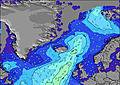 | 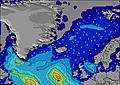 | 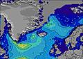 | 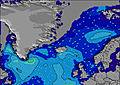 | 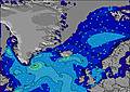 | 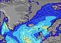 | 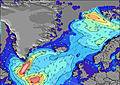 | 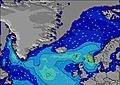 | 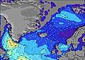 | ||||||||||||||
Oleaje Altura (m) Dirección Período (s) | SW 8 | SW 8 | SW 8 | SW 8 | SW 8 | SW 8 | SW 7 | SW 7 | WSW 7 | SW 7 | W 7 | S 7 | SW 7 | SW 7 | SW 7 | WSW 7 | S 10 | S 10 | WSW 6 | S 9 | WSW 6 | WSW 6 | S 11 |
Gráfico Olas | |||||||||||||||||||||||
78 | 64 | 63 | 49 | 36 | 36 | 27 | 23 | 19 | 13 | 8 | 14 | 12 | 12 | 7 | 5 | 7 | 8 | 4 | 7 | 4 | 4 | 2 | |
Viento (km/h) | |||||||||||||||||||||||
Estado del Viento Viento de Mar Viento de Mar-Cruzado Cruzado Viento de Tierra-Cruzado Viento de Tierra Cristalino | cross-off | cross-off | cross-off | cross-off | off | off | cross-off | cross-off | cross-off | cross-off | cross-off | cross-off | off | cross-off | cross-off | cross-off | cross-off | cross-off | off | off | off | off | off |
Marea alta | 5:34AM2.55m | 5:55PM2.96m | 6:10AM2.68m | 6:29PM3.08m | 6:43AM2.79m | 7:02PM3.16m | |||||||||||||||||
Marea baja | 11:34AM0.58m | 00:10AM0.56m | 12:10PM0.43m | 00:43AM0.42m | 12:44PM0.31m | ||||||||||||||||||
4:24 | — | — | — | — | — | — | — | 4:28 | — | — | — | — | — | — | — | 4:31 | — | — | — | — | — | — | |
— | — | — | — | — | — | 10:44 | — | — | — | — | — | — | — | 10:40 | — | — | — | — | — | — | — | 10:37 | |
mm | — | — | — | — | — | — | — | — | — | — | — | — | — | — | — | — | — | — | — | — | — | — | — |
Temp. °C | 10 | 10 | 10 | 12 | 13 | 11 | 11 | 10 | 9 | 7 | 8 | 10 | 11 | 12 | 11 | 8 | 8 | 8 | 10 | 10 | 12 | 12 | 13 |
Enfriamiento °C | 4 | 5 | 5 | 7 | 5 | 4 | 5 | 3 | 2 | 0 | 2 | 4 | 3 | 4 | 3 | -1 | 0 | 1 | 3 | 2 | 6 | 5 | 6 |
Oleaje 1 Altura (m) Dirección Período (s) | SW 8 | SW 8 | SW 8 | SW 8 | SW 8 | SW 8 | SE 7 | SE 7 | SE 7 | SE 6 | SE 6 | S 7 | SW 7 | SW 7 | SW 7 | WSW 7 | WSW 7 | WSW 6 | WSW 6 | WSW 6 | WSW 6 | WSW 6 | SW 6 |
78 | 64 | 63 | 49 | 36 | 36 | 29 | 37 | 35 | 21 | 14 | 14 | 12 | 12 | 7 | 5 | 4 | 4 | 4 | 4 | 4 | 4 | 2 | |
Oleaje 2 Altura (m) Dirección Período (s) | S 11 | WSW 9 | NE 5 | E 5 | SE 6 | SE 7 | SW 7 | SW 7 | WSW 7 | SW 7 | W 7 | S 7 | SE 6 | ESE 6 | ESE 6 | ESE 6 | ESE 7 | SE 7 | SE 8 | S 9 | SE 8 | S 9 | S 11 |
10 | 8 | 4 | 4 | 6 | 16 | 27 | 23 | 19 | 13 | 8 | 9 | 7 | 4 | 4 | 4 | 4 | 2 | 2 | 7 | 3 | 2 | 2 | |
Oleaje 3 Altura (m) Dirección Período (s) | S 11 | S 11 | S 11 | ENE 5 | S 10 | S 10 | S 11 | S 10 | S 10 | WSW 8 | SSW 9 | ENE 4 | SE 6 | S 10 | S 9 | S 10 | S 10 | S 10 | SE 8 | S 9 | S 10 | S 9 | SE 7 |
10 | 2 | 9 | 3 | 8 | 8 | 9 | 8 | 8 | 7 | 7 | 1 | 2 | 2 | 2 | 2 | 7 | 8 | 3 | 2 | 2 | 2 | 2 | |
Olas de Viento Altura (m) Dirección Período (s) | NNW 4 | NNE 4 | NNE 4 | N 5 | N 3 | NNW 4 | NNW 4 | NNW 4 | NNW 4 | N 4 | N 4 | NNW 4 | NNW 4 | NNW 4 | NNW 4 | NNW 4 | NNW 5 | NNW 5 | NW 5 | NW 4 | NW 4 | NW 4 | NW 5 |
6 | 6 | 10 | 11 | 8 | 16 | 18 | 9 | 10 | 6 | 7 | 8 | 11 | 37 | 29 | 34 | 37 | 32 | 23 | 19 | 24 | 21 | 45 | |
Viento del Tierra o Mar Limpio más proximo | |||||||||||||||||||||||
Distancia (km) | 1034 | 832 | 832 | 1109 | 1127 | 1140 | 1162 | 785 | 1127 | 1163 | 785 | 1256 | 1184 | 1127 | 1109 | 1109 | 1109 | 1109 | 1109 | 1672 | 1184 | 1264 | 1109 |
Mejores Olas Previstas en Reykjanes Peninsula | |||||||||||||||||||||||
Mejores Olas Previstas en Iceland | |||||||||||||||||||||||
Busca-Olas Global | |||||||||||||||||||||||
- Map Icons:
 Break
Break Live Wave Height (m)
 Live Wind Speed (km/h)
 Surf Rating (10 Max)
 Ocean Swells (m)
- Wind Speed (km/h)
GRÁTIS! Un widget de Surf-Forecast.com para tu sitio
Este widget grátis de previsiones de surf y tiempo puede ser añadido a cualquier otro sitio y da un resumen de previsiones de olas para Grindavik Antenas. Solo necesita cortar y pegar el código HTML de abajo en su web. Puede elegir preferencias de idioma y de unidades (métricas o imperiales) para convenir a los usuarios de su sitio. Clica aquí para obtener el código.
 Nearest